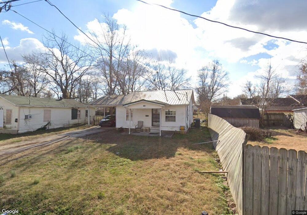
1034 Franklin St Poplar Bluff, MO 63901
Estimated Value: $59,141 - $92,000
--
Bed
--
Bath
994
Sq Ft
$78/Sq Ft
Est. Value
About This Home
This home is located at 1034 Franklin St, Poplar Bluff, MO 63901 and is currently estimated at $77,285, approximately $77 per square foot. 1034 Franklin St is a home with nearby schools including Eugene Field Elementary School, Poplar Bluff Fifth & Sixth Grade Center, and Poplar Bluff Junior High School.
Ownership History
Date
Name
Owned For
Owner Type
Purchase Details
Closed on
Aug 31, 2022
Sold by
Sullivan Ventures Llc
Bought by
Jlp Properties Llc
Current Estimated Value
Home Financials for this Owner
Home Financials are based on the most recent Mortgage that was taken out on this home.
Original Mortgage
$200,000
Interest Rate
5.54%
Mortgage Type
New Conventional
Purchase Details
Closed on
Jun 28, 2022
Sold by
Sullivan Ventures Llc
Bought by
Sullivan Ventures Llc
Purchase Details
Closed on
Dec 20, 2019
Sold by
Morse Tonya Rene and Sullivan Thomas Roger
Bought by
Sullivan Ventures Llc
Create a Home Valuation Report for This Property
The Home Valuation Report is an in-depth analysis detailing your home's value as well as a comparison with similar homes in the area
Home Values in the Area
Average Home Value in this Area
Purchase History
| Date | Buyer | Sale Price | Title Company |
|---|---|---|---|
| Jlp Properties Llc | -- | -- | |
| Sullivan Ventures Llc | -- | None Listed On Document | |
| Sullivan Ventures Llc | -- | None Available |
Source: Public Records
Mortgage History
| Date | Status | Borrower | Loan Amount |
|---|---|---|---|
| Closed | Jlp Properties Llc | $200,000 |
Source: Public Records
Tax History Compared to Growth
Tax History
| Year | Tax Paid | Tax Assessment Tax Assessment Total Assessment is a certain percentage of the fair market value that is determined by local assessors to be the total taxable value of land and additions on the property. | Land | Improvement |
|---|---|---|---|---|
| 2024 | $243 | $5,020 | $0 | $0 |
| 2023 | $243 | $5,020 | $0 | $0 |
| 2022 | $224 | $4,650 | $0 | $0 |
| 2021 | $224 | $4,650 | $0 | $0 |
| 2020 | $215 | $4,400 | $0 | $0 |
| 2019 | $215 | $4,400 | $0 | $0 |
| 2018 | $215 | $4,400 | $0 | $0 |
| 2017 | -- | $4,400 | $0 | $0 |
| 2016 | -- | $4,400 | $0 | $0 |
| 2015 | -- | $4,400 | $0 | $0 |
| 2014 | -- | $4,110 | $0 | $0 |
| 2012 | $175 | $4,110 | $0 | $0 |
Source: Public Records
Map
Nearby Homes
- 1025 Delano St
- 2121 Pike St
- 2335 Cheshire Blvd
- 712 Nickey St
- 1000 W Victor St
- 622 Nickey St
- 1315 S 11th St
- 1905 Kentucky Ave
- 1708 Kentucky Ave
- 2015 Arkansas Ave
- 2011 Arkansas Ave
- 2347 Arkansas Ave
- 2318 Arkansas Ave
- 1910 Arkansas Ave
- 912 Adam St
- 110 Hampton Ct
- 251 Hampton Ct
- 243 Hampton Ct
- 231 Hampton Ct
- 318 E Henry St
- 1032 Franklin St
- 2202 Mangold St
- 2206 Mangold St
- 1028 Franklin St
- 1037 Delano St
- 1033 Franklin St
- 2210 Mangold St
- 1033 Delano St
- 1035 Franklin St
- 1024 Franklin St
- 2214 Mangold St
- 1029 Franklin St
- 1039 Franklin St
- 1023 Franklin St
- 1101 Mangold St
- 1023 Delano St
- 1103 Delano St
- 1036 Delano St
- 1040 Delano St
- 1016 Franklin St