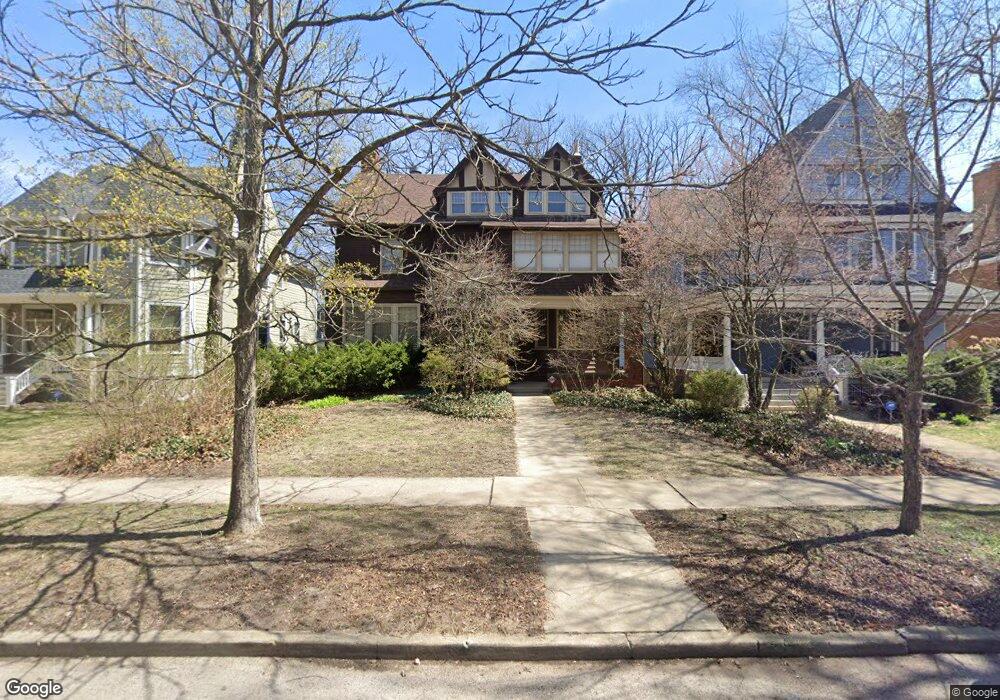
1035 Maple Ave Evanston, IL 60202
Southeast Evanston NeighborhoodEstimated Value: $1,251,000 - $1,438,000
4
Beds
3
Baths
3,713
Sq Ft
$369/Sq Ft
Est. Value
About This Home
This home is located at 1035 Maple Ave, Evanston, IL 60202 and is currently estimated at $1,370,100, approximately $369 per square foot. 1035 Maple Ave is a home located in Cook County with nearby schools including Nichols Middle School, Evanston Township High School, and Chiaravalle Montessori School.
Ownership History
Date
Name
Owned For
Owner Type
Purchase Details
Closed on
Sep 3, 1996
Sold by
Burroughs Doris
Bought by
Mcneilly Carey F and Mcneilly Jennifer J
Current Estimated Value
Home Financials for this Owner
Home Financials are based on the most recent Mortgage that was taken out on this home.
Original Mortgage
$300,000
Outstanding Balance
$19,639
Interest Rate
8.27%
Estimated Equity
$1,350,461
Create a Home Valuation Report for This Property
The Home Valuation Report is an in-depth analysis detailing your home's value as well as a comparison with similar homes in the area
Home Values in the Area
Average Home Value in this Area
Purchase History
| Date | Buyer | Sale Price | Title Company |
|---|---|---|---|
| Mcneilly Carey F | $375,000 | -- |
Source: Public Records
Mortgage History
| Date | Status | Borrower | Loan Amount |
|---|---|---|---|
| Open | Mcneilly Carey F | $300,000 |
Source: Public Records
Tax History
| Year | Tax Paid | Tax Assessment Tax Assessment Total Assessment is a certain percentage of the fair market value that is determined by local assessors to be the total taxable value of land and additions on the property. | Land | Improvement |
|---|---|---|---|---|
| 2025 | $24,206 | $120,000 | $26,240 | $93,760 |
| 2024 | $24,206 | $102,000 | $22,550 | $79,450 |
| 2023 | $23,196 | $102,000 | $22,550 | $79,450 |
| 2022 | $23,196 | $102,000 | $22,550 | $79,450 |
| 2021 | $19,768 | $76,831 | $13,120 | $63,711 |
| 2020 | $19,559 | $76,831 | $13,120 | $63,711 |
| 2019 | $19,227 | $84,430 | $13,120 | $71,310 |
| 2018 | $17,769 | $67,443 | $11,070 | $56,373 |
| 2017 | $17,319 | $67,443 | $11,070 | $56,373 |
| 2016 | $16,647 | $67,443 | $11,070 | $56,373 |
| 2015 | $13,406 | $51,918 | $9,225 | $42,693 |
| 2014 | $13,292 | $51,918 | $9,225 | $42,693 |
| 2013 | $12,969 | $51,918 | $9,225 | $42,693 |
Source: Public Records
Map
Nearby Homes
- 1011 Maple Ave
- 1122 Sherman Ave
- 1218 Elmwood Ave
- 1123 Main St
- 1235 Ridge Ave
- 1236 Chicago Ave Unit D403
- 1232 Ridge Ave
- 1025 Wesley Ave
- 1310 Maple Ave Unit 5C
- 900 Chicago Ave Unit 609
- 1049 Hinman Ave
- 1003 Wesley Ave
- 1323 Maple Ave Unit 3NE
- 921 Madison St
- 1315 Main St
- 515 Main St Unit 802
- 1211 Hinman Ave
- 1314 Main St Unit 2D
- 901 Hinman Ave Unit 5F
- 1315 Asbury Ave Unit 5
- 1031 Maple Ave
- 1039 Maple Ave
- 1027 Maple Ave
- 1043 Maple Ave
- 1023 Maple Ave
- 1045 Maple Ave
- 1034 Elmwood Ave
- 1036 Elmwood Ave
- 910 Greenleaf St
- 1026 Elmwood Ave
- 1040 Elmwood Ave
- 1032 Maple Ave
- 1030 Maple Ave
- 1036 Maple Ave
- 1015 Maple Ave
- 1024 Maple Ave
- 1101 Maple Ave
- 1044 Elmwood Ave
- 1018 Elmwood Ave
- 1022 Maple Ave
Your Personal Tour Guide
Ask me questions while you tour the home.