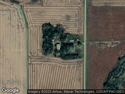
10353 430th Ave Comfrey, MN 56019
Estimated Value: $150,000 - $698,302
1
Bed
2
Baths
1,448
Sq Ft
$293/Sq Ft
Est. Value
About This Home
This home is located at 10353 430th Ave, Comfrey, MN 56019 and is currently estimated at $424,151, approximately $292 per square foot. 10353 430th Ave is a home located in Brown County with nearby schools including Comfrey Elementary School and Comfrey Secondary School.
Create a Home Valuation Report for This Property
The Home Valuation Report is an in-depth analysis detailing your home's value as well as a comparison with similar homes in the area
Home Values in the Area
Average Home Value in this Area
Tax History Compared to Growth
Tax History
| Year | Tax Paid | Tax Assessment Tax Assessment Total Assessment is a certain percentage of the fair market value that is determined by local assessors to be the total taxable value of land and additions on the property. | Land | Improvement |
|---|---|---|---|---|
| 2024 | $3,894 | $1,120,900 | $985,600 | $135,300 |
| 2023 | $3,894 | $977,700 | $848,100 | $129,600 |
| 2022 | $1,684 | $779,600 | $671,500 | $108,100 |
| 2021 | $2,128 | $675,200 | $577,600 | $97,600 |
| 2020 | $1,968 | $671,100 | $573,100 | $98,000 |
| 2019 | $1,942 | $656,700 | $570,400 | $86,300 |
| 2018 | $2,148 | $677,300 | $592,500 | $84,800 |
| 2017 | $1,980 | $698,700 | $616,000 | $82,700 |
| 2016 | $2,266 | $747,450 | $0 | $0 |
| 2015 | -- | $0 | $0 | $0 |
| 2014 | -- | $0 | $0 | $0 |
| 2013 | -- | $0 | $0 | $0 |
Source: Public Records
Map
Nearby Homes
- 48868 270th St
- xxx Liberty St S
- 321 S Main St
- 513 N Main St
- 207 E Duroe St
- 611 Garden St
- 120 S Paffrath Ave
- 214 Burns Ave
- xxx E Appel St
- 606 Appel St
- 12356 Us Highway 71
- 421 W Van Dusen St
- 118 N O'Connell Ave
- 38364 200th St
- TBD County Road 99
- 307 Sunset Ave
- 309 Sunset Ave
- 311 Sunset Ave
- 921 11th St N
- Blk 2 Lot 11 Sunset Avenue-Prairie Ln
