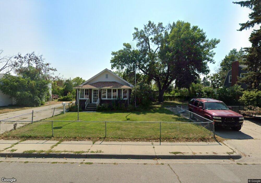
1036 and 1038 Lewis Ave Billings, MT 59102
East Central Billings NeighborhoodEstimated Value: $300,000 - $404,041
4
Beds
4
Baths
2,550
Sq Ft
$142/Sq Ft
Est. Value
About This Home
This home is located at 1036 and 1038 Lewis Ave, Billings, MT 59102 and is currently estimated at $361,260, approximately $141 per square foot. 1036 and 1038 Lewis Ave is a home located in Yellowstone County with nearby schools including Broadwater School, Lewis & Clark Junior High School, and Billings Senior High School.
Ownership History
Date
Name
Owned For
Owner Type
Purchase Details
Closed on
Oct 1, 2020
Sold by
Cole Robert B and Cole Janet S
Bought by
Green Paul C
Current Estimated Value
Home Financials for this Owner
Home Financials are based on the most recent Mortgage that was taken out on this home.
Original Mortgage
$255,750
Outstanding Balance
$226,961
Interest Rate
2.9%
Mortgage Type
VA
Estimated Equity
$134,299
Create a Home Valuation Report for This Property
The Home Valuation Report is an in-depth analysis detailing your home's value as well as a comparison with similar homes in the area
Home Values in the Area
Average Home Value in this Area
Purchase History
| Date | Buyer | Sale Price | Title Company |
|---|---|---|---|
| Green Paul C | -- | First American Title Company |
Source: Public Records
Mortgage History
| Date | Status | Borrower | Loan Amount |
|---|---|---|---|
| Open | Green Paul C | $255,750 |
Source: Public Records
Tax History Compared to Growth
Tax History
| Year | Tax Paid | Tax Assessment Tax Assessment Total Assessment is a certain percentage of the fair market value that is determined by local assessors to be the total taxable value of land and additions on the property. | Land | Improvement |
|---|---|---|---|---|
| 2025 | $3,825 | $428,272 | $56,832 | $371,440 |
| 2024 | $3,825 | $387,793 | $50,893 | $336,900 |
| 2023 | $3,845 | $387,793 | $50,893 | $336,900 |
| 2022 | $3,352 | $294,995 | $49,845 | $245,150 |
| 2021 | $3,168 | $294,995 | $0 | $0 |
| 2020 | $3,068 | $271,597 | $0 | $0 |
| 2019 | $2,930 | $271,597 | $0 | $0 |
| 2018 | $2,677 | $241,454 | $0 | $0 |
| 2017 | $2,600 | $241,454 | $0 | $0 |
| 2016 | $2,424 | $227,551 | $0 | $0 |
| 2015 | $2,370 | $227,551 | $0 | $0 |
| 2014 | $2,680 | $139,744 | $0 | $0 |
Source: Public Records
Map
Nearby Homes
- 1107 12th St W
- 1214 Clark Ave
- 1230 Clark Ave
- 1225 Clark Ave
- 1232 Burlington Ave
- 1263 Yellowstone Ave
- 1265 Yellowstone Ave
- 1256 & 1260 Yellowstone Ave
- 1116 8th St W
- 805 Clark Ave
- 1310 Yellowstone Ave Unit 6
- 1310 Yellowstone Ave Unit 11
- 1310 Yellowstone Ave Unit 16
- 743 Clark Ave
- 1506 9th St W
- 1019 Miles Ave
- 927 Miles Ave
- 925 Miles Ave
- 3 Carrie Lynn Dr
- 1113 Avenue D
- 1036 Lewis Ave
- 1034 Lewis Ave
- 1040 Lewis Ave
- 1101 Clark Ave
- 1095 Clark Ave
- 1028 Lewis Ave
- 1028 Lewis Ave
- 1093 Clark Ave
- 1037 Lewis Ave
- 1102 Lewis Ave
- 1103 Clark Ave
- 1026 Lewis Ave
- 1091 Clark Ave
- 1024 Lewis Ave
- 1039 Lewis Ave
- 1089 Clark Ave
- 912 Midway Lane #2
- 912 Avenue E
- 1045 Lewis Ave
- 1033 Lewis Ave