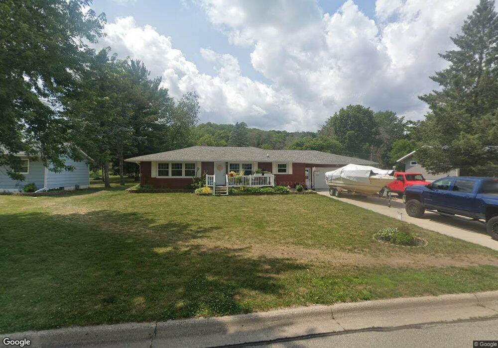
1036 Birch Ave Red Wing, MN 55066
Estimated Value: $287,175 - $351,000
4
Beds
2
Baths
1,344
Sq Ft
$233/Sq Ft
Est. Value
About This Home
This home is located at 1036 Birch Ave, Red Wing, MN 55066 and is currently estimated at $313,294, approximately $233 per square foot. 1036 Birch Ave is a home located in Goodhue County with nearby schools including Burnside Elementary School, Sunnyside Elementary School, and Twin Bluff Middle School.
Ownership History
Date
Name
Owned For
Owner Type
Purchase Details
Closed on
Jan 21, 2016
Sold by
Secretary Housing Urban Development
Bought by
Dunlap David Thomas and Dunlap Michelle Diane
Current Estimated Value
Home Financials for this Owner
Home Financials are based on the most recent Mortgage that was taken out on this home.
Original Mortgage
$136,484
Outstanding Balance
$108,013
Interest Rate
3.81%
Estimated Equity
$205,281
Purchase Details
Closed on
Aug 6, 2015
Sold by
Wells Fargo Bank Na
Bought by
Secretary Housing Urban Development
Purchase Details
Closed on
Jan 21, 2015
Sold by
Sheriff Of Goodhue County
Bought by
Wells Fargo Bank Na
Home Financials for this Owner
Home Financials are based on the most recent Mortgage that was taken out on this home.
Original Mortgage
$138,840
Interest Rate
3.94%
Purchase Details
Closed on
Aug 26, 2011
Sold by
Hill Jean M
Bought by
Meath James L
Create a Home Valuation Report for This Property
The Home Valuation Report is an in-depth analysis detailing your home's value as well as a comparison with similar homes in the area
Home Values in the Area
Average Home Value in this Area
Purchase History
| Date | Buyer | Sale Price | Title Company |
|---|---|---|---|
| Dunlap David Thomas | -- | Goodhue County Abstract | |
| Dunlap David David | $149,400 | -- | |
| Secretary Housing Urban Development | -- | Attorney | |
| Wells Fargo Bank Na | -- | Attorney | |
| Meath James L | $152,000 | -- |
Source: Public Records
Mortgage History
| Date | Status | Borrower | Loan Amount |
|---|---|---|---|
| Open | Dunlap David David | $136,484 | |
| Previous Owner | Wells Fargo Bank Na | $138,840 |
Source: Public Records
Tax History
| Year | Tax Paid | Tax Assessment Tax Assessment Total Assessment is a certain percentage of the fair market value that is determined by local assessors to be the total taxable value of land and additions on the property. | Land | Improvement |
|---|---|---|---|---|
| 2025 | $3,144 | $257,000 | $57,100 | $199,900 |
| 2024 | -- | $252,700 | $57,100 | $195,600 |
| 2023 | $3,048 | $239,500 | $57,100 | $182,400 |
| 2022 | $2,832 | $238,100 | $57,100 | $181,000 |
| 2021 | $2,646 | $205,300 | $57,100 | $148,200 |
| 2020 | $2,632 | $195,600 | $57,100 | $138,500 |
| 2019 | $2,602 | $183,300 | $57,100 | $126,200 |
| 2018 | $2,108 | $183,400 | $55,100 | $128,300 |
| 2017 | $2,080 | $162,900 | $55,100 | $107,800 |
| 2016 | $1,906 | $162,600 | $55,100 | $107,500 |
| 2015 | $1,838 | $157,400 | $55,100 | $102,300 |
| 2014 | -- | $146,700 | $55,100 | $91,600 |
Source: Public Records
Map
Nearby Homes
- 1056 Birch Ave
- 912 Aurora Cir
- 853 Aurora Cir
- 4739 Big Sky Ct
- 980 Aurora Cir
- 921 Snowbird Dr
- 914 Snowbird Dr
- 910 Snowbird Dr
- 133 Kingswood Dr
- 135 Kingswood Dr
- 4958 Chalet Ct
- 237 Butternut Ave
- 5542 Cannon Dale Ct
- 3429 Helen Ln
- 186 Sargent Dr
- 210 Sargent Dr Unit 103
- 113 Burnside Ave S
- 1125 Hewitt Blvd
- 2820 N Service Dr
- 374 Westwood South St
- 1028 Birch Ave
- 1046 Birch Ave
- 1045 Aspen Ave
- 1037 Birch Ave
- 1018 Birch Ave
- 1029 Birch Ave
- 1047 Birch Ave
- 1057 Aspen Ave
- 1039 Birch Ave
- 1019 Birch Ave
- 1057 Birch Ave
- 4611 Valley View Dr
- 1066 Birch Ave
- 1009 Aspen Ave
- 1067 Aspen Ave
- 1036 Cottonwood Ave
- 1009 Birch Ave
- 1067 Birch Ave
- 1046 Cottonwood Ave
- 1046 Aspen Ave
Your Personal Tour Guide
Ask me questions while you tour the home.