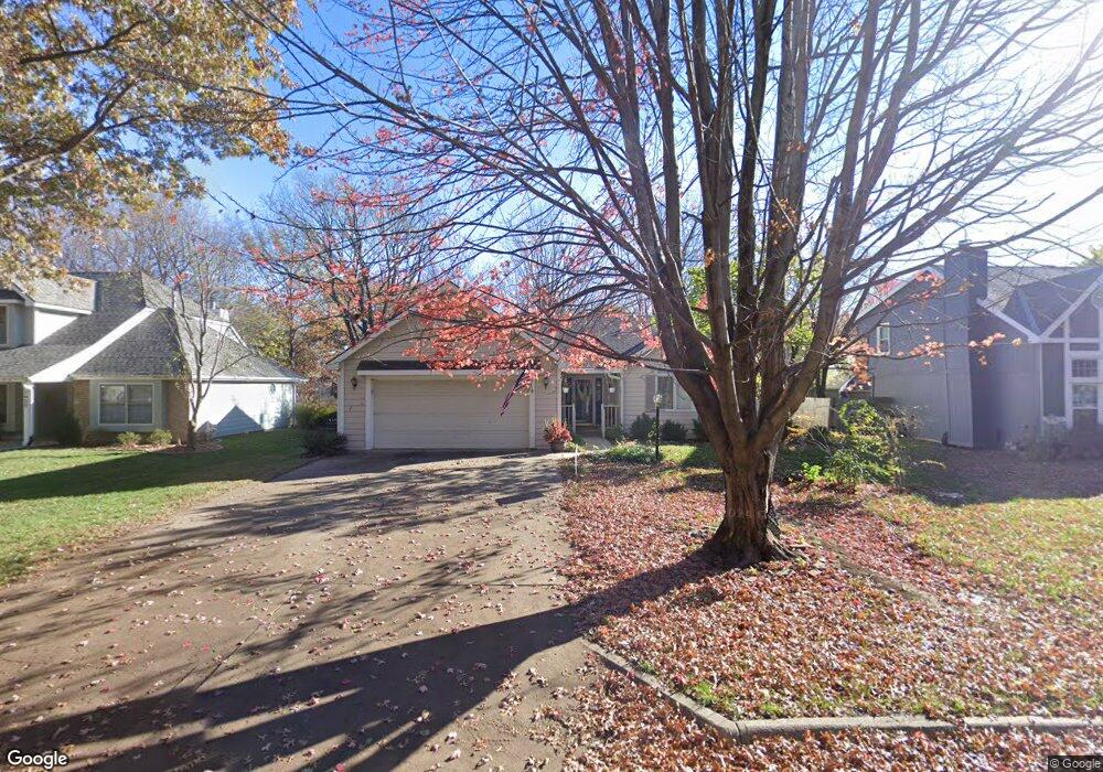
1036 Prescott Dr Lawrence, KS 66049
Quail Run NeighborhoodEstimated Value: $354,052 - $378,000
3
Beds
2
Baths
1,628
Sq Ft
$224/Sq Ft
Est. Value
About This Home
This home is located at 1036 Prescott Dr, Lawrence, KS 66049 and is currently estimated at $364,684, approximately $224 per square foot. 1036 Prescott Dr is a home located in Douglas County with nearby schools including Quail Run Elementary School, Southwest Middle School, and Lawrence Free State High School.
Ownership History
Date
Name
Owned For
Owner Type
Purchase Details
Closed on
Nov 24, 2008
Sold by
Meyer Allen E and Meyer Wilma B
Bought by
Meyer Allen E
Current Estimated Value
Purchase Details
Closed on
Dec 6, 2002
Sold by
Meyer Allen E and Meyer Wilma B
Bought by
Meyer Allen E and Meyer Wilma B
Home Financials for this Owner
Home Financials are based on the most recent Mortgage that was taken out on this home.
Original Mortgage
$108,700
Interest Rate
6.05%
Create a Home Valuation Report for This Property
The Home Valuation Report is an in-depth analysis detailing your home's value as well as a comparison with similar homes in the area
Home Values in the Area
Average Home Value in this Area
Purchase History
| Date | Buyer | Sale Price | Title Company |
|---|---|---|---|
| Meyer Allen E | -- | None Available | |
| Meyer Allen E | -- | Douglas County Title Co |
Source: Public Records
Mortgage History
| Date | Status | Borrower | Loan Amount |
|---|---|---|---|
| Closed | Meyer Allen E | $108,700 |
Source: Public Records
Tax History Compared to Growth
Tax History
| Year | Tax Paid | Tax Assessment Tax Assessment Total Assessment is a certain percentage of the fair market value that is determined by local assessors to be the total taxable value of land and additions on the property. | Land | Improvement |
|---|---|---|---|---|
| 2025 | $4,471 | $39,330 | $7,475 | $31,855 |
| 2024 | $4,471 | $36,191 | $7,475 | $28,716 |
| 2023 | $4,422 | $34,459 | $6,900 | $27,559 |
| 2022 | $4,043 | $31,326 | $6,900 | $24,426 |
| 2021 | $3,584 | $26,876 | $5,980 | $20,896 |
| 2020 | $3,437 | $25,921 | $5,980 | $19,941 |
| 2019 | $3,310 | $25,001 | $5,060 | $19,941 |
| 2018 | $3,010 | $22,601 | $4,600 | $18,001 |
| 2017 | $3,036 | $22,540 | $4,600 | $17,940 |
| 2016 | $2,905 | $22,529 | $4,600 | $17,929 |
| 2015 | $2,899 | $22,483 | $4,600 | $17,883 |
| 2014 | $2,689 | $21,080 | $4,600 | $16,480 |
Source: Public Records
Map
Nearby Homes
- 3916 Monterey Ct
- 1012 Alma Dr
- 1008 Wagon Wheel Rd
- 4403 Goldfield St
- 4201 Crofton Ct
- 3607 Crestview Rd
- 3900 Willshire Dr
- 3600 Parkview Ct
- 1204 Chadwick Ct
- 713 Sturbridge Ct
- 1120 Oak Tree Dr
- 611 Eldridge St
- 1406 Brighton Cir Unit B
- 3507 W 10th St
- 1580 Eldorado Dr
- 3404 Oxford Ct
- 3408 W 13th St
- 1413 Anthony Michael Dr
- 1507 Medinah Cir
- 904 Moundridge Dr
- 1100 Prescott Dr
- 1032 Prescott Dr
- 1037 Michael St
- 1104 Prescott Dr
- 1028 Prescott Dr
- 3929 W 11th Place
- 1105 Sturbridge Cir
- 1037 Prescott Dr
- 1108 Prescott Dr
- 1033 Prescott Dr
- 1101 Prescott Dr
- 1109 Sturbridge Cir
- 1033 Michael St
- 1105 Prescott Dr
- 1024 Prescott Dr
- 1029 Prescott Dr
- 3925 W 11th Place
- 1100 Sturbridge Cir
- 1112 Prescott Dr
- 1109 Prescott Dr