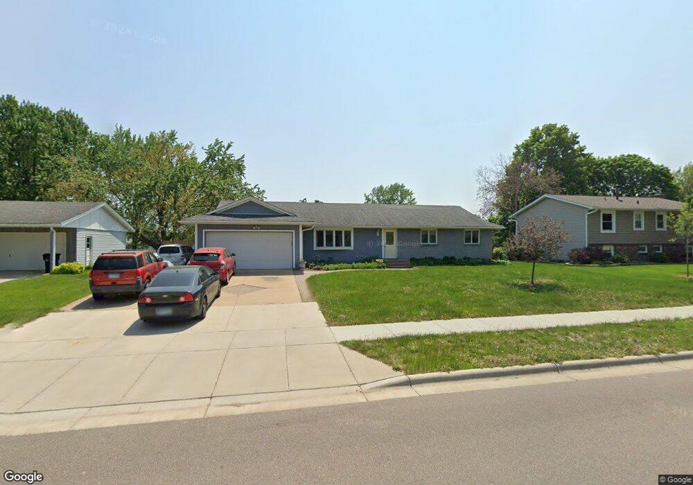
1036 Ramsdell Dr Saint Paul, MN 55124
Old Town NeighborhoodEstimated Value: $437,000 - $452,527
3
Beds
2
Baths
1,522
Sq Ft
$291/Sq Ft
Est. Value
About This Home
This home is located at 1036 Ramsdell Dr, Saint Paul, MN 55124 and is currently estimated at $443,632, approximately $291 per square foot. 1036 Ramsdell Dr is a home located in Dakota County with nearby schools including Southview Elementary School, Valley Middle School, and Apple Valley Senior High School.
Ownership History
Date
Name
Owned For
Owner Type
Purchase Details
Closed on
Apr 10, 2013
Sold by
Kegel Dayna Katherine
Bought by
Kegel Ralph Henry
Current Estimated Value
Purchase Details
Closed on
Jun 24, 2002
Sold by
Caberallo Llc
Bought by
Collier Joshua
Purchase Details
Closed on
Apr 15, 1997
Sold by
Davitt Richard H and Davitt Mary M
Bought by
Halverson Bruce L
Create a Home Valuation Report for This Property
The Home Valuation Report is an in-depth analysis detailing your home's value as well as a comparison with similar homes in the area
Home Values in the Area
Average Home Value in this Area
Purchase History
| Date | Buyer | Sale Price | Title Company |
|---|---|---|---|
| Kegel Ralph Henry | -- | None Available | |
| Collier Joshua | $200,000 | -- | |
| Halverson Bruce L | $119,900 | -- |
Source: Public Records
Mortgage History
| Date | Status | Borrower | Loan Amount |
|---|---|---|---|
| Closed | Halverson Bruce L | -- |
Source: Public Records
Tax History Compared to Growth
Tax History
| Year | Tax Paid | Tax Assessment Tax Assessment Total Assessment is a certain percentage of the fair market value that is determined by local assessors to be the total taxable value of land and additions on the property. | Land | Improvement |
|---|---|---|---|---|
| 2024 | $4,962 | $444,600 | $87,100 | $357,500 |
| 2023 | $4,962 | $438,400 | $87,300 | $351,100 |
| 2022 | $4,360 | $440,700 | $87,000 | $353,700 |
| 2021 | $4,074 | $375,600 | $75,700 | $299,900 |
| 2020 | $4,130 | $347,500 | $72,100 | $275,400 |
| 2019 | $3,533 | $342,000 | $68,600 | $273,400 |
| 2018 | $3,482 | $308,400 | $65,400 | $243,000 |
| 2017 | $3,429 | $292,000 | $62,200 | $229,800 |
| 2016 | $2,902 | $274,300 | $59,300 | $215,000 |
| 2015 | $2,719 | $217,602 | $54,075 | $163,527 |
| 2014 | -- | $205,067 | $51,659 | $153,408 |
| 2013 | -- | $185,774 | $47,034 | $138,740 |
Source: Public Records
Map
Nearby Homes
- 249 Elm Dr
- 148 Spruce Dr
- 892 Redwell Ln
- 921 Cortland Dr S
- 1516 Rushmore Dr
- 14825 Haven Dr
- 441 Walnut Ln
- 14709 White Oak Dr
- 15813 Garden View Dr
- 889 Whitney Dr
- 841 Cortland Dr
- 14786 Hallmark Dr
- 8681 144th Street Ct
- 15964 Hyland Dr
- 1312 Summit Oaks Dr
- 834 Fireside Dr
- 15931 Hyland Pointe Ct
- 15979 Harwell Ave
- 1101 Lavon Ln
- 8090 159th St W
- 1032 Ramsdell Dr
- 1040 Ramsdell Dr
- 1044 Ramsdell Dr
- 1028 Ramsdell Dr
- 1037 Baldwin Dr
- 1041 Baldwin Dr
- 1033 Baldwin Dr
- 1035 Ramsdell Dr
- 1031 Ramsdell Dr
- 1039 Ramsdell Dr
- 1045 Baldwin Dr
- 1029 Baldwin Dr
- 1048 Ramsdell Dr
- 1024 Ramsdell Dr
- 1027 Ramsdell Dr
- 1043 Ramsdell Dr
- 1025 Baldwin Dr
- 1052 Ramsdell Dr
- 1047 Ramsdell Dr
- 1034 Lowell Dr