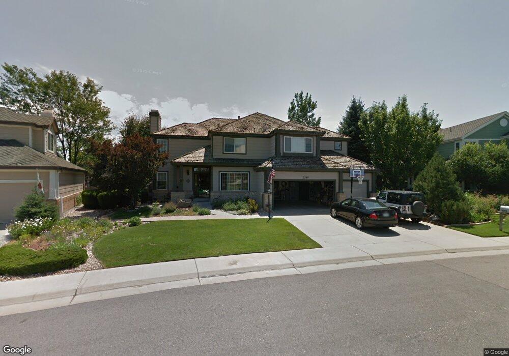
10360 Kennemere Ln Parker, CO 80134
Stonegate NeighborhoodEstimated Value: $760,481 - $791,000
4
Beds
4
Baths
2,763
Sq Ft
$280/Sq Ft
Est. Value
About This Home
This home is located at 10360 Kennemere Ln, Parker, CO 80134 and is currently estimated at $773,620, approximately $279 per square foot. 10360 Kennemere Ln is a home located in Douglas County with nearby schools including Pine Grove Elementary School, Sierra Middle School, and Chaparral High School.
Ownership History
Date
Name
Owned For
Owner Type
Purchase Details
Closed on
Aug 15, 1997
Sold by
John Keane Michael
Bought by
Hanrahan Peter F and Hanrahan Patricia M
Current Estimated Value
Home Financials for this Owner
Home Financials are based on the most recent Mortgage that was taken out on this home.
Original Mortgage
$237,600
Outstanding Balance
$33,932
Interest Rate
7%
Estimated Equity
$739,688
Purchase Details
Closed on
Jan 24, 1996
Sold by
Falcon Partnership Ltd
Bought by
Keane Michael John
Home Financials for this Owner
Home Financials are based on the most recent Mortgage that was taken out on this home.
Original Mortgage
$186,400
Interest Rate
7.14%
Mortgage Type
Balloon
Purchase Details
Closed on
May 29, 1990
Sold by
Stonegate Dev Inc
Bought by
Falcon Home Ltd
Create a Home Valuation Report for This Property
The Home Valuation Report is an in-depth analysis detailing your home's value as well as a comparison with similar homes in the area
Home Values in the Area
Average Home Value in this Area
Purchase History
| Date | Buyer | Sale Price | Title Company |
|---|---|---|---|
| Hanrahan Peter F | $264,000 | -- | |
| Keane Michael John | $233,000 | Land Title | |
| Falcon Home Ltd | $250,000 | -- |
Source: Public Records
Mortgage History
| Date | Status | Borrower | Loan Amount |
|---|---|---|---|
| Open | Hanrahan Peter F | $237,600 | |
| Previous Owner | Keane Michael John | $186,400 |
Source: Public Records
Tax History Compared to Growth
Tax History
| Year | Tax Paid | Tax Assessment Tax Assessment Total Assessment is a certain percentage of the fair market value that is determined by local assessors to be the total taxable value of land and additions on the property. | Land | Improvement |
|---|---|---|---|---|
| 2024 | $5,223 | $52,450 | $9,480 | $42,970 |
| 2023 | $5,267 | $52,450 | $9,480 | $42,970 |
| 2022 | $4,181 | $37,880 | $6,400 | $31,480 |
| 2021 | $4,301 | $37,880 | $6,400 | $31,480 |
| 2020 | $4,259 | $38,470 | $7,010 | $31,460 |
| 2019 | $4,156 | $38,470 | $7,010 | $31,460 |
| 2018 | $3,575 | $32,640 | $6,330 | $26,310 |
| 2017 | $3,371 | $32,640 | $6,330 | $26,310 |
| 2016 | $3,477 | $33,130 | $5,570 | $27,560 |
| 2015 | $3,543 | $33,130 | $5,570 | $27,560 |
| 2014 | $3,382 | $28,510 | $5,410 | $23,100 |
Source: Public Records
Map
Nearby Homes
- 16056 Quarry Hill Dr
- 16642 Autumn Rock Cove
- 16341 Maple Rock Ct
- 16382 Maple Rock Ct
- 10251 Hedge Ln
- 10414 Stonewillow Dr
- 16745 Rockledge Cove
- 15565 Flowerhill Cir
- 10312 Stoneflower Dr
- 10056 Carnelian Place
- 10158 Stoneridge Terrace
- 16136 Sequoia Dr
- 10553 Stonemeadow Dr
- 10311 Mica Way
- 10371 Knollside Dr
- 11626 Masonville Dr
- 11613 Masonville Dr
- 17071 Knollside Ave
- 16641 Martingale Dr
- 10676 Cottoneaster Way
- 10350 Kennemere Ln
- 10370 Kennemere Ln
- 10373 Crimson Ct
- 10383 Crimson Ct
- 10363 Crimson Ct
- 10340 Kennemere Ln
- 10380 Kennemere Ln
- 16141 Parkside Dr
- 10365 Kettering Ln
- 10355 Kettering Ln
- 10330 Kennemere Ln
- 16131 Parkside Dr
- 16151 Parkside Dr
- 10364 Crimson Ct
- 10374 Crimson Ct
- 10320 Kennemere Ln
- 10345 Kettering Ln
- 10405 Saranac Way
- 10356 Kettering Ln
- 10385 Saranac Way