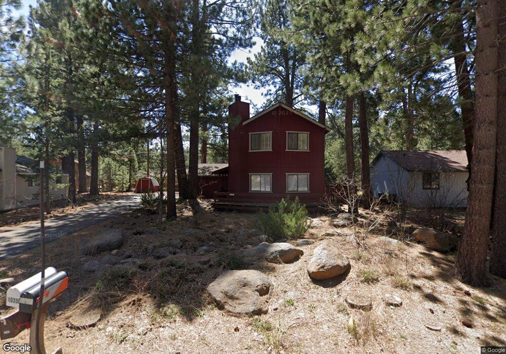
10363 Red Fir Rd Truckee, CA 96161
Sierra Meadows NeighborhoodEstimated Value: $919,682 - $1,130,000
3
Beds
2
Baths
2,024
Sq Ft
$509/Sq Ft
Est. Value
About This Home
This home is located at 10363 Red Fir Rd, Truckee, CA 96161 and is currently estimated at $1,029,921, approximately $508 per square foot. 10363 Red Fir Rd is a home located in Nevada County with nearby schools including Truckee Elementary School, Alder Creek Middle School, and Tahoe Truckee High School.
Ownership History
Date
Name
Owned For
Owner Type
Purchase Details
Closed on
Jul 18, 2011
Sold by
Watson Meredith and Raso Louis
Bought by
Watson Meredith and Raso Louis
Current Estimated Value
Purchase Details
Closed on
Feb 26, 2002
Sold by
Raso Louis and Watson Meredith
Bought by
Raso Louis M and Watson Meredith A
Home Financials for this Owner
Home Financials are based on the most recent Mortgage that was taken out on this home.
Original Mortgage
$56,000
Interest Rate
6.8%
Create a Home Valuation Report for This Property
The Home Valuation Report is an in-depth analysis detailing your home's value as well as a comparison with similar homes in the area
Home Values in the Area
Average Home Value in this Area
Purchase History
| Date | Buyer | Sale Price | Title Company |
|---|---|---|---|
| Watson Meredith | -- | None Available | |
| Watson Meredith | -- | None Available | |
| Raso Louis M | -- | Fidelity National Title |
Source: Public Records
Mortgage History
| Date | Status | Borrower | Loan Amount |
|---|---|---|---|
| Closed | Raso Louis M | $56,000 |
Source: Public Records
Tax History Compared to Growth
Tax History
| Year | Tax Paid | Tax Assessment Tax Assessment Total Assessment is a certain percentage of the fair market value that is determined by local assessors to be the total taxable value of land and additions on the property. | Land | Improvement |
|---|---|---|---|---|
| 2025 | $2,778 | $181,539 | $26,249 | $155,290 |
| 2024 | $2,754 | $177,981 | $25,735 | $152,246 |
| 2023 | $2,754 | $174,492 | $25,231 | $149,261 |
| 2022 | $2,684 | $171,072 | $24,737 | $146,335 |
| 2021 | $2,427 | $167,718 | $24,252 | $143,466 |
| 2020 | $2,412 | $165,999 | $24,004 | $141,995 |
| 2019 | $2,393 | $162,745 | $23,534 | $139,211 |
| 2018 | $2,294 | $159,555 | $23,073 | $136,482 |
| 2017 | $2,219 | $156,428 | $22,621 | $133,807 |
| 2016 | $2,203 | $153,363 | $22,178 | $131,185 |
| 2015 | $2,151 | $151,061 | $21,845 | $129,216 |
| 2014 | -- | $148,104 | $21,418 | $126,686 |
Source: Public Records
Map
Nearby Homes
- 10294 Sugar Pine Rd
- 10309 Jeffery Pine Rd
- 10228 Jeffery Pine Rd
- 10537 Stone Pine Rd
- 9240 Heartwood Dr
- 9234 Heartwood Dr
- 11467 Brockway Rd Unit Martis Drive
- 10113 Corrie Ct
- 9264 Heartwood Dr
- 10300 Palisades Dr
- 10336 Palisades Dr
- 10121 Palisades Dr Unit 2
- 10035 Nicolas Dr Unit D
- 9185 Heartwood Dr
- 10209 Modane Place
- 10277 Modane Place Unit 313
- 10400 Estates Dr
- 10232 Modane Place
- 10316 Shady Ln
- 10335 Old Brockway Rd
- 10379 Red Fir Rd
- 10351 Red Fir Rd
- 10370 Red Fir Rd Unit 1
- 10350 Red Fir Rd
- 10388 Red Fir Rd
- 10372 White Fir Rd
- 10340 White Fir Rd
- 10333 Red Fir Rd
- 10358 White Fir Rd
- 51273 Red Fir Rd
- 10334 Red Fir Rd
- 10402 Red Fir Rd
- 10303 Red Fir Rd
- 10984 Star Pine Rd
- 10998 Star Pine Rd
- 10533 Jeffery Pine Rd
- 10326 White Fir Rd
- 11026 Star Pine Rd
- 10511 Jeffery Pine Rd