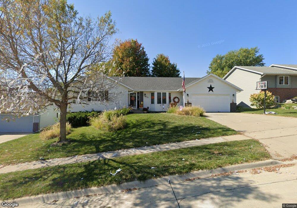
1037 Amy Ave Carroll, IA 51401
Estimated Value: $360,000 - $403,000
4
Beds
3
Baths
1,796
Sq Ft
$212/Sq Ft
Est. Value
About This Home
This home is located at 1037 Amy Ave, Carroll, IA 51401 and is currently estimated at $380,902, approximately $212 per square foot. 1037 Amy Ave is a home located in Carroll County with nearby schools including Fairview Elementary School, Adams Elementary School, and Carroll Middle School.
Ownership History
Date
Name
Owned For
Owner Type
Purchase Details
Closed on
Jul 19, 2022
Sold by
Aldag Bird Dorian M
Bought by
Bird William K
Current Estimated Value
Purchase Details
Closed on
Mar 27, 2015
Sold by
Bach Michael A
Bought by
Bird William K and Bird Dorian M Aldag
Home Financials for this Owner
Home Financials are based on the most recent Mortgage that was taken out on this home.
Original Mortgage
$216,000
Interest Rate
3.67%
Mortgage Type
New Conventional
Create a Home Valuation Report for This Property
The Home Valuation Report is an in-depth analysis detailing your home's value as well as a comparison with similar homes in the area
Home Values in the Area
Average Home Value in this Area
Purchase History
| Date | Buyer | Sale Price | Title Company |
|---|---|---|---|
| Bird William K | -- | None Listed On Document | |
| Bird William K | $270,000 | Security Title & Investment |
Source: Public Records
Mortgage History
| Date | Status | Borrower | Loan Amount |
|---|---|---|---|
| Previous Owner | Bird William K | $216,000 |
Source: Public Records
Tax History Compared to Growth
Tax History
| Year | Tax Paid | Tax Assessment Tax Assessment Total Assessment is a certain percentage of the fair market value that is determined by local assessors to be the total taxable value of land and additions on the property. | Land | Improvement |
|---|---|---|---|---|
| 2025 | $4,048 | $354,680 | $32,290 | $322,390 |
| 2024 | $4,048 | $314,850 | $32,290 | $282,560 |
| 2023 | $3,989 | $314,850 | $32,290 | $282,560 |
| 2022 | $3,786 | $261,180 | $35,880 | $225,300 |
| 2021 | $3,786 | $261,180 | $35,880 | $225,300 |
| 2020 | $3,872 | $261,180 | $35,880 | $225,300 |
| 2019 | $3,926 | $261,180 | $35,880 | $225,300 |
| 2018 | $3,696 | $261,180 | $35,880 | $225,300 |
| 2017 | $3,694 | $258,052 | $38,392 | $219,660 |
| 2016 | $3,322 | $232,010 | $0 | $0 |
| 2015 | $3,322 | $218,920 | $0 | $0 |
| 2014 | $2,974 | $200,050 | $0 | $0 |
Source: Public Records
Map
Nearby Homes
- 1068 Amy Ave
- 1022 Skyline Dr
- 1102 Skyline Dr
- 1137 High Ridge Rd
- 903 Amy Cir
- 1206 Woodland Dr
- 0 Monterey Dr Unit 6307161
- 0 Monterey Dr Unit 6137563
- 1037 Bella Vista Dr
- 1407 E 10th St
- 1409 E 10th St
- 01 Bella Vista Dr
- 1399 E 11th St
- 1401 E 11th St
- 621 Alta Vista Dr
- 1505 E 10th St
- 638 Capistrano Ave
- 1026 N Clark St
- 0 Northridge Dr Unit 6151180
- 1550 Edgewood Dr
- 1029 Amy Ave
- 1045 Amy Ave
- 1032 High Ridge Rd
- 1038 High Ridge Rd
- 1038 Amy Ave
- 1026 High Ridge Rd
- 1030 Amy Ave
- 1051 Amy Ave
- 1046 Amy Ave
- 1024 Amy Ave
- 1015 Amy Ave
- 1100 High Ridge Rd
- 1052 Amy Ave
- 1106 High Ridge Rd
- 1018 High Ridge Rd
- 1059 Amy Ave
- 1014 Amy Ave
- 1033 High Ridge Rd
- 1041 High Ridge Rd
- 1010 High Ridge Rd