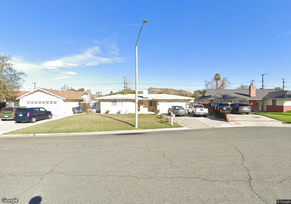
10375 Bryan St Riverside, CA 92505
La Sierra NeighborhoodEstimated Value: $528,154 - $631,000
3
Beds
2
Baths
1,122
Sq Ft
$504/Sq Ft
Est. Value
About This Home
This home is located at 10375 Bryan St, Riverside, CA 92505 and is currently estimated at $565,539, approximately $504 per square foot. 10375 Bryan St is a home located in Riverside County with nearby schools including Collett Elementary School, Arizona Middle School, and La Sierra High School.
Ownership History
Date
Name
Owned For
Owner Type
Purchase Details
Closed on
Sep 11, 1996
Sold by
American Svgs Bank Fa
Bought by
Barajas Jose and Barajas Esther
Current Estimated Value
Home Financials for this Owner
Home Financials are based on the most recent Mortgage that was taken out on this home.
Original Mortgage
$83,691
Outstanding Balance
$6,977
Interest Rate
7.87%
Mortgage Type
FHA
Estimated Equity
$558,562
Purchase Details
Closed on
Feb 16, 1996
Sold by
Angellar Robert N and Angellar Patricia E
Bought by
American Svgs Bank Fa
Create a Home Valuation Report for This Property
The Home Valuation Report is an in-depth analysis detailing your home's value as well as a comparison with similar homes in the area
Home Values in the Area
Average Home Value in this Area
Purchase History
| Date | Buyer | Sale Price | Title Company |
|---|---|---|---|
| Barajas Jose | $83,909 | Investors Title Company | |
| American Svgs Bank Fa | $66,725 | Orange Coast Title |
Source: Public Records
Mortgage History
| Date | Status | Borrower | Loan Amount |
|---|---|---|---|
| Open | Barajas Jose | $83,691 |
Source: Public Records
Tax History
| Year | Tax Paid | Tax Assessment Tax Assessment Total Assessment is a certain percentage of the fair market value that is determined by local assessors to be the total taxable value of land and additions on the property. | Land | Improvement |
|---|---|---|---|---|
| 2025 | $1,581 | $135,144 | $48,840 | $86,304 |
| 2023 | $1,581 | $129,898 | $46,945 | $82,953 |
| 2022 | $1,462 | $127,352 | $46,025 | $81,327 |
| 2021 | $1,450 | $124,856 | $45,123 | $79,733 |
| 2020 | $1,426 | $123,577 | $44,661 | $78,916 |
| 2019 | $1,407 | $121,155 | $43,786 | $77,369 |
| 2018 | $1,387 | $118,780 | $42,928 | $75,852 |
| 2017 | $1,360 | $116,452 | $42,087 | $74,365 |
| 2016 | $1,337 | $114,169 | $41,262 | $72,907 |
| 2015 | $1,316 | $112,457 | $40,644 | $71,813 |
| 2014 | $1,309 | $110,256 | $39,849 | $70,407 |
Source: Public Records
Map
Nearby Homes
- 4314 Baggett Dr
- 10233 Clara Vista Ln
- 10649 Renner St
- 0 Polk St
- 10520 Cook Ave
- 4615 Mobley Ave
- 3946 Tomlinson Ave
- 0 Cook Ave Unit PW25235031
- 3535 Banbury Dr Unit 88
- 3535 Banbury Dr Unit 14
- 3549 Polk St
- 3665 Ross St
- 4389 Drexel Ave
- 3625 Ross St
- 4201 Ferguson Ct
- 10028 Mildred Ct
- 4060 Harrison St
- 4834 Hedrick Ave
- 4247 Bravado
- 10710 Brookfield Dr
- 10383 Bryan St
- 10371 Bryan St
- 10376 Hole Ave
- 10387 Bryan St
- 10372 Hole Ave
- 10365 Bryan St
- 10378 Bryan St
- 10368 Bryan St
- 10366 Hole Ave
- 10372 Bryan St
- 10394 Hole Ave
- 10395 Bryan St
- 10380 Hole Ave
- 10382 Bryan St
- 10442 Bonita Ave
- 10327 Pendleton St
- 10319 Pendleton St
- 10309 Pendleton St
- 10458 Bonita Ave
- 10347 Pendleton St
Your Personal Tour Guide
Ask me questions while you tour the home.