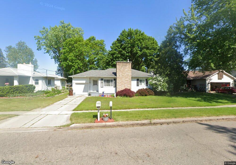
1038 Robins Rd Lansing, MI 48917
Estimated Value: $168,000 - $225,000
2
Beds
1
Bath
1,595
Sq Ft
$122/Sq Ft
Est. Value
About This Home
This home is located at 1038 Robins Rd, Lansing, MI 48917 and is currently estimated at $194,172, approximately $121 per square foot. 1038 Robins Rd is a home located in Eaton County with nearby schools including Waverly Senior High School, Windemere Park Charter Academy, and St. Gerard Elementary School.
Ownership History
Date
Name
Owned For
Owner Type
Purchase Details
Closed on
Jul 25, 2008
Sold by
Gillentine Lara M and Obrien Lara M
Bought by
Brandell Mary Lynn
Current Estimated Value
Home Financials for this Owner
Home Financials are based on the most recent Mortgage that was taken out on this home.
Original Mortgage
$117,161
Outstanding Balance
$77,535
Interest Rate
6.5%
Mortgage Type
FHA
Estimated Equity
$116,637
Purchase Details
Closed on
May 4, 2005
Sold by
The Estate Of Harold J Flannery Lip
Bought by
Obrien Lara M
Home Financials for this Owner
Home Financials are based on the most recent Mortgage that was taken out on this home.
Original Mortgage
$122,123
Interest Rate
5.73%
Mortgage Type
Fannie Mae Freddie Mac
Create a Home Valuation Report for This Property
The Home Valuation Report is an in-depth analysis detailing your home's value as well as a comparison with similar homes in the area
Home Values in the Area
Average Home Value in this Area
Purchase History
| Date | Buyer | Sale Price | Title Company |
|---|---|---|---|
| Brandell Mary Lynn | $119,000 | Tri County Title Agency Llc | |
| Obrien Lara M | $125,900 | Trans |
Source: Public Records
Mortgage History
| Date | Status | Borrower | Loan Amount |
|---|---|---|---|
| Open | Brandell Mary Lynn | $117,161 | |
| Previous Owner | Obrien Lara M | $122,123 |
Source: Public Records
Tax History
| Year | Tax Paid | Tax Assessment Tax Assessment Total Assessment is a certain percentage of the fair market value that is determined by local assessors to be the total taxable value of land and additions on the property. | Land | Improvement |
|---|---|---|---|---|
| 2025 | $2,720 | $77,300 | $0 | $0 |
| 2024 | $1,587 | $71,800 | $0 | $0 |
| 2023 | $1,526 | $65,600 | $0 | $0 |
| 2022 | $2,403 | $61,600 | $0 | $0 |
| 2021 | $2,325 | $56,000 | $0 | $0 |
| 2020 | $2,395 | $53,600 | $0 | $0 |
| 2019 | $2,340 | $51,812 | $0 | $0 |
| 2018 | $2,336 | $50,800 | $0 | $0 |
| 2017 | $2,247 | $50,600 | $0 | $0 |
| 2016 | -- | $49,300 | $0 | $0 |
| 2015 | -- | $49,000 | $0 | $0 |
| 2014 | -- | $48,400 | $0 | $0 |
| 2013 | -- | $48,900 | $0 | $0 |
Source: Public Records
Map
Nearby Homes
- 807 Maycroft Rd
- 4908 Applewood Dr
- 1031 Mall Dr E
- 0 San Gabriel
- 415 Winifred Ave
- 410 Renker Rd
- 401 Richard Ave
- 321 Renker Rd
- 0000 N Dibble Ave
- 215 Winifred Ave Unit A & B
- 1222 Ravenswood Dr
- 217 Richard Ave
- 3423 Upton Rd
- 1805 Boynton Dr
- 5137 Dorene Dr
- 2216 River Ct
- 1510 Sand Point Dr
- 1015 Westfield Rd
- 3733 Colchester Rd
- 3003 Timber Dr
- 1044 Robins Rd
- 1050 Robins Rd
- 1045 Robins Rd
- 1014 Robins Rd
- 1041 Robins Rd
- 1035 Robins Rd
- 1027 Robins Rd
- 4515 Addison Rd
- 1012 Robins Rd
- 1100 Robins Rd
- 1006 Robins Rd
- 1107 Robins Rd
- 1106 Robins Rd
- 4525 Addison Rd
- 1030 Bretton Rd
- 1024 Bretton Rd
- 4500 Elizabeth Rd
- 1112 Robins Rd
- 1002 Robins Rd
- 4516 Addison Rd
Your Personal Tour Guide
Ask me questions while you tour the home.