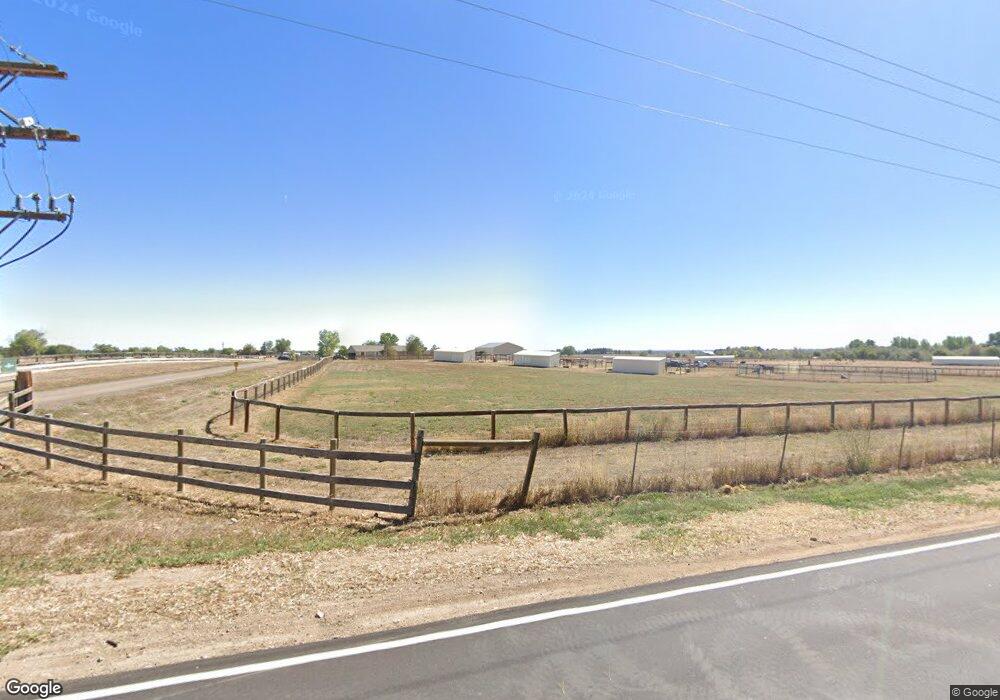
10394 N 65th St Longmont, CO 80503
Estimated Value: $822,486 - $986,000
3
Beds
2
Baths
1,490
Sq Ft
$616/Sq Ft
Est. Value
About This Home
This home is located at 10394 N 65th St, Longmont, CO 80503 and is currently estimated at $917,122, approximately $615 per square foot. 10394 N 65th St is a home located in Boulder County with nearby schools including Blue Mountain Elementary School, Altona Middle School, and Silver Creek High School.
Ownership History
Date
Name
Owned For
Owner Type
Purchase Details
Closed on
Dec 18, 2019
Sold by
Miller Stephen M
Bought by
Stephen M Miller & Mary O Wasson Liv Tr
Current Estimated Value
Purchase Details
Closed on
Nov 6, 2006
Sold by
Wheatley Stephen P and Wheatley Paula S
Bought by
Miller Stephen M
Purchase Details
Closed on
Aug 2, 2001
Sold by
Wheatley Stephen P and Wheatley Paula S
Bought by
Wheatley Stephen P
Purchase Details
Closed on
Jun 8, 1973
Bought by
Miller Stephen M
Create a Home Valuation Report for This Property
The Home Valuation Report is an in-depth analysis detailing your home's value as well as a comparison with similar homes in the area
Home Values in the Area
Average Home Value in this Area
Purchase History
| Date | Buyer | Sale Price | Title Company |
|---|---|---|---|
| Stephen M Miller & Mary O Wasson Liv Tr | -- | None Available | |
| Miller Stephen M | $425,000 | Guardian Title | |
| Wheatley Stephen P | -- | -- | |
| Miller Stephen M | $60,000 | -- |
Source: Public Records
Tax History Compared to Growth
Tax History
| Year | Tax Paid | Tax Assessment Tax Assessment Total Assessment is a certain percentage of the fair market value that is determined by local assessors to be the total taxable value of land and additions on the property. | Land | Improvement |
|---|---|---|---|---|
| 2025 | $5,048 | $50,581 | $15,031 | $35,550 |
| 2024 | $5,048 | $50,581 | $15,031 | $35,550 |
| 2023 | $4,963 | $52,407 | $9,045 | $47,047 |
| 2022 | $4,083 | $41,464 | $8,257 | $33,207 |
| 2021 | $4,091 | $42,657 | $8,494 | $34,163 |
| 2020 | $3,496 | $37,302 | $7,436 | $29,866 |
| 2019 | $3,436 | $37,302 | $7,436 | $29,866 |
| 2018 | $3,332 | $36,403 | $9,288 | $27,115 |
| 2017 | $3,248 | $40,245 | $10,268 | $29,977 |
| 2016 | $3,280 | $36,393 | $16,079 | $20,314 |
| 2015 | $3,007 | $29,985 | $12,736 | $17,249 |
| 2014 | $2,551 | $29,985 | $12,736 | $17,249 |
Source: Public Records
Map
Nearby Homes
- 10619 N 65th St
- 6880 Saint Vrain Rd
- 10077 N 75th St
- 7373 Nelson Rd
- 150 N 75th St
- 733 Kubat Ln Unit B
- 5595 Wheaton Ave
- 729 Kubat Ln Unit A
- 750 Kubat Ln Unit B
- 751 W Grange Ct Unit A
- 5717 Four Leaf Dr
- 5616 Wheaton Ave
- 5611 Wheaton Ave
- 5608 Grandville Ave
- 1106 Redbud Cir
- 5604 Grandville Ave
- 2100 2-Story Front Load Plan at West Grange
- 2100 Retreat Modern Butterfly Plan at West Grange
- 1600 Ranch Duplex Plan at West Grange
- Quad Tri-Level Townhomes Plan at West Grange
- 10522 N 65th St
- 10403 N 65th St
- 10353 N 65th St
- 10319 N 65th St
- 10287 N 65th St
- 6914 Saint Vrain Rd
- 10255 N 65th St
- 10221 N 65th St
- 10338 Phillipi Way
- 10370 Phillipi Way
- 10292 Phillipi Way
- 10006 N 65th St
- 10264 Phillipi Way
- 10152 N 65th St
- 10264 Phillipi Way
- 6389 Corinth Rd
- 10145 N 65th St
- 6381 Ephesus Rd
- 6386 Ephesus Rd
- 6900 Saint Vrain Rd