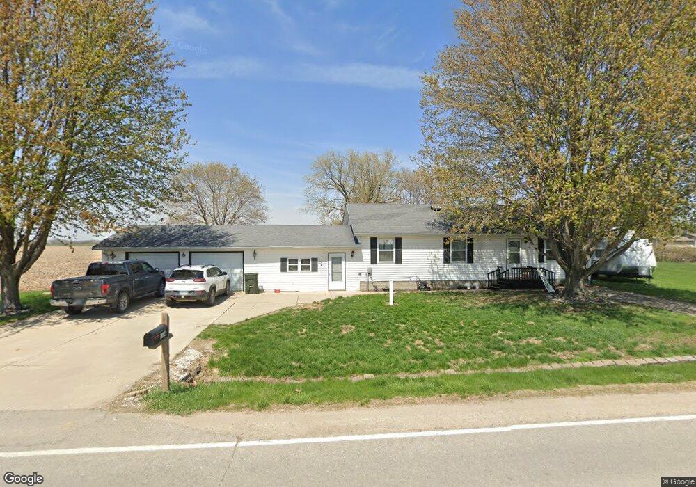
104 Broad St Reasnor, IA 50232
Estimated Value: $106,000 - $183,000
2
Beds
2
Baths
1,196
Sq Ft
$117/Sq Ft
Est. Value
About This Home
This home is located at 104 Broad St, Reasnor, IA 50232 and is currently estimated at $140,103, approximately $117 per square foot. 104 Broad St is a home located in Jasper County with nearby schools including PCM High School.
Ownership History
Date
Name
Owned For
Owner Type
Purchase Details
Closed on
May 24, 2023
Sold by
Hansen Rose M
Bought by
Hofer Jamie I and Hofer Randi J
Current Estimated Value
Home Financials for this Owner
Home Financials are based on the most recent Mortgage that was taken out on this home.
Original Mortgage
$75,850
Outstanding Balance
$73,741
Interest Rate
6.39%
Mortgage Type
FHA
Estimated Equity
$66,362
Purchase Details
Closed on
Apr 4, 2011
Sold by
Hansen Robert E and Hansen Rose M
Bought by
Hansen Rose M
Create a Home Valuation Report for This Property
The Home Valuation Report is an in-depth analysis detailing your home's value as well as a comparison with similar homes in the area
Home Values in the Area
Average Home Value in this Area
Purchase History
| Date | Buyer | Sale Price | Title Company |
|---|---|---|---|
| Hofer Jamie I | $77,500 | None Listed On Document | |
| Hansen Rose M | -- | None Available |
Source: Public Records
Mortgage History
| Date | Status | Borrower | Loan Amount |
|---|---|---|---|
| Open | Hofer Jamie I | $75,850 |
Source: Public Records
Tax History Compared to Growth
Tax History
| Year | Tax Paid | Tax Assessment Tax Assessment Total Assessment is a certain percentage of the fair market value that is determined by local assessors to be the total taxable value of land and additions on the property. | Land | Improvement |
|---|---|---|---|---|
| 2025 | $1,426 | $117,800 | $13,120 | $104,680 |
| 2024 | $1,426 | $90,160 | $13,120 | $77,040 |
| 2023 | $2,034 | $90,160 | $13,120 | $77,040 |
| 2022 | $2,218 | $114,870 | $13,120 | $101,750 |
| 2021 | $2,198 | $105,230 | $13,120 | $92,110 |
| 2020 | $2,198 | $94,830 | $9,790 | $85,040 |
| 2019 | $1,674 | $82,560 | $0 | $0 |
| 2018 | $1,674 | $82,560 | $0 | $0 |
| 2017 | $1,536 | $82,560 | $0 | $0 |
| 2016 | $1,692 | $82,560 | $0 | $0 |
| 2015 | $1,600 | $82,560 | $0 | $0 |
| 2014 | $1,486 | $82,560 | $0 | $0 |
Source: Public Records
Map
Nearby Homes
- 424 Newton St
- 5760 S 80th Ave E
- 5211 S 70th Ave E
- 7404 Sioux Ave
- 6657 E 78th St S
- 1397 S 52nd Ave E
- 713 N Monroe St
- 310 E Lincoln St
- 411 N Virginia St
- 307 E Lincoln St
- 410 E Washington St
- 601 N Commerce St
- 101 N Virginia St
- 213 W Lincoln St
- 413 N Buchanan St
- 410 W Washington St
- 606 W South St
- 4683 Legion St Unit ST80
- 206 Beverly Cir
- 305-307 Coneflower Ct