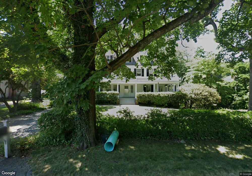
104 Brookside Dr Greenwich, CT 06831
Pemberwick NeighborhoodEstimated Value: $3,185,525 - $4,940,000
7
Beds
5
Baths
4,875
Sq Ft
$805/Sq Ft
Est. Value
About This Home
This home is located at 104 Brookside Dr, Greenwich, CT 06831 and is currently estimated at $3,923,631, approximately $804 per square foot. 104 Brookside Dr is a home located in Fairfield County with nearby schools including North Street School, Central Middle School, and Greenwich High School.
Ownership History
Date
Name
Owned For
Owner Type
Purchase Details
Closed on
Mar 11, 1999
Sold by
Quinby Constance
Bought by
Stallard Michael L and Stallard Katharine P
Current Estimated Value
Home Financials for this Owner
Home Financials are based on the most recent Mortgage that was taken out on this home.
Original Mortgage
$945,000
Interest Rate
6.5%
Mortgage Type
Purchase Money Mortgage
Create a Home Valuation Report for This Property
The Home Valuation Report is an in-depth analysis detailing your home's value as well as a comparison with similar homes in the area
Home Values in the Area
Average Home Value in this Area
Purchase History
| Date | Buyer | Sale Price | Title Company |
|---|---|---|---|
| Stallard Michael L | $1,350,000 | -- |
Source: Public Records
Mortgage History
| Date | Status | Borrower | Loan Amount |
|---|---|---|---|
| Open | Stallard Michael L | $915,000 | |
| Closed | Stallard Michael L | $945,000 |
Source: Public Records
Tax History Compared to Growth
Tax History
| Year | Tax Paid | Tax Assessment Tax Assessment Total Assessment is a certain percentage of the fair market value that is determined by local assessors to be the total taxable value of land and additions on the property. | Land | Improvement |
|---|---|---|---|---|
| 2025 | $16,920 | $1,369,060 | $627,340 | $741,720 |
| 2024 | $16,341 | $1,369,060 | $627,340 | $741,720 |
| 2023 | $15,930 | $1,369,060 | $627,340 | $741,720 |
| 2022 | $15,785 | $1,369,060 | $627,340 | $741,720 |
| 2021 | $16,644 | $1,382,430 | $576,800 | $805,630 |
| 2020 | $16,617 | $1,382,430 | $576,800 | $805,630 |
| 2019 | $16,783 | $1,382,430 | $576,800 | $805,630 |
| 2018 | $16,409 | $1,382,430 | $576,800 | $805,630 |
| 2017 | $16,575 | $1,379,070 | $576,730 | $802,340 |
| 2016 | $16,313 | $1,379,070 | $576,730 | $802,340 |
| 2015 | $16,595 | $1,391,600 | $722,260 | $669,340 |
| 2014 | $16,177 | $1,391,600 | $722,260 | $669,340 |
Source: Public Records
Map
Nearby Homes
- 15 Dearfield Ln
- 68 Dearfield Dr
- 6 Benedict Place
- 57 Prospect St
- 125 Field Point Rd Unit PH B5
- 34 Edgewood Dr
- 25 W Elm St Unit 36
- 15 Lafayette Ct Unit 4D
- 14 Meadow Dr
- 115 Lake Ave
- 1 Sound View Terrace
- 4 Lafayette Ct Unit 1C
- 4 Lafayette Ct Unit PH
- 50 Sound View Dr Unit 4n
- 98 Prospect St
- 47 Lafayette Place Unit 6J
- 47 Lafayette Place Unit 6J
- 25 Woodland Dr Unit C
- 75 Ritch Ave Unit A
- 75 Mason St
- 4 Brookside Park
- 100 Brookside Dr
- 1124 Brookside Dr
- 117 Brookside Dr
- 96 Brookside Dr
- 10 Brookside Park
- 12 Brookside Park
- 1 Brookside Park
- 88 Brookside Dr
- 5 Brookside Park
- 7 Brookside Park
- 7 Brookside Park
- 97 Brookside Dr
- 9 Edgewood Dr
- 101 Brookside Dr
- 93 Brookside Dr
- 84 Brookside Dr
- 84 Brookside Dr Unit 84a
- 82 Brookside Dr