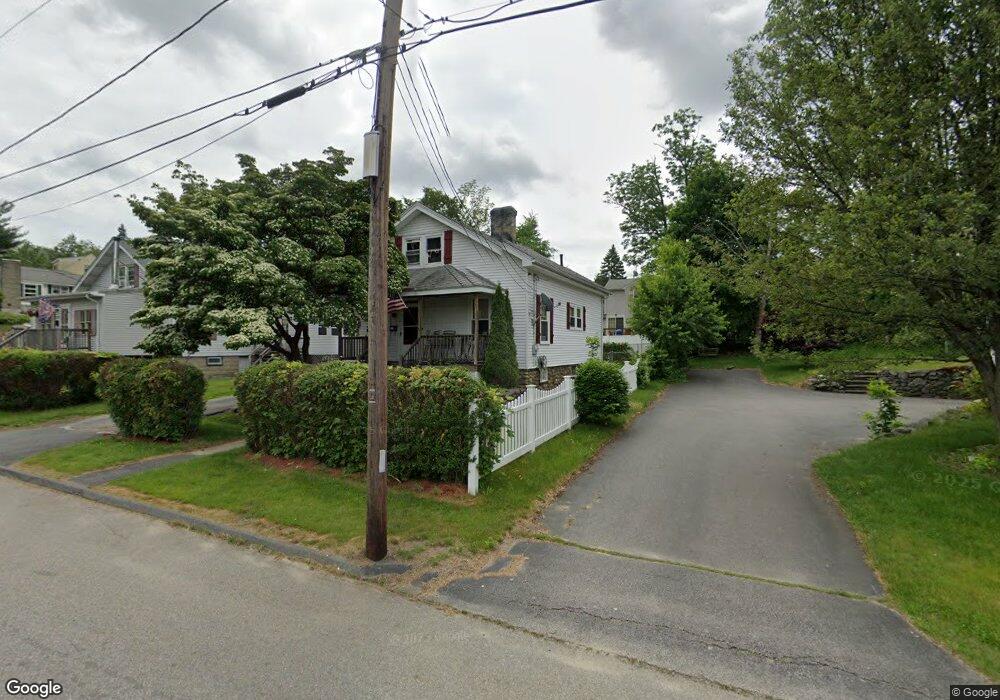
104 Christine St Worcester, MA 01606
Greendale NeighborhoodEstimated Value: $354,000 - $391,000
3
Beds
1
Bath
1,092
Sq Ft
$337/Sq Ft
Est. Value
About This Home
This home is located at 104 Christine St, Worcester, MA 01606 and is currently estimated at $368,478, approximately $337 per square foot. 104 Christine St is a home located in Worcester County with nearby schools including Jacob Hiatt Magnet School, Chandler Magnet, and Thorndyke Road School.
Ownership History
Date
Name
Owned For
Owner Type
Purchase Details
Closed on
Oct 25, 2021
Sold by
Dickinson Wendy K
Bought by
Erickson Carl and Obrien Tammy
Current Estimated Value
Home Financials for this Owner
Home Financials are based on the most recent Mortgage that was taken out on this home.
Original Mortgage
$252,835
Outstanding Balance
$231,062
Interest Rate
2.8%
Mortgage Type
FHA
Estimated Equity
$137,416
Create a Home Valuation Report for This Property
The Home Valuation Report is an in-depth analysis detailing your home's value as well as a comparison with similar homes in the area
Home Values in the Area
Average Home Value in this Area
Purchase History
| Date | Buyer | Sale Price | Title Company |
|---|---|---|---|
| Erickson Carl | $257,500 | None Available |
Source: Public Records
Mortgage History
| Date | Status | Borrower | Loan Amount |
|---|---|---|---|
| Open | Erickson Carl | $252,835 |
Source: Public Records
Tax History Compared to Growth
Tax History
| Year | Tax Paid | Tax Assessment Tax Assessment Total Assessment is a certain percentage of the fair market value that is determined by local assessors to be the total taxable value of land and additions on the property. | Land | Improvement |
|---|---|---|---|---|
| 2025 | $4,039 | $306,200 | $97,900 | $208,300 |
| 2024 | $3,876 | $281,900 | $97,900 | $184,000 |
| 2023 | $3,715 | $259,100 | $85,100 | $174,000 |
| 2022 | $3,413 | $224,400 | $68,100 | $156,300 |
| 2021 | $3,238 | $198,900 | $54,500 | $144,400 |
| 2020 | $3,091 | $181,800 | $54,500 | $127,300 |
| 2019 | $2,966 | $164,800 | $49,000 | $115,800 |
| 2018 | $2,961 | $156,600 | $49,000 | $107,600 |
| 2017 | $2,810 | $146,200 | $49,000 | $97,200 |
| 2016 | $2,772 | $134,500 | $36,400 | $98,100 |
| 2015 | $2,699 | $134,500 | $36,400 | $98,100 |
| 2014 | $2,628 | $134,500 | $36,400 | $98,100 |
Source: Public Records
Map
Nearby Homes
- 3 Granville Ave
- 48 Wilkinson St
- 314 Burncoat St
- 131 Airlie St
- 15 Ericsson St
- 80 Clark St
- 40 Francis St
- 43 Fales St
- 14 Fales St
- 29 Tylee Ave
- 23 Viele Ave
- 8 Cherry Blossom Cir Unit 50
- 14 Housatonic St
- 28 Brooks St
- 276 Saint Nicholas Ave
- 37 Kenwood Ave
- 2 Stowell Ave Unit A
- 68 Housatonic St
- 37 Uncatena Ave
- 30 Danielles Way
- 110 Christine St
- 98 Christine St
- 111 Wilkinson St
- 1 Marmion Ave
- 105 Wilkinson St
- 103 Christine St
- 111 Christine St
- 95 Christine St
- 90 Christine St Unit 2
- 90 Christine St Unit 1
- 90 Christine St
- 99 Wilkinson St
- 4 Marmion Ave
- 91 Christine St
- 14 Marmion Ave
- 84 Christine St
- 96 Kalmar St
- 106 Wilkinson St
- 98 Kalmar St
- 118 Wilkinson St