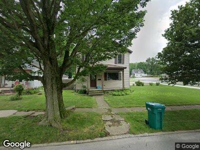
104 K St La Porte, IN 46350
Estimated Value: $169,277 - $220,000
3
Beds
2
Baths
1,924
Sq Ft
$102/Sq Ft
Est. Value
About This Home
This home is located at 104 K St, La Porte, IN 46350 and is currently estimated at $196,069, approximately $101 per square foot. 104 K St is a home located in LaPorte County with nearby schools including La Porte High School, Handley Elementary School, and Door Prairie Adventist School.
Ownership History
Date
Name
Owned For
Owner Type
Purchase Details
Closed on
Feb 4, 2015
Sold by
Ross Tom
Bought by
Ross Keith A
Current Estimated Value
Home Financials for this Owner
Home Financials are based on the most recent Mortgage that was taken out on this home.
Original Mortgage
$122,580
Interest Rate
3.82%
Mortgage Type
VA
Purchase Details
Closed on
May 24, 2013
Sold by
Laporte Community Fcu
Bought by
Ross Tom
Purchase Details
Closed on
Feb 14, 2013
Sold by
White Nicholas A and White Dorothy A
Bought by
Laporte Community Fcu
Create a Home Valuation Report for This Property
The Home Valuation Report is an in-depth analysis detailing your home's value as well as a comparison with similar homes in the area
Home Values in the Area
Average Home Value in this Area
Purchase History
| Date | Buyer | Sale Price | Title Company |
|---|---|---|---|
| Ross Keith A | -- | None Available | |
| Ross Tom | -- | None Available | |
| Laporte Community Fcu | -- | None Available |
Source: Public Records
Mortgage History
| Date | Status | Borrower | Loan Amount |
|---|---|---|---|
| Open | Ross Keith A | $115,498 | |
| Closed | Ross Keith A | $126,701 | |
| Closed | Ross Keith A | $122,580 |
Source: Public Records
Tax History Compared to Growth
Tax History
| Year | Tax Paid | Tax Assessment Tax Assessment Total Assessment is a certain percentage of the fair market value that is determined by local assessors to be the total taxable value of land and additions on the property. | Land | Improvement |
|---|---|---|---|---|
| 2024 | $1,428 | $148,100 | $17,500 | $130,600 |
| 2022 | $1,211 | $121,100 | $14,600 | $106,500 |
| 2021 | $1,121 | $112,100 | $14,600 | $97,500 |
| 2020 | $1,061 | $112,100 | $14,600 | $97,500 |
| 2019 | $1,109 | $106,100 | $17,400 | $88,700 |
| 2018 | $1,017 | $96,900 | $15,300 | $81,600 |
| 2017 | $968 | $92,000 | $15,300 | $76,700 |
| 2016 | $886 | $87,300 | $17,000 | $70,300 |
| 2014 | $864 | $41,500 | $16,900 | $24,600 |
Source: Public Records
Map
Nearby Homes
- 0 State Road 39
- 387 Hawthorne St
- 411 E St
- 516 E St
- 302 C St
- 302 & 302-1/2 C St
- 1002 L St
- 502 C St
- 705 Pennsylvania Ave
- 312 E Dr Scholl Ln E
- 0000 W 12th St
- 0 1st St Unit NRA542339
- 1103 Indiana Ave
- 826 Kingsporte Ave
- 1201 Michigan Ave
- 106 W 10th St
- 508 Maple Ave
- 1211 Highway 4
- 1312 Michigan Ave
- 52 Victoria Cir