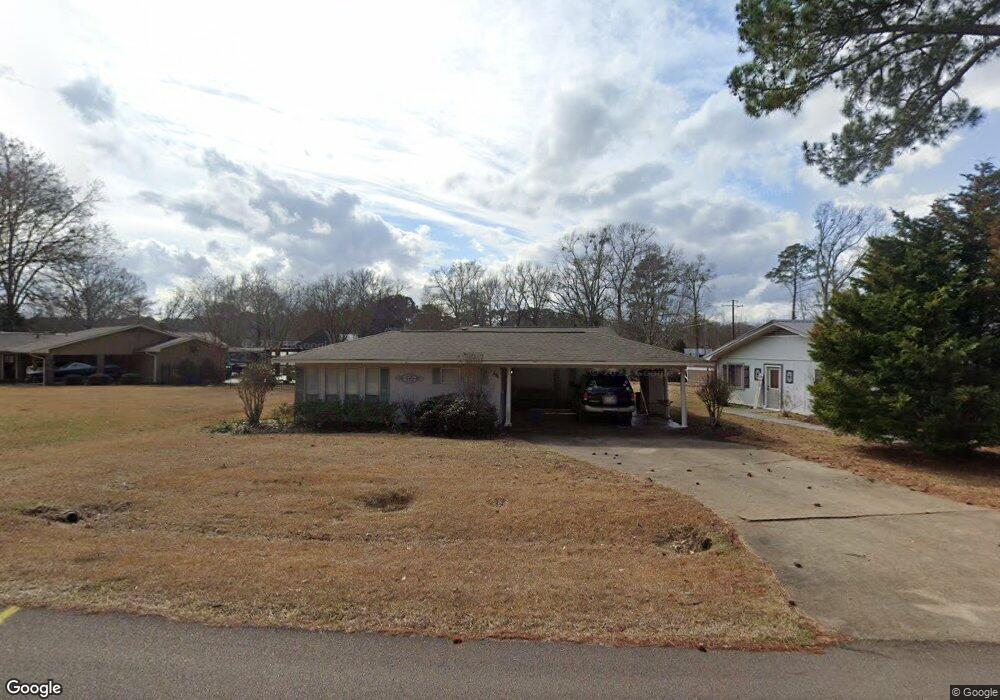
104 Trace Harbor Rd Madison, MS 39110
Estimated Value: $205,300 - $282,000
3
Beds
2
Baths
1,984
Sq Ft
$125/Sq Ft
Est. Value
About This Home
This home is located at 104 Trace Harbor Rd, Madison, MS 39110 and is currently estimated at $248,825, approximately $125 per square foot. 104 Trace Harbor Rd is a home located in Madison County with nearby schools including Madison Crossing Elementary School, Germantown Middle School, and Germantown High School.
Ownership History
Date
Name
Owned For
Owner Type
Purchase Details
Closed on
Sep 8, 2015
Sold by
Tatum Mavis E
Bought by
Whittington Melanie T and Tatum Mavis E
Current Estimated Value
Home Financials for this Owner
Home Financials are based on the most recent Mortgage that was taken out on this home.
Original Mortgage
$78,663
Interest Rate
4.02%
Mortgage Type
Future Advance Clause Open End Mortgage
Purchase Details
Closed on
Feb 23, 2007
Sold by
Tatum Mavis E and Tatum Holcomb P
Bought by
Whittington Melanie T
Create a Home Valuation Report for This Property
The Home Valuation Report is an in-depth analysis detailing your home's value as well as a comparison with similar homes in the area
Purchase History
| Date | Buyer | Sale Price | Title Company |
|---|---|---|---|
| Whittington Melanie T | -- | First Guaranty Title Inc | |
| Whittington Melanie T | -- | None Available |
Source: Public Records
Mortgage History
| Date | Status | Borrower | Loan Amount |
|---|---|---|---|
| Closed | Whittington Melanie T | $78,663 |
Source: Public Records
Tax History
| Year | Tax Paid | Tax Assessment Tax Assessment Total Assessment is a certain percentage of the fair market value that is determined by local assessors to be the total taxable value of land and additions on the property. | Land | Improvement |
|---|---|---|---|---|
| 2025 | $420 | $11,969 | $0 | $0 |
| 2024 | $420 | $11,969 | $0 | $0 |
| 2023 | $420 | $11,969 | $0 | $0 |
| 2022 | $420 | $11,969 | $0 | $0 |
| 2021 | $412 | $11,589 | $0 | $0 |
| 2020 | $412 | $11,589 | $0 | $0 |
| 2019 | $412 | $11,589 | $0 | $0 |
| 2018 | $379 | $11,589 | $0 | $0 |
| 2017 | $365 | $11,437 | $0 | $0 |
| 2016 | $365 | $11,437 | $0 | $0 |
| 2015 | $365 | $11,437 | $0 | $0 |
| 2014 | $268 | $10,393 | $0 | $0 |
Source: Public Records
Map
Nearby Homes
- 222 Trace Harbor Rd
- 102 Channel Ln
- 106 Shadow Hill Dr
- 119 Hidden Crest
- 115 Hidden Crest
- 133 Shadow Hill Dr
- 115 Shadow Hill Dr
- 213 Ironwood Plantation Blvd
- 0 Old Rice Rd Unit 22320205
- 186 Ironwood Plantation Blvd
- 116 Carrington Dr
- 0 Port St
- 136 Water St
- 134 Water St
- 137 Water St
- 130 Water St
- 135 Water St
- 133 Water St
- 112 Saddle Creek Cove
- 145 Republic St Unit Penthouse 431
- 102 Trace Harbor Rd
- 202 Trace Harbor Rd
- 100 Trace Harbor Rd
- 100 Summit Dr
- 204 Trace Harbor Rd
- 418 Old Rice Rd
- 103 Trace Harbor Rd
- 101 Trace Harbor Rd
- 201 Trace Harbor Rd
- 206 Trace Harbor Rd
- 102 Summit Dr
- 416 Old Rice Rd
- 103 Summit Dr
- 502 Old Rice Rd
- 203 Trace Harbor Rd
- 101 Summit Dr
- 414 Old Rice Rd
- 106 Summit Dr
- 105 Summit Dr
- 504 Old Rice Rd
Your Personal Tour Guide
Ask me questions while you tour the home.