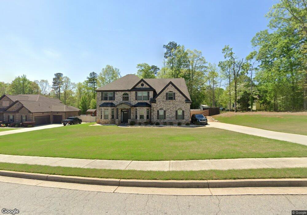
104 Way Point Dr Stockbridge, GA 30281
Estimated Value: $462,859 - $539,000
5
Beds
3
Baths
3,433
Sq Ft
$144/Sq Ft
Est. Value
About This Home
This home is located at 104 Way Point Dr, Stockbridge, GA 30281 and is currently estimated at $494,965, approximately $144 per square foot. 104 Way Point Dr is a home with nearby schools including Woodland Elementary School, Woodland Middle School, and Woodland High School.
Ownership History
Date
Name
Owned For
Owner Type
Purchase Details
Closed on
Sep 2, 2016
Sold by
Boakye Nana
Bought by
Agyemang Nana Boakye and Ramsey Demetria
Current Estimated Value
Purchase Details
Closed on
May 15, 2015
Sold by
Dr Horton Crown Llc
Bought by
Agyemong Nana and Ramsey Demetria
Home Financials for this Owner
Home Financials are based on the most recent Mortgage that was taken out on this home.
Original Mortgage
$259,218
Interest Rate
3.87%
Mortgage Type
FHA
Create a Home Valuation Report for This Property
The Home Valuation Report is an in-depth analysis detailing your home's value as well as a comparison with similar homes in the area
Home Values in the Area
Average Home Value in this Area
Purchase History
| Date | Buyer | Sale Price | Title Company |
|---|---|---|---|
| Agyemang Nana Boakye | -- | -- | |
| Agyemong Nana | $264,976 | -- |
Source: Public Records
Mortgage History
| Date | Status | Borrower | Loan Amount |
|---|---|---|---|
| Previous Owner | Agyemong Nana | $259,218 |
Source: Public Records
Tax History Compared to Growth
Tax History
| Year | Tax Paid | Tax Assessment Tax Assessment Total Assessment is a certain percentage of the fair market value that is determined by local assessors to be the total taxable value of land and additions on the property. | Land | Improvement |
|---|---|---|---|---|
| 2025 | $7,794 | $194,720 | $20,000 | $174,720 |
| 2024 | $7,794 | $183,760 | $20,000 | $163,760 |
| 2023 | $7,109 | $182,800 | $16,000 | $166,800 |
| 2022 | $5,700 | $146,080 | $16,000 | $130,080 |
| 2021 | $5,125 | $131,080 | $16,000 | $115,080 |
| 2020 | $4,859 | $124,160 | $14,000 | $110,160 |
| 2019 | $4,690 | $119,760 | $12,000 | $107,760 |
| 2018 | $4,485 | $114,400 | $12,000 | $102,400 |
| 2016 | $4,146 | $105,560 | $12,000 | $93,560 |
| 2015 | $396 | $10,000 | $10,000 | $0 |
Source: Public Records
Map
Nearby Homes
- 116 Way Point Dr
- 405 Tatum Terrace
- 100 Kim Trail
- 825 Bufflehead Ct
- 1548 Harlequin Way
- 1493 Harlequin Way
- 1009 Moseley Rd
- 1001 Moseley Rd
- 242 Summerford Place
- 551 Hood Rd
- 0 W Hemphill Rd Unit 10295429
- 0 W Hemphill Rd Unit 10536232
- 2581 Union Church Rd SW
- 278 Sound Cir
- 286 Sound Cir
- 120 Montgomery Dr
- 104 Montgomery Dr
- 544 Highway 138 E
- 0 N Highway 42 Unit 10627424
- 0 Highway 155 N Unit 7649185
- 108 Waypoint Dr Unit LOT 43
- 108 Way Point Dr Unit 43
- 1088 Highway 138 E
- 105 Way Point Dr
- 401 Tatum Terrace
- 112 Way Point Dr
- 301 Squadron Ln
- 105 Waypoint Dr
- 304 Squadron Ln
- 405 Tatum Terrace Unit LOT 33
- 116 Waypoint Dr Unit LOT 45
- 1064 Highway 138 E
- 116 Way Point Dr Unit 45
- 400 Tatum Terrace
- 305 Squadron Ln
- 404 Tatum Terrace
- 308 Squadron Ln Unit 39
- 120 Waypoint Dr Unit LOT 46
- 120 Way Point Dr Unit 46
- 309 Squadron Ln