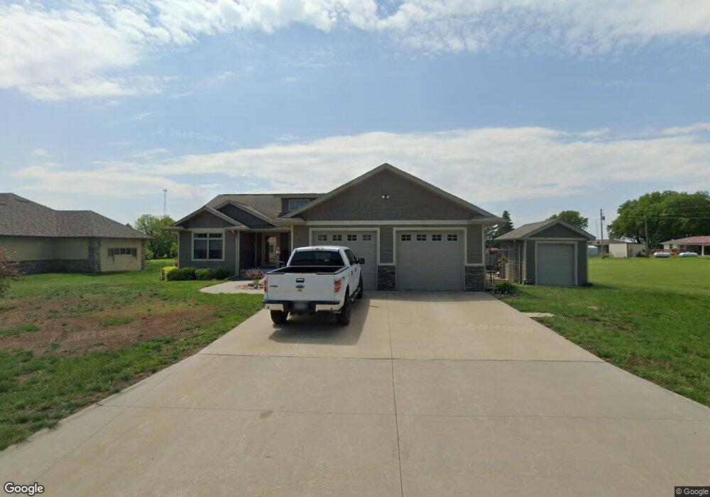
104 Westgate Rd Anthon, IA 51004
Estimated Value: $250,000 - $306,491
3
Beds
3
Baths
2,242
Sq Ft
$126/Sq Ft
Est. Value
About This Home
This home is located at 104 Westgate Rd, Anthon, IA 51004 and is currently estimated at $282,623, approximately $126 per square foot. 104 Westgate Rd is a home located in Woodbury County with nearby schools including Anthon Elementary School, Mvao Middle School, and Maple Valley-Anthon Oto High School.
Ownership History
Date
Name
Owned For
Owner Type
Purchase Details
Closed on
Aug 16, 2010
Sold by
City Of Anthon
Bought by
Fundermann Scott and Fundermann Tammy
Current Estimated Value
Purchase Details
Closed on
Jun 14, 2010
Sold by
City Of Anthon
Bought by
Fundermann Scott and Fundermann Tammy
Create a Home Valuation Report for This Property
The Home Valuation Report is an in-depth analysis detailing your home's value as well as a comparison with similar homes in the area
Purchase History
| Date | Buyer | Sale Price | Title Company |
|---|---|---|---|
| Fundermann Scott | -- | -- | |
| Fundermann Scott | -- | -- |
Source: Public Records
Tax History
| Year | Tax Paid | Tax Assessment Tax Assessment Total Assessment is a certain percentage of the fair market value that is determined by local assessors to be the total taxable value of land and additions on the property. | Land | Improvement |
|---|---|---|---|---|
| 2025 | $4,010 | $313,770 | $10,670 | $303,100 |
| 2024 | $38 | $268,860 | $10,670 | $258,190 |
| 2023 | $3,480 | $268,860 | $10,670 | $258,190 |
| 2022 | $2,916 | $205,640 | $10,670 | $194,970 |
| 2021 | $2,916 | $176,310 | $10,670 | $165,640 |
| 2020 | $2,698 | $155,930 | $11,420 | $144,510 |
| 2019 | $2,798 | $155,930 | $11,420 | $144,510 |
| 2018 | $2,770 | $155,930 | $11,420 | $144,510 |
| 2017 | $2,770 | $155,930 | $11,420 | $144,510 |
| 2016 | $2,742 | $155,930 | $0 | $0 |
| 2015 | $2,420 | $145,730 | $10,670 | $135,060 |
| 2014 | $2,420 | $136,090 | $10,670 | $125,420 |
Source: Public Records
Map
Nearby Homes
- 106 Westgate Rd
- 102 Westgate Rd
- 105 Westgate Rd
- 107 Westgate Rd
- 206 Westgate Ave
- 100 Westgate Rd
- 109 Westgate Rd
- 208 Westgate Ave
- 101 Westgate Rd
- 403 W Division St
- 300 Westgate Rd
- 405 W Division St
- 111 Westgate Rd
- 401 W Division St
- 306 E Randolph St
- 205 Westgate Ave
- 301 S Fox Ave
- 115 Westgate Rd
- 207 Westgate Rd
- 207 Westgate Ave
Your Personal Tour Guide
Ask me questions while you tour the home.