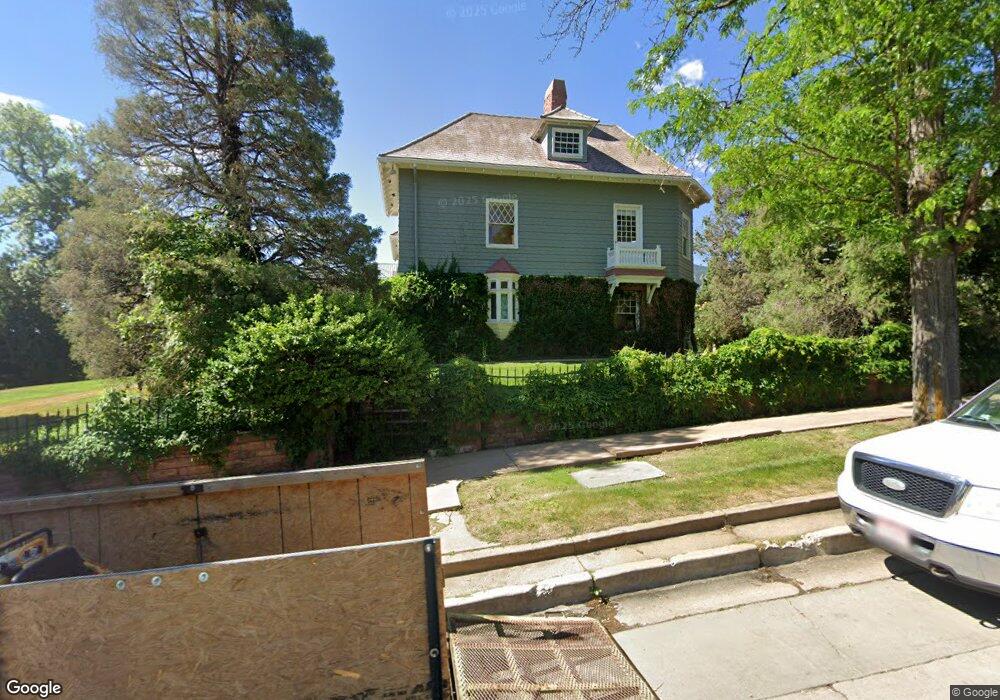
1040 Mapleton Ave Boulder, CO 80304
Mapleton Hill NeighborhoodEstimated Value: $5,126,338 - $7,197,000
4
Beds
3
Baths
5,146
Sq Ft
$1,170/Sq Ft
Est. Value
About This Home
This home is located at 1040 Mapleton Ave, Boulder, CO 80304 and is currently estimated at $6,021,779, approximately $1,170 per square foot. 1040 Mapleton Ave is a home located in Boulder County with nearby schools including Whittier Elementary School, Casey Middle School, and Boulder High School.
Ownership History
Date
Name
Owned For
Owner Type
Purchase Details
Closed on
Jan 12, 1988
Bought by
Barrett Richard W and Barrett Elaine E
Current Estimated Value
Purchase Details
Closed on
Nov 27, 1987
Bought by
Barrett Richard W and Barrett Elaine E
Purchase Details
Closed on
Jul 11, 1983
Bought by
Barrett Richard W and Barrett Elaine E
Purchase Details
Closed on
Mar 1, 1982
Bought by
Barrett Richard W and Barrett Elaine E
Create a Home Valuation Report for This Property
The Home Valuation Report is an in-depth analysis detailing your home's value as well as a comparison with similar homes in the area
Home Values in the Area
Average Home Value in this Area
Purchase History
| Date | Buyer | Sale Price | Title Company |
|---|---|---|---|
| Barrett Richard W | -- | -- | |
| Barrett Richard W | $671,900 | -- | |
| Barrett Richard W | $570,000 | -- | |
| Barrett Richard W | -- | -- |
Source: Public Records
Tax History
| Year | Tax Paid | Tax Assessment Tax Assessment Total Assessment is a certain percentage of the fair market value that is determined by local assessors to be the total taxable value of land and additions on the property. | Land | Improvement |
|---|---|---|---|---|
| 2025 | $38,750 | $412,951 | $261,188 | $151,763 |
| 2024 | $38,750 | $412,951 | $261,188 | $151,763 |
| 2023 | $38,078 | $440,927 | $276,248 | $168,364 |
| 2022 | $33,751 | $363,443 | $195,802 | $167,641 |
| 2021 | $32,184 | $373,902 | $201,437 | $172,465 |
| 2020 | $33,527 | $385,171 | $225,783 | $159,388 |
| 2019 | $33,014 | $385,171 | $225,783 | $159,388 |
| 2018 | $30,588 | $352,800 | $225,072 | $127,728 |
| 2017 | $29,631 | $435,452 | $248,830 | $186,622 |
| 2016 | $24,255 | $280,192 | $177,747 | $102,445 |
| 2015 | $22,968 | $206,045 | $86,844 | $119,201 |
| 2014 | $17,324 | $206,045 | $86,844 | $119,201 |
Source: Public Records
Map
Nearby Homes
- 1111 Maxwell Ave Unit 109
- 1111 Maxwell Ave Unit 105
- 2033 11th St Unit 3, 1
- 934 Spruce St
- 827 Maxwell Ave Unit E
- 745 Highland Ave
- 1020 Portland Place
- 946 Portland Place
- 1031 Portland Place Unit 4
- 900 Portland Place
- 1009 Portland Place
- 643 Mapleton Ave
- 604 Mapleton Ave
- 1155 Canyon Blvd Unit 202
- 1155 Canyon Blvd Unit 205
- 613 Pine St
- 1077 Canyon Blvd Unit 304
- 1077 Canyon Blvd Unit 403
- 1077 Canyon Blvd Unit 305
- 1077 Canyon Blvd Unit 211
- 1150 Mapleton Ave
- 1020 Mapleton Ave
- 1116 Mapleton Ave
- 1053 Pine St
- 1103 Pine St
- 1045 Pine St Unit 1
- 1109 Pine St
- 1063 Mapleton Ave
- 1041 Pine St Unit 2
- 1047 Pine St Unit 3
- 1043 Pine St Unit 4
- 1014 Mapleton Ave
- 1039 Mapleton Ave
- 1109 Mapleton Ave
- 1117 Pine St
- 1043 Mapleton Ave
- 1045 Mapleton Ave
- 1037 Pine St
- 1025 Mapleton Ave
- 1027 Pine St
Your Personal Tour Guide
Ask me questions while you tour the home.