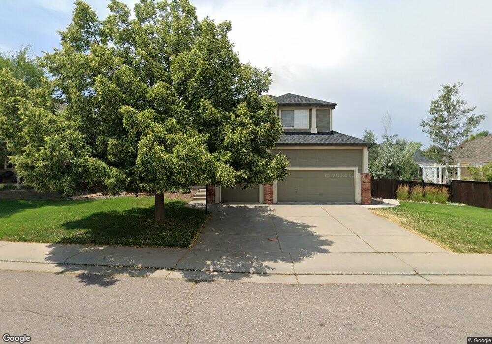
10401 Longleaf Dr Parker, CO 80134
Stonegate NeighborhoodEstimated Value: $770,088 - $797,000
5
Beds
4
Baths
3,434
Sq Ft
$227/Sq Ft
Est. Value
About This Home
This home is located at 10401 Longleaf Dr, Parker, CO 80134 and is currently estimated at $778,272, approximately $226 per square foot. 10401 Longleaf Dr is a home located in Douglas County with nearby schools including Pine Grove Elementary School, Sierra Middle School, and Chaparral High School.
Ownership History
Date
Name
Owned For
Owner Type
Purchase Details
Closed on
Jul 21, 2014
Sold by
Emerson Jeffrey W and Emerson Elizaebth C
Bought by
Garcia Frank and Garcia Natalia Joy
Current Estimated Value
Home Financials for this Owner
Home Financials are based on the most recent Mortgage that was taken out on this home.
Original Mortgage
$384,702
Outstanding Balance
$291,229
Interest Rate
4.23%
Mortgage Type
New Conventional
Estimated Equity
$487,043
Purchase Details
Closed on
Sep 26, 2002
Sold by
Busch Properties Inc
Bought by
Emerson Jeffrey W and Emerson Elizabeth C
Home Financials for this Owner
Home Financials are based on the most recent Mortgage that was taken out on this home.
Original Mortgage
$291,650
Interest Rate
5.5%
Purchase Details
Closed on
Sep 23, 2002
Sold by
Busch Properties Inc
Bought by
Emerson Jeffrey W and Emerson Elizabeth C
Home Financials for this Owner
Home Financials are based on the most recent Mortgage that was taken out on this home.
Original Mortgage
$291,650
Interest Rate
5.5%
Purchase Details
Closed on
May 15, 2002
Sold by
Smith Brendan M and Smith Elaine M
Bought by
Busch Properties Inc
Purchase Details
Closed on
May 1, 2002
Sold by
Smith Brendan M and Smith Elaine M
Bought by
Busch Properties Inc
Purchase Details
Closed on
Nov 9, 2000
Sold by
Lane Kelvin R and Lane Jacqueline M
Bought by
Smith Brendan M and Smith Elaine M
Home Financials for this Owner
Home Financials are based on the most recent Mortgage that was taken out on this home.
Original Mortgage
$207,000
Interest Rate
7.72%
Mortgage Type
Balloon
Purchase Details
Closed on
Nov 7, 2000
Sold by
Lane Kelvin R and Lane Jacqueline M
Bought by
Smith Brendan M and Smith Elaine M
Home Financials for this Owner
Home Financials are based on the most recent Mortgage that was taken out on this home.
Original Mortgage
$207,000
Interest Rate
7.72%
Mortgage Type
Balloon
Purchase Details
Closed on
Dec 20, 1996
Sold by
Casto Paul K and Casto Stephanie D
Bought by
Lane Kelvin R and Lane Jacqueline M
Home Financials for this Owner
Home Financials are based on the most recent Mortgage that was taken out on this home.
Original Mortgage
$190,000
Interest Rate
6.75%
Purchase Details
Closed on
Dec 7, 1995
Sold by
Falcon Partnership Ltd
Bought by
Casto Paul K and Casto Stephanie D
Home Financials for this Owner
Home Financials are based on the most recent Mortgage that was taken out on this home.
Original Mortgage
$174,200
Interest Rate
7.4%
Purchase Details
Closed on
Jun 9, 1995
Sold by
Stonegate Dev Inc
Bought by
Falcon Partnership Ltd
Create a Home Valuation Report for This Property
The Home Valuation Report is an in-depth analysis detailing your home's value as well as a comparison with similar homes in the area
Home Values in the Area
Average Home Value in this Area
Purchase History
We collect this data history from publicly available records. To have your information removed, we recommend requesting removal directly through your county’s website.
| Date | Buyer | Sale Price | Title Company |
|---|---|---|---|
| Garcia Frank | $404,950 | None Available | |
| Emerson Jeffrey W | $307,000 | -- | |
| Emerson Jeffrey W | $307,000 | -- | |
| Busch Properties Inc | $320,250 | -- | |
| Busch Properties Inc | $320,300 | -- | |
| Smith Brendan M | $300,000 | -- | |
| Smith Brendan M | $300,000 | -- | |
| Lane Kelvin R | $220,000 | Land Title | |
| Casto Paul K | $217,806 | Land Title | |
| Falcon Partnership Ltd | $291,100 | -- |
Source: Public Records
Mortgage History
We collect this data history from publicly available records. To have your information removed, we recommend requesting removal directly through your county’s website.
| Date | Status | Borrower | Loan Amount |
|---|---|---|---|
| Open | Garcia Frank | $384,702 | |
| Previous Owner | Emerson Jeffrey W | $291,650 | |
| Previous Owner | Smith Brendan M | $207,000 | |
| Previous Owner | Lane Kelvin R | $190,000 | |
| Previous Owner | Casto Paul K | $174,200 |
Source: Public Records
Tax History
| Year | Tax Paid | Tax Assessment Tax Assessment Total Assessment is a certain percentage of the fair market value that is determined by local assessors to be the total taxable value of land and additions on the property. | Land | Improvement |
|---|---|---|---|---|
| 2025 | $5,414 | $53,490 | $11,730 | $41,760 |
| 2024 | $5,414 | $54,240 | $9,870 | $44,370 |
| 2023 | $5,461 | $54,240 | $9,870 | $44,370 |
| 2022 | $4,193 | $37,980 | $6,620 | $31,360 |
| 2021 | $4,311 | $37,980 | $6,620 | $31,360 |
| 2020 | $4,066 | $36,720 | $7,220 | $29,500 |
| 2019 | $3,967 | $36,720 | $7,220 | $29,500 |
| 2018 | $3,669 | $33,500 | $6,530 | $26,970 |
| 2017 | $3,460 | $33,500 | $6,530 | $26,970 |
| 2016 | $3,500 | $33,350 | $5,570 | $27,780 |
| 2015 | $1,783 | $33,350 | $5,570 | $27,780 |
| 2014 | $3,151 | $26,560 | $5,410 | $21,150 |
Source: Public Records
Map
Nearby Homes
- 10420 White Pine Dr
- 16642 Autumn Rock Cove
- 10580 Wintersweet Ct
- 16648 Oakmoor Place
- 16351 Parkside Dr
- 17130 Opal Hill Dr
- 10755 Willow Reed Ct
- 16361 Oakmoor Place
- 17351 Cornerstone Dr
- 10318 Severance Dr
- 17302 Witten Ct
- 10515 Holyoke Dr
- 9923 Boca Cir
- 10858 Willow Reed Cir E
- 10269 Lodestone Way
- 16224 Quarry Hill Dr
- 10072 Boca Cir
- 10617 Clarke Farms Dr
- 10886 Willow Reed Cir W
- 17002 Walsh Ave
- 10409 Longleaf Dr
- 10412 White Pine Dr
- 10408 White Pine Dr
- 10417 Longleaf Dr
- 10394 Longleaf Dr
- 10402 Longleaf Dr
- 10388 Longleaf Dr
- 10426 White Pine Dr
- 10410 Longleaf Dr
- 10448 Shorepine Ct
- 10445 Shorepine Ct
- 10378 Longleaf Dr
- 10427 Longleaf Dr
- 10418 Longleaf Dr
- 10432 White Pine Dr
- 10411 White Pine Dr
- 10407 White Pine Dr
- 10419 White Pine Dr
- 10426 Longleaf Dr
- 10436 White Pine Dr
Your Personal Tour Guide
Ask me questions while you tour the home.