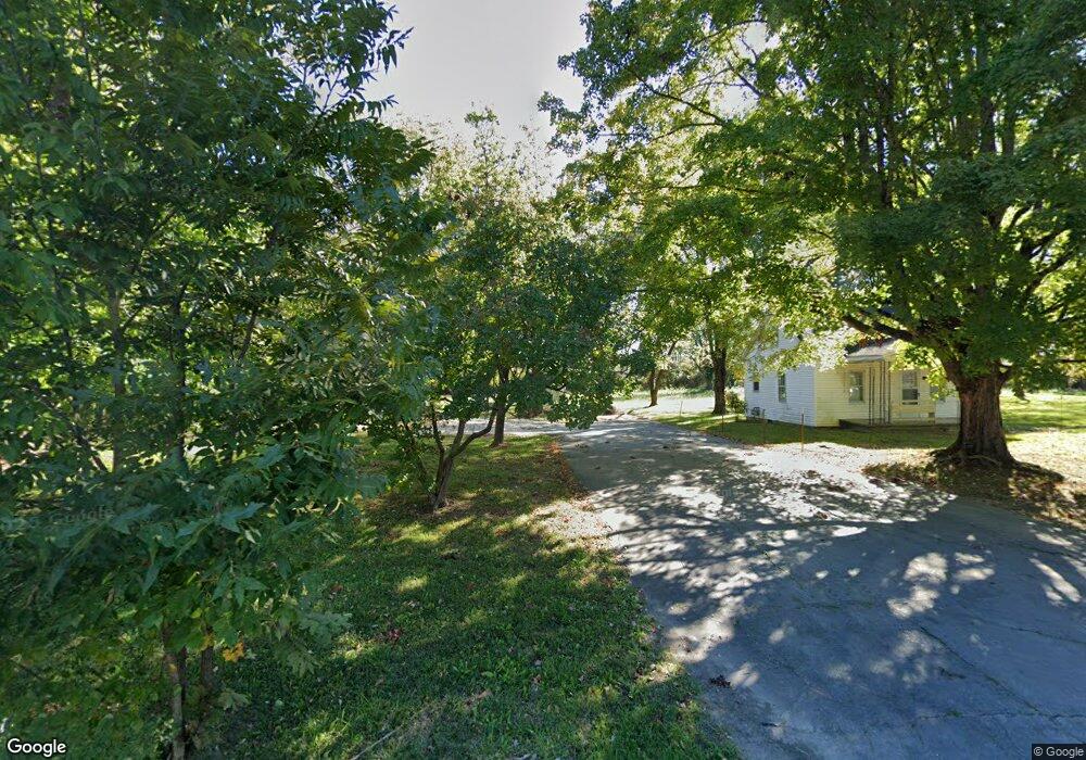
1041 Fisk Rd Cookeville, TN 38501
Four NeighborhoodEstimated Value: $238,000 - $850,574
2
Beds
1
Bath
506
Sq Ft
$1,214/Sq Ft
Est. Value
About This Home
This home is located at 1041 Fisk Rd, Cookeville, TN 38501 and is currently estimated at $614,394, approximately $1,214 per square foot. 1041 Fisk Rd is a home located in Putnam County with nearby schools including Northeast Elementary School, Cookeville High School, and Algood Middle School.
Ownership History
Date
Name
Owned For
Owner Type
Purchase Details
Closed on
Sep 2, 2014
Sold by
Bradley Larry Harold Trust
Bought by
Gaw Shirley Family Partnership
Current Estimated Value
Purchase Details
Closed on
Sep 7, 2012
Sold by
Bradley Annella
Bought by
Bradley Larry Harold Rlt and Bradley Larry Harold (Tr)
Purchase Details
Closed on
Dec 6, 1996
Sold by
Bradley Living Trust
Bought by
City Of Cookeville
Purchase Details
Closed on
Aug 29, 1996
Sold by
Annella Bradley
Bought by
Bradley Living Trust
Purchase Details
Closed on
Oct 22, 1963
Bought by
Smith Fannie A
Purchase Details
Closed on
Sep 28, 1946
Create a Home Valuation Report for This Property
The Home Valuation Report is an in-depth analysis detailing your home's value as well as a comparison with similar homes in the area
Home Values in the Area
Average Home Value in this Area
Purchase History
| Date | Buyer | Sale Price | Title Company |
|---|---|---|---|
| Gaw Shirley Family Partnership | $375,000 | -- | |
| Bradley Larry Harold Rlt | -- | -- | |
| City Of Cookeville | -- | -- | |
| Bradley Living Trust | -- | -- | |
| Smith Fannie A | -- | -- | |
| -- | -- | -- |
Source: Public Records
Tax History Compared to Growth
Tax History
| Year | Tax Paid | Tax Assessment Tax Assessment Total Assessment is a certain percentage of the fair market value that is determined by local assessors to be the total taxable value of land and additions on the property. | Land | Improvement |
|---|---|---|---|---|
| 2024 | $7,719 | $215,600 | $164,840 | $50,760 |
| 2023 | $7,719 | $215,600 | $164,840 | $50,760 |
| 2022 | $9,706 | $294,840 | $164,840 | $130,000 |
| 2021 | $9,706 | $294,840 | $164,840 | $130,000 |
| 2020 | $5,874 | $294,840 | $164,840 | $130,000 |
| 2019 | $5,874 | $150,000 | $75,000 | $75,000 |
| 2018 | $5,355 | $150,000 | $75,000 | $75,000 |
| 2017 | $5,355 | $150,000 | $75,000 | $75,000 |
| 2016 | $5,355 | $150,000 | $75,000 | $75,000 |
| 2015 | $8,210 | $221,600 | $151,360 | $70,240 |
| 2014 | $5,488 | $148,125 | $0 | $0 |
Source: Public Records
Map
Nearby Homes
- 1175 Meadow Rd
- 108 Landmark Ct
- 1215 Meadow Rd
- 1115 Patrick St
- 977 Sunset Dr
- 1010 Country Club Rd Unit N3
- 1010 Country Club Rd
- 1281 E 10th St
- 1275 Carol Ln
- 1050 Oaklawn Dr
- 1155 Winterhill Dr
- 1200 Park Dr
- 1362 Ivy Ln
- 810 Breeding Ave
- 600 N Pickard Ave
- 585 Jamestown Rd
- 756 Brown Ave
- 545 Saddle Ln
- 629 Clark Ave
- 727 Timber Ln