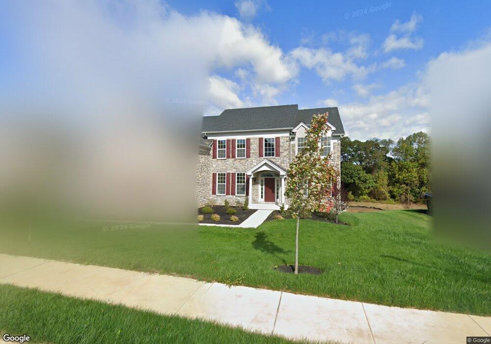
1042 Matthew Way New Castle, DE 19720
Saint Georges NeighborhoodEstimated Value: $784,000 - $915,000
4
Beds
4
Baths
4,041
Sq Ft
$210/Sq Ft
Est. Value
About This Home
This home is located at 1042 Matthew Way, New Castle, DE 19720 and is currently estimated at $849,544, approximately $210 per square foot. 1042 Matthew Way is a home with nearby schools including Southern Elementary School, Gunning Bedford Middle School, and Aquinas Academy.
Ownership History
Date
Name
Owned For
Owner Type
Purchase Details
Closed on
May 26, 2020
Sold by
Forrest Isaac
Bought by
Forrest Isaac and Forrest Eleanor
Current Estimated Value
Home Financials for this Owner
Home Financials are based on the most recent Mortgage that was taken out on this home.
Original Mortgage
$510,400
Outstanding Balance
$451,430
Interest Rate
3.2%
Mortgage Type
New Conventional
Estimated Equity
$398,114
Purchase Details
Closed on
May 14, 2020
Sold by
Toll De Lp
Bought by
Forrest Isaac
Home Financials for this Owner
Home Financials are based on the most recent Mortgage that was taken out on this home.
Original Mortgage
$510,400
Outstanding Balance
$451,430
Interest Rate
3.2%
Mortgage Type
New Conventional
Estimated Equity
$398,114
Create a Home Valuation Report for This Property
The Home Valuation Report is an in-depth analysis detailing your home's value as well as a comparison with similar homes in the area
Home Values in the Area
Average Home Value in this Area
Purchase History
| Date | Buyer | Sale Price | Title Company |
|---|---|---|---|
| Forrest Isaac | -- | None Available | |
| Forrest Isaac | $650,000 | None Available |
Source: Public Records
Mortgage History
| Date | Status | Borrower | Loan Amount |
|---|---|---|---|
| Open | Forrest Isaac | $510,400 |
Source: Public Records
Tax History Compared to Growth
Tax History
| Year | Tax Paid | Tax Assessment Tax Assessment Total Assessment is a certain percentage of the fair market value that is determined by local assessors to be the total taxable value of land and additions on the property. | Land | Improvement |
|---|---|---|---|---|
| 2024 | $5,811 | $167,100 | $13,600 | $153,500 |
| 2023 | $5,312 | $167,100 | $13,600 | $153,500 |
| 2022 | $5,386 | $162,700 | $13,600 | $149,100 |
| 2021 | $5,383 | $162,700 | $13,600 | $149,100 |
| 2020 | $5,418 | $162,700 | $13,600 | $149,100 |
| 2019 | $233 | $7,100 | $7,100 | $0 |
| 2018 | $233 | $7,100 | $7,100 | $0 |
| 2017 | $185 | $7,100 | $7,100 | $0 |
| 2016 | $185 | $7,100 | $7,100 | $0 |
| 2015 | -- | $7,100 | $7,100 | $0 |
| 2014 | $185 | $7,100 | $7,100 | $0 |
Source: Public Records
Map
Nearby Homes
- 1119 Casey Dr
- 1225 Caitlin Way
- 1224 Caitlin Way
- 2159 Mccoy Rd
- 1902 Mccoy Rd
- 402 Derrytown Dr
- 31 Crestpoint Dr
- 0 Delaware St
- 4010 Kirkwood Saint Georges Rd
- 107 Nicholas Ct
- 229 Kline St Unit A106
- 769 Javelin Way Unit 147
- 218 Fieldstone Crossing Dr
- 240 Armata Dr
- 35 N Dragon Dr
- 232 Armata Dr
- 127 Margaretta Dr
- 105 Parker Dr
- 348 Starboard Dr
- 120 George Ct
- 1040 Matthew Way
- 1044 Matthew Way
- 720 Jake Way
- 1039 Matthew Way
- 1038 Matthew Way
- 1046 Matthew Way
- 0 Matthew Way Unit STANSB 7098675
- 0 Matthew Way Unit 6993920
- 0 Matthew Way Unit STANSB 6931950
- 0 Matthew Way Unit CLARID 6849367
- 0 Matthew Way Unit STANSB 6849369
- 0 Matthew Way Unit 6993452
- 1045 Matthew Way
- 1129 Casey Dr
- 1037 Matthew Way
- 718 Jake Way
- 1036 Matthew Way
- 1048 Matthew Way
- 1047 Matthew Way
- 1049 Matthew Way