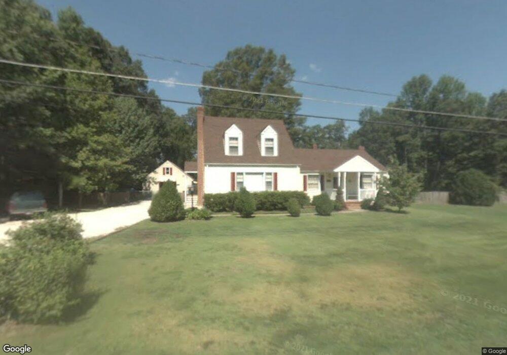
10423 Malboro Rd Mechanicsville, VA 23116
Atlee NeighborhoodEstimated Value: $359,000 - $412,000
2
Beds
2
Baths
2,124
Sq Ft
$179/Sq Ft
Est. Value
About This Home
This home is located at 10423 Malboro Rd, Mechanicsville, VA 23116 and is currently estimated at $380,553, approximately $179 per square foot. 10423 Malboro Rd is a home located in Hanover County with nearby schools including Kersey Creek Elementary School, Oak Knoll Middle School, and Hanover High School.
Ownership History
Date
Name
Owned For
Owner Type
Purchase Details
Closed on
Sep 27, 2022
Sold by
Inge Charles
Bought by
Inge Joseph A and Inge Angela D
Current Estimated Value
Home Financials for this Owner
Home Financials are based on the most recent Mortgage that was taken out on this home.
Original Mortgage
$232,471
Outstanding Balance
$222,200
Interest Rate
5.13%
Mortgage Type
New Conventional
Estimated Equity
$158,353
Create a Home Valuation Report for This Property
The Home Valuation Report is an in-depth analysis detailing your home's value as well as a comparison with similar homes in the area
Home Values in the Area
Average Home Value in this Area
Purchase History
| Date | Buyer | Sale Price | Title Company |
|---|---|---|---|
| Inge Joseph A | $250,000 | Old Republic National Title |
Source: Public Records
Mortgage History
| Date | Status | Borrower | Loan Amount |
|---|---|---|---|
| Open | Inge Joseph A | $232,471 |
Source: Public Records
Tax History Compared to Growth
Tax History
| Year | Tax Paid | Tax Assessment Tax Assessment Total Assessment is a certain percentage of the fair market value that is determined by local assessors to be the total taxable value of land and additions on the property. | Land | Improvement |
|---|---|---|---|---|
| 2025 | $2,641 | $326,000 | $87,800 | $238,200 |
| 2024 | $2,330 | $287,600 | $78,100 | $209,500 |
| 2023 | $2,214 | $287,600 | $78,100 | $209,500 |
| 2022 | $2,191 | $270,500 | $73,400 | $197,100 |
| 2021 | $1,972 | $243,500 | $66,500 | $177,000 |
| 2020 | $1,972 | $243,500 | $66,500 | $177,000 |
| 2019 | $1,748 | $215,800 | $58,900 | $156,900 |
| 2018 | $1,748 | $215,800 | $58,900 | $156,900 |
| 2017 | $1,703 | $210,200 | $54,300 | $155,900 |
| 2016 | $1,703 | $210,200 | $54,300 | $155,900 |
| 2015 | $1,703 | $210,200 | $54,300 | $155,900 |
| 2014 | $1,703 | $210,200 | $54,300 | $155,900 |
Source: Public Records
Map
Nearby Homes
- 9013 Laurel Branch Cir
- 8487 Cheraw Rd
- 10342 Kilby Ct
- 10434 Oak Cottage Dr
- 10347 Hepburn Ct
- 8572 Anderson Ct
- 8564 Anderson Ct
- 10996 Seward Way
- 11251 Linderwood Dr
- The Ellwood Plan at Patrick Henry Heights
- 8355 Patrick Henry Blvd
- 10292 Wanchese Way
- 10288 Wanchese Way
- 11021 Milestone Dr
- 11012 Milestone Dr
- 9273 Susquehanna Trail
- 9509 Indianfield Dr
- 11289 Silverstone Dr
- 10259 Matthews Grove Ln
- 11142 Countryside Ln
- 10415 Malboro Rd
- 10418 Malboro Rd
- 10426 Malboro Rd
- 10435 Malboro Rd
- 10408 Malboro Rd
- 10758 Ashcake Station Place
- 10762 Ashcake Station Place
- 10404 Malboro Rd
- 10754 Ashcake Station Place
- 10766 Ashcake Station Place
- 10750 Ashcake Station Place
- 10440 Malboro Rd
- 10443 Malboro Rd
- 10770 Ashcake Station Place
- 9012 Laurel Branch Cir
- 10774 Ashcake Station Place
- 10414 New Ashcake Rd
- 6904 Rockingham Rd
- 10446 Malboro Rd
- 9010 Laurel Branch Cir