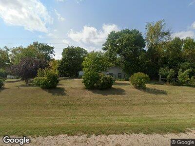
10423 Us Highway 59 Dalton, MN 56324
Estimated Value: $292,000 - $396,000
4
Beds
2
Baths
1,740
Sq Ft
$197/Sq Ft
Est. Value
About This Home
This home is located at 10423 Us Highway 59, Dalton, MN 56324 and is currently estimated at $342,660, approximately $196 per square foot. 10423 Us Highway 59 is a home located in Otter Tail County with nearby schools including McKinley Elementary School, Adams Elementary School, and Cleveland Elementary School.
Ownership History
Date
Name
Owned For
Owner Type
Purchase Details
Closed on
Jun 3, 2016
Sold by
Klemetson Roxanne Roxanne
Bought by
Koep Christopher and Hart Tammi
Current Estimated Value
Home Financials for this Owner
Home Financials are based on the most recent Mortgage that was taken out on this home.
Original Mortgage
$134,000
Interest Rate
3.59%
Create a Home Valuation Report for This Property
The Home Valuation Report is an in-depth analysis detailing your home's value as well as a comparison with similar homes in the area
Home Values in the Area
Average Home Value in this Area
Purchase History
| Date | Buyer | Sale Price | Title Company |
|---|---|---|---|
| Koep Christopher | $134,000 | -- |
Source: Public Records
Mortgage History
| Date | Status | Borrower | Loan Amount |
|---|---|---|---|
| Open | Koep Christopher | $128,000 | |
| Closed | Koep Christopher | $134,000 |
Source: Public Records
Tax History Compared to Growth
Tax History
| Year | Tax Paid | Tax Assessment Tax Assessment Total Assessment is a certain percentage of the fair market value that is determined by local assessors to be the total taxable value of land and additions on the property. | Land | Improvement |
|---|---|---|---|---|
| 2024 | $2,056 | $287,100 | $68,600 | $218,500 |
| 2023 | $1,944 | $246,200 | $54,700 | $191,500 |
| 2022 | $1,706 | $194,400 | $0 | $0 |
| 2021 | $1,566 | $246,200 | $54,700 | $191,500 |
| 2020 | $1,548 | $176,600 | $38,000 | $138,600 |
| 2019 | $1,568 | $171,000 | $36,900 | $134,100 |
| 2018 | $1,384 | $171,000 | $36,900 | $134,100 |
| 2017 | $1,348 | $157,900 | $35,700 | $122,200 |
| 2016 | $1,176 | $145,600 | $35,700 | $109,900 |
| 2015 | $814 | $0 | $0 | $0 |
| 2014 | -- | $143,200 | $34,800 | $108,400 |
Source: Public Records
Map
Nearby Homes
- 10827 U S 59
- 32062 Us Highway 59
- 12475 Thunselle Rd
- 13467 Obrien Trail
- 32741 County Road 11
- 15126 Tumuli Rd
- 110 E Main St
- 110 Tower St
- 21690 175th St
- 17850 Cedar Park Loop
- 17071 County Highway 35
- 918 W Division St
- 612 E Division St
- 400 Main St
- 14916 Upper Sandy Rd
- 515 2nd St SE
- XXX County Road 10
- 202 Melby Ave
- 319 6th Ave SE
- 312 Melby Ave
- 10423 Us Highway 59
- 10423 U S 59
- 11287 Us Highway 59
- 10827 Us Highway 59
- 22837 County Road 26
- 23947 100th St
- 21287 County Road 26
- 23812 110th St
- 22571 County Highway 26
- 22888 110th St
- 00000 Morningside Dr
- 10944 Morningside Dr
- 10926 Morningside Dr
- 10998 Morningside Dr
- 10870 Morningside Dr
- 11000 Morningside Dr
- 11052 Morningside Dr
- 10854 Morningside Dr
- Xxx Morningside Dr
- 11076 Morningside Dr
