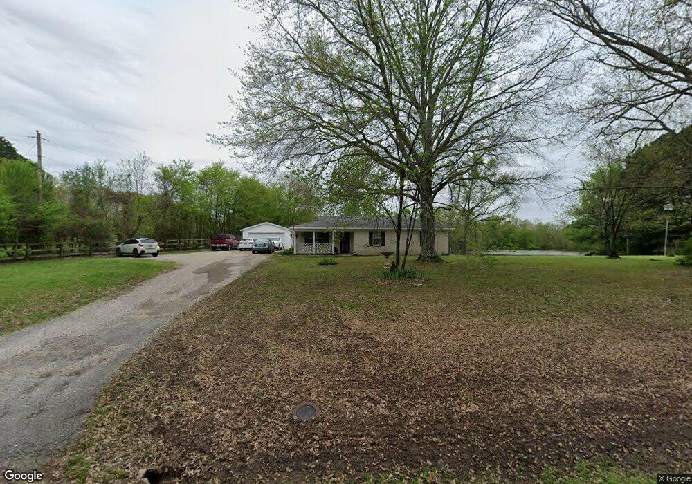
10439 Raleigh Lagrange Rd E Eads, TN 38028
Gray's Creek NeighborhoodEstimated Value: $237,544 - $420,000
3
Beds
1
Bath
1,277
Sq Ft
$233/Sq Ft
Est. Value
About This Home
This home is located at 10439 Raleigh Lagrange Rd E, Eads, TN 38028 and is currently estimated at $297,136, approximately $232 per square foot. 10439 Raleigh Lagrange Rd E is a home located in Shelby County with nearby schools including Macon-Hall Elementary School, Mt. Pisgah Middle School, and Germantown High School.
Ownership History
Date
Name
Owned For
Owner Type
Purchase Details
Closed on
Mar 8, 2001
Sold by
Price Mary L
Bought by
German Winston W and German Shelma R
Current Estimated Value
Home Financials for this Owner
Home Financials are based on the most recent Mortgage that was taken out on this home.
Original Mortgage
$132,600
Outstanding Balance
$48,536
Interest Rate
7.09%
Mortgage Type
VA
Estimated Equity
$248,600
Create a Home Valuation Report for This Property
The Home Valuation Report is an in-depth analysis detailing your home's value as well as a comparison with similar homes in the area
Home Values in the Area
Average Home Value in this Area
Purchase History
| Date | Buyer | Sale Price | Title Company |
|---|---|---|---|
| German Winston W | $130,000 | -- |
Source: Public Records
Mortgage History
| Date | Status | Borrower | Loan Amount |
|---|---|---|---|
| Open | German Winston W | $132,600 |
Source: Public Records
Tax History Compared to Growth
Tax History
| Year | Tax Paid | Tax Assessment Tax Assessment Total Assessment is a certain percentage of the fair market value that is determined by local assessors to be the total taxable value of land and additions on the property. | Land | Improvement |
|---|---|---|---|---|
| 2025 | -- | $47,775 | $23,475 | $24,300 |
| 2024 | -- | $46,525 | $21,800 | $24,725 |
| 2023 | $1,577 | $46,525 | $21,800 | $24,725 |
| 2022 | $1,577 | $46,525 | $21,800 | $24,725 |
| 2021 | $1,605 | $46,525 | $21,800 | $24,725 |
| 2020 | $1,321 | $32,625 | $20,125 | $12,500 |
| 2019 | $1,321 | $32,625 | $20,125 | $12,500 |
| 2018 | $1,321 | $32,625 | $20,125 | $12,500 |
| 2017 | $1,341 | $32,625 | $20,125 | $12,500 |
| 2016 | $1,427 | $32,650 | $0 | $0 |
| 2014 | $1,389 | $31,775 | $0 | $0 |
Source: Public Records
Map
Nearby Homes
- 10485 Raleigh Lagrange Rd E
- 45 Pisgah N
- 0 Lexington Manor Cove Unit 10207168
- 0 Lexington Manor Cove Unit 22 10185176
- 360 Lexington Manor Dr
- 9951 Kemrock Dr S
- 11090 Cedar Dr
- 10555 Sparkle Creek Cove
- 530 Lexington Manor Ln Unit lot 29
- 590 Shady Hollow Cove
- 314 Delphinium Dr E
- 324 Delphinium Dr E
- 9947 Kemrock Dr S
- Spencer Plan at Amherst
- Kincaid Plan at Amherst
- Beckett Plan at Amherst
- Patton Plan at Amherst
- Carson Plan at Amherst
- Cooper Plan at Amherst
- 9939 Kemrock Dr S
- 10450 Raleigh Lagrange Rd E
- 10497 Raleigh Lagrange Rd E
- 10445 Raleigh Lagrange Rd E
- 10359 Twin Bridges Cove
- 10505 Raleigh Lagrange Rd E
- 10510 Raleigh Lagrange Rd E
- 10470 Raleigh Lagrange Rd E
- 10345 Raleigh Lagrange Rd E
- 10351 Twin Bridges Cove
- 10409 Raleigh Lagrange Rd E
- 10344 Twin Bridges Cove
- 10550 Raleigh Lagrange Rd E
- 10453 Raleigh Lagrange Rd E
- 230 Twin Bridges Cove
- 10315 Twin Bridges Cove
- 230 Twin Bridges Dr
- 10515 Raleigh Lagrange Rd E
- 10311 Raleigh Lagrange Rd E
- 10570 Raleigh Lagrange Rd E
- 10300 Twin Bridges Cove