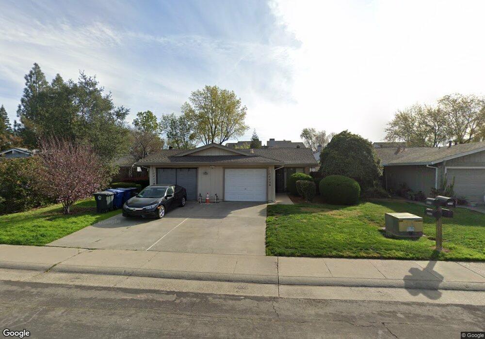
10446 S White Rock Rd Rancho Cordova, CA 95670
South White Rock NeighborhoodEstimated Value: $433,000 - $572,000
6
Beds
4
Baths
2,082
Sq Ft
$240/Sq Ft
Est. Value
About This Home
This home is located at 10446 S White Rock Rd, Rancho Cordova, CA 95670 and is currently estimated at $500,335, approximately $240 per square foot. 10446 S White Rock Rd is a home located in Sacramento County with nearby schools including Cordova Villa Elementary School, Mills Middle School, and Cordova High School.
Ownership History
Date
Name
Owned For
Owner Type
Purchase Details
Closed on
Oct 13, 2017
Sold by
Revocabl Rountree Lois A and Revocabl Marvin M Carness 1994
Bought by
Carness David Daniel
Current Estimated Value
Purchase Details
Closed on
Jun 1, 2017
Sold by
Rountree Lois A and The Complete Restatement Of Ma
Bought by
Rountree Lois A and The Complete Restatement Of Ma
Purchase Details
Closed on
Feb 17, 1994
Sold by
Carness Marvin M
Bought by
Carness Marvin M
Create a Home Valuation Report for This Property
The Home Valuation Report is an in-depth analysis detailing your home's value as well as a comparison with similar homes in the area
Home Values in the Area
Average Home Value in this Area
Purchase History
| Date | Buyer | Sale Price | Title Company |
|---|---|---|---|
| Carness David Daniel | -- | None Available | |
| Rountree Lois A | -- | None Available | |
| Carness Marvin M | -- | -- |
Source: Public Records
Tax History Compared to Growth
Tax History
| Year | Tax Paid | Tax Assessment Tax Assessment Total Assessment is a certain percentage of the fair market value that is determined by local assessors to be the total taxable value of land and additions on the property. | Land | Improvement |
|---|---|---|---|---|
| 2025 | $2,200 | $179,821 | $33,281 | $146,540 |
| 2024 | $2,200 | $176,296 | $32,629 | $143,667 |
| 2023 | $2,156 | $172,840 | $31,990 | $140,850 |
| 2022 | $2,127 | $169,452 | $31,363 | $138,089 |
| 2021 | $2,086 | $166,131 | $30,749 | $135,382 |
| 2020 | $2,071 | $164,428 | $30,434 | $133,994 |
| 2019 | $2,038 | $161,205 | $29,838 | $131,367 |
| 2018 | $1,986 | $158,045 | $29,253 | $128,792 |
| 2017 | $1,936 | $154,947 | $28,680 | $126,267 |
| 2016 | $1,878 | $151,910 | $28,118 | $123,792 |
| 2015 | $1,784 | $149,629 | $27,696 | $121,933 |
| 2014 | $1,898 | $146,699 | $27,154 | $119,545 |
Source: Public Records
Map
Nearby Homes
- 10395 S White Rock Rd Unit B
- 10518 Mills Acres Cir
- 10850 Basie Way
- 10834 Basie Way
- 10806 Basie Way
- 10276 S White Rock Rd
- 10472 Abbottford Way
- 10335 White Rock Rd
- 10732 Paiute Way
- 2669 Dawes St
- 10228 Coloma Rd
- 2640 Tronero Way
- 2724 Zinfandel Dr
- 2628 Tronero Way
- 2901 Kachina Way
- 2870 Cochise Ct
- 10854 Paiute Way
- 2840 Cochise Ct
- 10233 Countryside Way
- 10412 Dolecetto Dr
- 10446 S White Rock Rd Unit B
- 10440 S White Rock Rd
- 10448 S White Rock Rd
- 10438 S White Rock Rd
- 10452 S White Rock Rd Unit 4
- 10434 S White Rock Rd
- 10424 S White Rock Rd
- 10422 S White Rock Rd
- 3466 Data Dr Unit ID6814A
- 3466 Data Dr Unit ID6644A
- 3466 Data Dr Unit ID6611A
- 3466 Data Dr Unit ID6581A
- 3466 Data Dr Unit ID6534A
- 3466 Data Dr Unit ID6487A
- 3466 Data Dr Unit ID6456A
- 3466 Data Dr Unit ID6444A
- 3466 Data Dr Unit ID6429A
- 3466 Data Dr Unit ID6376A
- 3466 Data Dr Unit ID6293A
- 3466 Data Dr Unit ID6295A