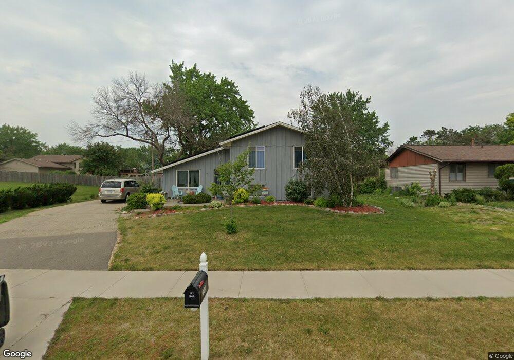
1045 Baldwin Dr Saint Paul, MN 55124
Old Town NeighborhoodEstimated Value: $374,000 - $410,000
3
Beds
2
Baths
1,186
Sq Ft
$328/Sq Ft
Est. Value
About This Home
This home is located at 1045 Baldwin Dr, Saint Paul, MN 55124 and is currently estimated at $388,574, approximately $327 per square foot. 1045 Baldwin Dr is a home located in Dakota County with nearby schools including Southview Elementary School, Valley Middle School, and Apple Valley Senior High School.
Ownership History
Date
Name
Owned For
Owner Type
Purchase Details
Closed on
Jul 24, 2018
Sold by
Clark Bruce R and Clark Teresa E
Bought by
Benson Zachariah L and Benson Sara
Current Estimated Value
Home Financials for this Owner
Home Financials are based on the most recent Mortgage that was taken out on this home.
Original Mortgage
$274,928
Outstanding Balance
$238,266
Interest Rate
4.5%
Mortgage Type
FHA
Estimated Equity
$150,308
Purchase Details
Closed on
May 16, 1994
Sold by
Zubert Peter C
Bought by
Clark Bruce R and Clark Teresa E
Create a Home Valuation Report for This Property
The Home Valuation Report is an in-depth analysis detailing your home's value as well as a comparison with similar homes in the area
Home Values in the Area
Average Home Value in this Area
Purchase History
| Date | Buyer | Sale Price | Title Company |
|---|---|---|---|
| Benson Zachariah L | $280,000 | Burnet Title | |
| Clark Bruce R | $92,000 | -- |
Source: Public Records
Mortgage History
| Date | Status | Borrower | Loan Amount |
|---|---|---|---|
| Open | Benson Zachariah L | $274,928 | |
| Closed | Clark Bruce R | -- |
Source: Public Records
Tax History Compared to Growth
Tax History
| Year | Tax Paid | Tax Assessment Tax Assessment Total Assessment is a certain percentage of the fair market value that is determined by local assessors to be the total taxable value of land and additions on the property. | Land | Improvement |
|---|---|---|---|---|
| 2024 | $3,728 | $337,100 | $86,300 | $250,800 |
| 2023 | $3,728 | $334,400 | $86,400 | $248,000 |
| 2022 | $3,294 | $334,200 | $86,200 | $248,000 |
| 2021 | $3,138 | $291,600 | $74,900 | $216,700 |
| 2020 | $3,124 | $273,300 | $71,400 | $201,900 |
| 2019 | $2,766 | $264,600 | $68,000 | $196,600 |
| 2018 | $2,687 | $247,200 | $64,700 | $182,500 |
| 2017 | $2,666 | $231,400 | $61,600 | $169,800 |
| 2016 | $2,609 | $219,200 | $58,700 | $160,500 |
| 2015 | $2,539 | $194,821 | $50,696 | $144,125 |
| 2014 | -- | $191,006 | $48,618 | $142,388 |
| 2013 | -- | $177,926 | $44,436 | $133,490 |
Source: Public Records
Map
Nearby Homes
- 249 Elm Dr
- 148 Spruce Dr
- 892 Redwell Ln
- 921 Cortland Dr S
- 1516 Rushmore Dr
- 14825 Haven Dr
- 15813 Garden View Dr
- 441 Walnut Ln
- 14709 White Oak Dr
- 889 Whitney Dr
- 841 Cortland Dr
- 14786 Hallmark Dr
- 15964 Hyland Dr
- 15931 Hyland Pointe Ct
- 8681 144th Street Ct
- 15979 Harwell Ave
- 14350 Hickory Way
- 1312 Summit Oaks Dr
- 1101 Lavon Ln
- 834 Fireside Dr
- 1041 Baldwin Dr
- 1049 Baldwin Cir
- 1037 Baldwin Dr
- 1044 Ramsdell Dr
- 1040 Ramsdell Dr
- 1057 Baldwin Cir
- 1036 Ramsdell Dr
- 1033 Baldwin Dr
- 1048 Ramsdell Dr
- 1032 Ramsdell Dr
- 1052 Ramsdell Dr
- 1061 Baldwin Cir
- 1029 Baldwin Dr
- 1069 Baldwin Cir
- 1056 Ramsdell Dr
- 1028 Ramsdell Dr
- 1065 Baldwin Cir
- 1060 Ramsdell Dr
- 1025 Baldwin Dr
- 1039 Ramsdell Dr