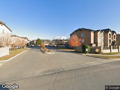
1045 S 1700 W Unit 611 Payson, UT 84651
Estimated Value: $274,000 - $339,000
3
Beds
2
Baths
1,223
Sq Ft
$244/Sq Ft
Est. Value
About This Home
This home is located at 1045 S 1700 W Unit 611, Payson, UT 84651 and is currently estimated at $298,225, approximately $243 per square foot. 1045 S 1700 W Unit 611 is a home located in Utah County with nearby schools including Taylor Elementary School, Mt. Nebo Junior High School, and Salem Junior High School.
Ownership History
Date
Name
Owned For
Owner Type
Purchase Details
Closed on
Dec 27, 2023
Sold by
Brown James Oakley and Brown Paula Workman
Bought by
James O Brown Ii And Paula W Brown Trust and Brown
Current Estimated Value
Purchase Details
Closed on
Jun 29, 2023
Sold by
Jacquelyn Durrant Family Trust
Bought by
Brown James Oakley and Brown Paula Workman
Purchase Details
Closed on
Sep 21, 2016
Sold by
Durrant Jacquelyn
Bought by
Durrant Jaquelyn and Jacquelyn Durrant Family Trust
Purchase Details
Closed on
Oct 8, 2010
Sold by
Ridge Stone Development Llc
Bought by
Dommer Marilyn
Create a Home Valuation Report for This Property
The Home Valuation Report is an in-depth analysis detailing your home's value as well as a comparison with similar homes in the area
Home Values in the Area
Average Home Value in this Area
Purchase History
| Date | Buyer | Sale Price | Title Company |
|---|---|---|---|
| James O Brown Ii And Paula W Brown Trust | -- | None Listed On Document | |
| Brown James Oakley | -- | Inwest Title | |
| Durrant Jaquelyn | -- | None Available | |
| Dommer Marilyn | -- | First American Spanish Fo |
Source: Public Records
Mortgage History
| Date | Status | Borrower | Loan Amount |
|---|---|---|---|
| Previous Owner | Jacquelyn Durrant Family Trust | $145,000 | |
| Previous Owner | Durrant Jacquelyn | $109,650 |
Source: Public Records
Tax History Compared to Growth
Tax History
| Year | Tax Paid | Tax Assessment Tax Assessment Total Assessment is a certain percentage of the fair market value that is determined by local assessors to be the total taxable value of land and additions on the property. | Land | Improvement |
|---|---|---|---|---|
| 2024 | $1,445 | $147,015 | $0 | $0 |
| 2023 | $1,387 | $141,515 | $0 | $0 |
| 2022 | $1,421 | $142,670 | $0 | $0 |
| 2021 | $1,185 | $190,800 | $22,900 | $167,900 |
| 2020 | $1,154 | $181,700 | $21,800 | $159,900 |
| 2019 | $1,072 | $173,100 | $20,000 | $153,100 |
| 2018 | $1,040 | $161,800 | $20,000 | $141,800 |
| 2017 | $921 | $77,110 | $0 | $0 |
| 2016 | $866 | $72,050 | $0 | $0 |
| 2015 | $826 | $68,200 | $0 | $0 |
| 2014 | $787 | $65,450 | $0 | $0 |
Source: Public Records
Map
Nearby Homes
- 1045 S 1700 W Unit 1213
- 1045 S 1700 W Unit 320
- 1045 S 1700 W Unit 912
- 1045 S 1700 W
- 1045 S 1700 W Unit 1032
- 1045 S 1700 W Unit 811
- 1045 S 1700 W Unit 412
- 1045 S 1700 W Unit 133
- 1828 W 1130 S
- 1546 W 800 S
- 841 N Dryland Cir Unit WINDSR
- 841 N Dryland Cir Unit WAKEFI
- 841 N Dryland Cir Unit HILDAL
- 841 N Dryland Cir Unit BALLAR
- 841 N Dryland Cir Unit DREXEL
- 841 N Dryland Cir Unit LUCAS
- 841 N Dryland Cir Unit CALDWL
- 841 N Dryland Cir Unit HARMON
- 841 N Dryland Cir Unit COLUMB
- 841 N Dryland Cir Unit AUBREY
- 1045 S 1700 W Unit BUI
- 1045 S 1700 W Unit BUI
- 1045 S 1700 W Unit BUI
- 1045 S 1700 W Unit BUI
- 1045 S 1700 W Unit BUI
- 1045 S 1700 W Unit BUI
- 1045 S 1700 W Unit BUI
- 1045 S 1700 W Unit BUI
- 1045 S 1700 W Unit BUI
- 1045 S 1700 W Unit BUI
- 1045 S 1700 W Unit BUI
- 1045 S 1700 W Unit BUI
- 1045 S 1700 W Unit BUI
- 1045 S 1700 W Unit BUI
- 1045 S 1700 W Unit BUI
- 1045 S 1700 W Unit BUI
- 1045 S 1700 W Unit BUI
- 1045 S 1700 W Unit BUI
- 1045 S 1700 W Unit BUI
- 1045 S 1700 W Unit BUI