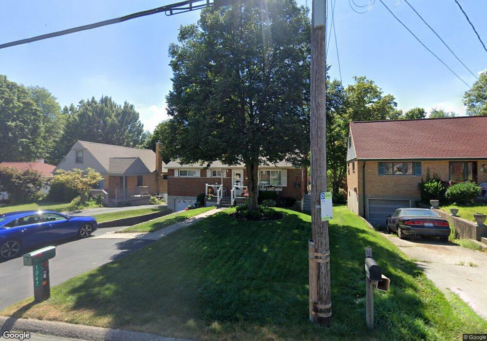
1047 Anderson Ferry Rd Cincinnati, OH 45238
Central Delhi NeighborhoodEstimated Value: $193,419 - $208,000
3
Beds
1
Bath
950
Sq Ft
$210/Sq Ft
Est. Value
About This Home
This home is located at 1047 Anderson Ferry Rd, Cincinnati, OH 45238 and is currently estimated at $199,355, approximately $209 per square foot. 1047 Anderson Ferry Rd is a home located in Hamilton County with nearby schools including C.O. Harrison Elementary School, Rapid Run Middle School, and Oak Hills High School.
Ownership History
Date
Name
Owned For
Owner Type
Purchase Details
Closed on
Nov 14, 1995
Sold by
Pasqualetti Linda
Bought by
Pasqualetti Gerardo
Current Estimated Value
Home Financials for this Owner
Home Financials are based on the most recent Mortgage that was taken out on this home.
Original Mortgage
$25,000
Interest Rate
7.65%
Create a Home Valuation Report for This Property
The Home Valuation Report is an in-depth analysis detailing your home's value as well as a comparison with similar homes in the area
Home Values in the Area
Average Home Value in this Area
Purchase History
| Date | Buyer | Sale Price | Title Company |
|---|---|---|---|
| Pasqualetti Gerardo | -- | -- |
Source: Public Records
Mortgage History
| Date | Status | Borrower | Loan Amount |
|---|---|---|---|
| Previous Owner | Pasqualetti Gerardo | $25,000 |
Source: Public Records
Tax History Compared to Growth
Tax History
| Year | Tax Paid | Tax Assessment Tax Assessment Total Assessment is a certain percentage of the fair market value that is determined by local assessors to be the total taxable value of land and additions on the property. | Land | Improvement |
|---|---|---|---|---|
| 2024 | $1,960 | $43,768 | $9,212 | $34,556 |
| 2023 | $2,014 | $43,768 | $9,212 | $34,556 |
| 2022 | $1,518 | $31,903 | $8,187 | $23,716 |
| 2021 | $1,476 | $31,903 | $8,187 | $23,716 |
| 2020 | $1,511 | $31,903 | $8,187 | $23,716 |
| 2019 | $1,358 | $27,500 | $7,056 | $20,444 |
| 2018 | $1,360 | $27,500 | $7,056 | $20,444 |
| 2017 | $1,221 | $27,500 | $7,056 | $20,444 |
| 2016 | $1,232 | $27,797 | $7,448 | $20,349 |
| 2015 | $1,242 | $27,797 | $7,448 | $20,349 |
| 2014 | $1,244 | $27,797 | $7,448 | $20,349 |
| 2013 | $1,261 | $29,260 | $7,840 | $21,420 |
Source: Public Records
Map
Nearby Homes
- 5226 Locust St
- 5229 Rapid Run Rd
- 5435 Lariat Dr
- 5434 Lariat Dr
- 5176 Dundas Dr
- 5468 Rapid Run Rd
- 774 Ivyhill Dr
- 5341 Carefree Ct
- 1398 Colonial Dr
- 5140 Willnet Dr
- 1020 Seibel Ln
- 685 Ivyhill Dr
- 1136 Betty Ln
- 990 Covedale Ave
- 1650 Colonial Dr
- 5132 Ralph Ave
- 5199 Foley Rd
- 5086 Garden Grove Ln
- 5010 Garden Grove Ln
- 1195 Nancy Lee Ln
- 1039 Anderson Ferry Rd
- 1055 Anderson Ferry Rd
- 1063 Anderson Ferry Rd
- 1033 Anderson Ferry Rd
- 1071 Anderson Ferry Rd
- 1058 Tony Ct
- 1046 Tony Ct
- 1070 Tony Ct
- 1081 Anderson Ferry Rd
- 5315 Alvera Dr
- 1042 Anderson Ferry Rd
- 1038 Anderson Ferry Rd
- 1064 Anderson Ferry Rd
- 1064 Anderson Ferry Rd Unit 1
- 5319 Alvera Dr
- 1011 Anderson Ferry Rd
- 1072 Anderson Ferry Rd
- 1022 Anderson Ferry Rd
- 5323 Alvera Dr
- 5290 Andy Ct