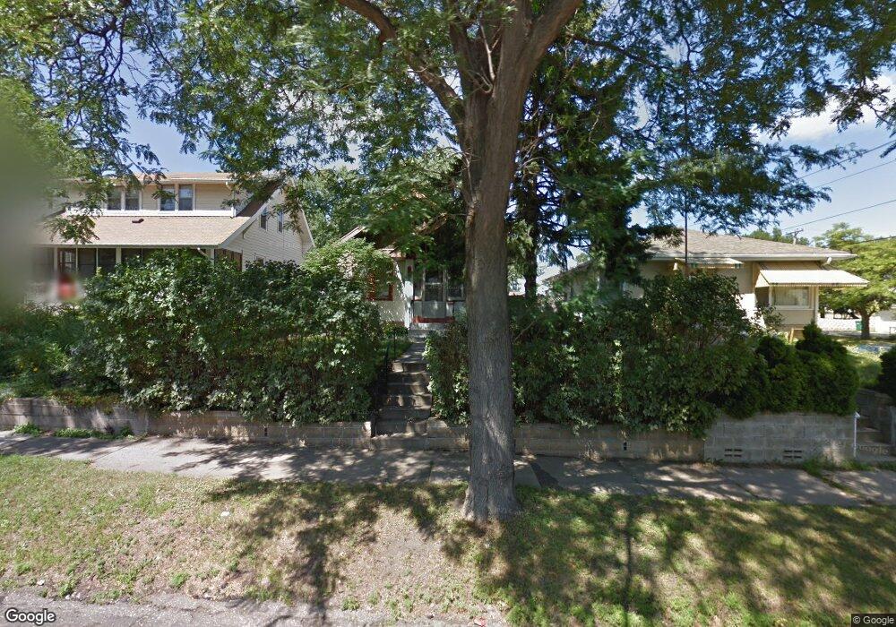
1047 Lafond Ave Saint Paul, MN 55104
Frogtown NeighborhoodEstimated Value: $245,484 - $270,000
2
Beds
1
Bath
922
Sq Ft
$283/Sq Ft
Est. Value
About This Home
This home is located at 1047 Lafond Ave, Saint Paul, MN 55104 and is currently estimated at $260,621, approximately $282 per square foot. 1047 Lafond Ave is a home located in Ramsey County with nearby schools including Maxfield Magnet Elementary School, Hidden River Middle School, and Central Senior High School.
Ownership History
Date
Name
Owned For
Owner Type
Purchase Details
Closed on
Apr 10, 2019
Sold by
Houghtaling Melissa J and Houghtaling Laura
Bought by
Hansen Tobin F
Current Estimated Value
Home Financials for this Owner
Home Financials are based on the most recent Mortgage that was taken out on this home.
Original Mortgage
$160,800
Outstanding Balance
$141,372
Interest Rate
4.3%
Mortgage Type
New Conventional
Estimated Equity
$119,249
Purchase Details
Closed on
Nov 16, 2000
Sold by
Kramer Peter Luke and Kramer Tanya P
Bought by
Cellman Demeri M
Purchase Details
Closed on
Mar 27, 1998
Sold by
Schriefer Gary Edwin and Schriefer Kathy A
Bought by
Kramer Peter Luke and Kramer Tanya P
Create a Home Valuation Report for This Property
The Home Valuation Report is an in-depth analysis detailing your home's value as well as a comparison with similar homes in the area
Home Values in the Area
Average Home Value in this Area
Purchase History
We collect this data history from publicly available records. To have your information removed, we recommend requesting removal directly through your county’s website.
| Date | Buyer | Sale Price | Title Company |
|---|---|---|---|
| Hansen Tobin F | $201,000 | Results Title | |
| Cellman Demeri M | $115,100 | -- | |
| Kramer Peter Luke | $69,900 | -- |
Source: Public Records
Mortgage History
We collect this data history from publicly available records. To have your information removed, we recommend requesting removal directly through your county’s website.
| Date | Status | Borrower | Loan Amount |
|---|---|---|---|
| Open | Hansen Tobin F | $160,800 |
Source: Public Records
Tax History
| Year | Tax Paid | Tax Assessment Tax Assessment Total Assessment is a certain percentage of the fair market value that is determined by local assessors to be the total taxable value of land and additions on the property. | Land | Improvement |
|---|---|---|---|---|
| 2025 | $3,300 | $247,500 | $25,000 | $222,500 |
| 2023 | $3,300 | $223,300 | $20,000 | $203,300 |
| 2022 | $3,034 | $229,800 | $20,000 | $209,800 |
| 2021 | $2,944 | $201,300 | $20,000 | $181,300 |
| 2020 | $3,160 | $202,400 | $11,200 | $191,200 |
| 2019 | $2,844 | $202,400 | $11,200 | $191,200 |
| 2018 | $2,560 | $164,300 | $11,200 | $153,100 |
| 2017 | $2,400 | $151,700 | $11,200 | $140,500 |
| 2016 | $2,044 | $0 | $0 | $0 |
| 2015 | $2,032 | $120,900 | $11,200 | $109,700 |
| 2014 | $2,068 | $0 | $0 | $0 |
Source: Public Records
Map
Nearby Homes
- 1062 Blair Ave
- 1077 Lafond Ave
- 1072 Thomas Ave
- 991 Minnehaha Ave W
- 1055 Englewood Ave
- 1170 Minnehaha Ave W
- 895 Edmund Ave
- 865 Thomas Ave
- 879 Charles Ave
- 1224 Edmund Ave
- 1206 Seminary Ave
- 1254 Thomas Ave
- 827 Lafond Ave
- 826 Blair Ave
- 1259 Charles Ave
- 982 Topping St
- 821 Edmund Ave
- 1186 Hewitt Ave
- 1125 Central Ave W
- 1002 Burgess St
- 1043 Lafond Ave
- 1051 Lafond Ave
- 1055 Lafond Ave
- 1061 Lafond Ave
- 1042 Blair Ave
- 1050 Blair Ave
- 1039 Lafond Ave
- 1065 Lafond Ave
- 1048 Lafond Ave
- 1054 Blair Ave
- 1044 Lafond Ave
- 1035 Lafond Ave
- 1069 Lafond Ave
- 1038 Blair Ave
- 1054 Lafond Ave
- 1060 Lafond Ave
- 1066 Blair Ave
- 1064 Lafond Ave
- 1032 Blair Ave
- 1027 Lafond Ave
Your Personal Tour Guide
Ask me questions while you tour the home.