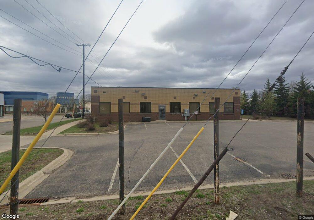
1047 University Ave W Saint Paul, MN 55104
Frogtown NeighborhoodEstimated Value: $953,903
--
Bed
--
Bath
3,723
Sq Ft
$256/Sq Ft
Est. Value
About This Home
This home is located at 1047 University Ave W, Saint Paul, MN 55104 and is currently estimated at $953,903, approximately $256 per square foot. 1047 University Ave W is a home located in Ramsey County with nearby schools including Maxfield Magnet Elementary School, Hidden River Middle School, and Central Senior High School.
Ownership History
Date
Name
Owned For
Owner Type
Purchase Details
Closed on
Oct 19, 2017
Sold by
Dr Bobby K Yang Md Medical Clinic Llc
Bought by
And Nou Thior Bobby Yang
Current Estimated Value
Purchase Details
Closed on
Sep 20, 2016
Sold by
Yang Bobby Bobby
Home Financials for this Owner
Home Financials are based on the most recent Mortgage that was taken out on this home.
Original Mortgage
$512,700
Interest Rate
3.43%
Mortgage Type
Commercial
Create a Home Valuation Report for This Property
The Home Valuation Report is an in-depth analysis detailing your home's value as well as a comparison with similar homes in the area
Home Values in the Area
Average Home Value in this Area
Purchase History
| Date | Buyer | Sale Price | Title Company |
|---|---|---|---|
| And Nou Thior Bobby Yang | -- | Home Title Inc | |
| Dr Bobby K Yang Md Medical Clinic Llc | -- | Home Title Inc | |
| -- | $605,000 | -- | |
| Snj Llc | $6,324 | Home Title Inc |
Source: Public Records
Mortgage History
| Date | Status | Borrower | Loan Amount |
|---|---|---|---|
| Previous Owner | Snj Llc | $512,700 | |
| Previous Owner | -- | $605,000 |
Source: Public Records
Tax History Compared to Growth
Tax History
| Year | Tax Paid | Tax Assessment Tax Assessment Total Assessment is a certain percentage of the fair market value that is determined by local assessors to be the total taxable value of land and additions on the property. | Land | Improvement |
|---|---|---|---|---|
| 2025 | $20,400 | $653,200 | $348,100 | $305,100 |
| 2023 | $20,400 | $615,600 | $348,100 | $267,500 |
| 2022 | $23,716 | $636,500 | $348,100 | $288,400 |
| 2021 | $22,450 | $657,900 | $348,100 | $309,800 |
| 2020 | $30,698 | $638,500 | $348,100 | $290,400 |
| 2019 | $26,702 | $803,000 | $348,100 | $454,900 |
| 2018 | $26,192 | $698,200 | $348,100 | $350,100 |
| 2017 | $25,534 | $692,500 | $348,100 | $344,400 |
| 2016 | $22,448 | $0 | $0 | $0 |
| 2015 | $25,430 | $564,400 | $348,100 | $216,300 |
| 2014 | $22,600 | $0 | $0 | $0 |
Source: Public Records
Map
Nearby Homes
- 507 Lexington Pkwy N
- 1134 Charles Ave
- 962 Aurora Ave
- 1107 Edmund Ave W
- 1107 Edmund Ave
- 950 Aurora Ave
- 931 Sherburne Ave
- 1174 Sherburne Ave
- 1174 Charles Ave
- 971 Thomas Ave
- 915 Fuller Ave
- 1158 Central Ave W
- 934 Central Ave W
- 886 Edmund Ave
- 877 Charles Ave
- 885 Edmund Ave
- 1239 Sherburne Ave
- 969 Carroll Ave
- 846 Sherburne Ave
- 838 Sherburne Ave
- 1048 Sherburne Ave
- 1054 Sherburne Ave
- 1058 Sherburne Ave
- 1062 Sherburne Ave
- 1064 Sherburne Ave
- 1070 Sherburne Ave
- 1074 Sherburne Ave
- 1047 Sherburne Ave
- 1043 Sherburne Ave
- 1051 Sherburne Ave
- 1053 Sherburne Ave
- 1059 Sherburne Ave
- 1078 Sherburne Ave
- 1037 Sherburne Ave
- 1063 Sherburne Ave
- 1069 Sherburne Ave
- 1033 Sherburne Ave
- 1082 Sherburne Ave
- 1071 Sherburne Ave
- 1029 Sherburne Ave