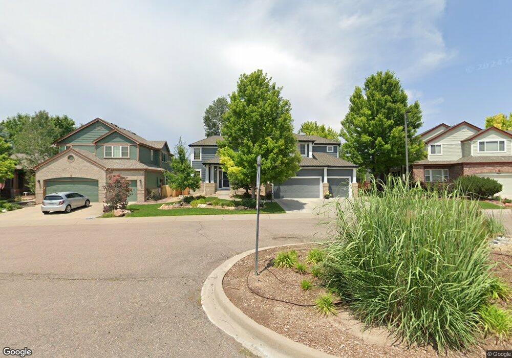
10475 Shorepine Ct Parker, CO 80134
Stonegate NeighborhoodEstimated Value: $802,000 - $862,000
4
Beds
4
Baths
4,202
Sq Ft
$195/Sq Ft
Est. Value
About This Home
This home is located at 10475 Shorepine Ct, Parker, CO 80134 and is currently estimated at $818,810, approximately $194 per square foot. 10475 Shorepine Ct is a home located in Douglas County with nearby schools including Pine Grove Elementary School, Sierra Middle School, and Chaparral High School.
Ownership History
Date
Name
Owned For
Owner Type
Purchase Details
Closed on
Sep 28, 2015
Sold by
Smith Karl R and Smith Carole L
Bought by
Reppe Calvin C and Reppe Benjamin J
Current Estimated Value
Home Financials for this Owner
Home Financials are based on the most recent Mortgage that was taken out on this home.
Original Mortgage
$415,000
Outstanding Balance
$323,932
Interest Rate
3.97%
Mortgage Type
New Conventional
Estimated Equity
$494,878
Purchase Details
Closed on
May 25, 1995
Sold by
Falcon Partnership Ltd
Bought by
Smith Karl R and Smith Carole L
Home Financials for this Owner
Home Financials are based on the most recent Mortgage that was taken out on this home.
Original Mortgage
$212,450
Interest Rate
6.25%
Purchase Details
Closed on
Oct 14, 1994
Sold by
Stonegate Developments Inc
Bought by
Falcon Partnership Ltd
Create a Home Valuation Report for This Property
The Home Valuation Report is an in-depth analysis detailing your home's value as well as a comparison with similar homes in the area
Home Values in the Area
Average Home Value in this Area
Purchase History
| Date | Buyer | Sale Price | Title Company |
|---|---|---|---|
| Reppe Calvin C | $490,000 | Land Title Guarantee | |
| Smith Karl R | $249,735 | Land Title | |
| Falcon Partnership Ltd | $380,400 | -- |
Source: Public Records
Mortgage History
| Date | Status | Borrower | Loan Amount |
|---|---|---|---|
| Open | Reppe Calvin C | $415,000 | |
| Previous Owner | Smith Karl R | $212,450 |
Source: Public Records
Tax History
| Year | Tax Paid | Tax Assessment Tax Assessment Total Assessment is a certain percentage of the fair market value that is determined by local assessors to be the total taxable value of land and additions on the property. | Land | Improvement |
|---|---|---|---|---|
| 2025 | $5,922 | $53,910 | $10,860 | $43,050 |
| 2024 | $5,922 | $58,980 | $9,930 | $49,050 |
| 2023 | $5,973 | $58,980 | $9,930 | $49,050 |
| 2022 | $4,523 | $40,970 | $6,660 | $34,310 |
| 2021 | $4,651 | $40,970 | $6,660 | $34,310 |
| 2020 | $4,395 | $39,690 | $7,250 | $32,440 |
| 2019 | $4,288 | $39,690 | $7,250 | $32,440 |
| 2018 | $4,006 | $36,580 | $6,560 | $30,020 |
| 2017 | $3,778 | $36,580 | $6,560 | $30,020 |
| 2016 | $3,405 | $32,450 | $5,570 | $26,880 |
| 2015 | $2,620 | $32,450 | $5,570 | $26,880 |
| 2014 | $1,604 | $27,040 | $5,410 | $21,630 |
Source: Public Records
Map
Nearby Homes
- 16351 Parkside Dr
- 11605 Masonville Dr
- 17130 Opal Hill Dr
- 10505 Berthoud Way
- 17235 Opal Hill Dr
- 16224 Quarry Hill Dr
- 10858 Willow Reed Cir E
- 17351 Cornerstone Dr
- 16230 Martingale Dr
- 10318 Severance Dr
- 10738 Jordan Ct
- 10678 Stone Creek Ct
- 10520 Holyoke Dr
- 10539 Holyoke Dr
- 10607 Clarke Farms Dr
- 16160 Martingale Dr
- 17002 Walsh Ave
- 16116 Martingale Dr
- 10130 Lodestone Way
- 10221 Amethyst Way
- 10483 Shorepine Ct
- 10459 Shorepine Ct
- 10456 White Pine Dr
- 10450 White Pine Dr
- 10495 Shorepine Ct
- 10464 White Pine Dr
- 10444 White Pine Dr
- 10472 White Pine Dr
- 10436 White Pine Dr
- 10445 Shorepine Ct
- 10488 White Pine Dr
- 10484 Shorepine Ct
- 10496 Shorepine Ct
- 10432 White Pine Dr
- 10474 Shorepine Ct
- 10448 Shorepine Ct
- 10460 Shorepine Ct
- 10426 White Pine Dr
- 10449 White Pine Dr
- 10443 White Pine Dr
Your Personal Tour Guide
Ask me questions while you tour the home.