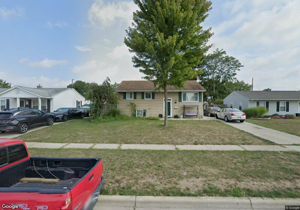
1048 Langtry Ave Columbus, OH 43207
Obetz-Lockbourne NeighborhoodEstimated Value: $232,000 - $271,000
4
Beds
2
Baths
1,459
Sq Ft
$171/Sq Ft
Est. Value
About This Home
This home is located at 1048 Langtry Ave, Columbus, OH 43207 and is currently estimated at $249,363, approximately $170 per square foot. 1048 Langtry Ave is a home located in Franklin County with nearby schools including Hamilton Elementary School, Hamilton Intermediate School, and Hamilton Middle School.
Ownership History
Date
Name
Owned For
Owner Type
Purchase Details
Closed on
Sep 28, 2006
Sold by
Hankins Phillip D and Hankins Kimberly S
Bought by
Marteney Bryan D
Current Estimated Value
Home Financials for this Owner
Home Financials are based on the most recent Mortgage that was taken out on this home.
Original Mortgage
$128,881
Outstanding Balance
$75,432
Interest Rate
6.49%
Mortgage Type
FHA
Estimated Equity
$173,931
Purchase Details
Closed on
Apr 27, 1992
Bought by
Hankins Phillip D
Purchase Details
Closed on
Mar 21, 1989
Purchase Details
Closed on
Sep 14, 1988
Create a Home Valuation Report for This Property
The Home Valuation Report is an in-depth analysis detailing your home's value as well as a comparison with similar homes in the area
Home Values in the Area
Average Home Value in this Area
Purchase History
| Date | Buyer | Sale Price | Title Company |
|---|---|---|---|
| Marteney Bryan D | $129,900 | Chicago Tit | |
| Hankins Phillip D | $63,900 | -- | |
| -- | $49,900 | -- | |
| -- | -- | -- |
Source: Public Records
Mortgage History
| Date | Status | Borrower | Loan Amount |
|---|---|---|---|
| Open | Marteney Bryan D | $128,881 |
Source: Public Records
Tax History
| Year | Tax Paid | Tax Assessment Tax Assessment Total Assessment is a certain percentage of the fair market value that is determined by local assessors to be the total taxable value of land and additions on the property. | Land | Improvement |
|---|---|---|---|---|
| 2025 | $3,473 | $71,970 | $16,140 | $55,830 |
| 2024 | $3,473 | $71,970 | $16,140 | $55,830 |
| 2023 | $3,456 | $71,960 | $16,135 | $55,825 |
| 2022 | $2,194 | $37,380 | $5,670 | $31,710 |
| 2021 | $2,221 | $37,380 | $5,670 | $31,710 |
| 2020 | $2,407 | $37,380 | $5,670 | $31,710 |
| 2019 | $1,968 | $31,160 | $4,730 | $26,430 |
| 2018 | $2,007 | $31,160 | $4,730 | $26,430 |
| 2017 | $1,932 | $31,160 | $4,730 | $26,430 |
| 2016 | $1,920 | $29,680 | $5,530 | $24,150 |
| 2015 | $1,821 | $29,680 | $5,530 | $24,150 |
| 2014 | $1,811 | $29,680 | $5,530 | $24,150 |
| 2013 | $969 | $32,970 | $6,125 | $26,845 |
Source: Public Records
Map
Nearby Homes
- 4926 Meadowbrook Dr
- 5112 Fairlane Rd
- 1291 Webb Dr Unit Lot 90
- 1307 Webb Dr Unit Lot 92
- 1315 Webb Dr Unit Lot 93
- 5220 Edgeview Rd
- 908 Tecumseh Ave
- 1132 Ayrshire Dr
- 4436 Wesley Trail
- 4410 Holstein Dr
- 4917 Crestbrook Dr
- 990 Jerry Lee Dr
- 1962 Reese Ave
- 4455 Catamaran Dr
- 4344 Brett Ln
- 4412 Catamaran Dr
- 1987 Reese Ave
- 2027 Reese Ave
- 4356 Monterey Ct
- 692 Tinkers Creek Ln
- 1040 Langtry Ave
- 1056 Langtry Ave
- 1064 Langtry Ave
- 1051 Gilcrest Ave
- 1059 Gilcrest Ave
- 1043 Gilcrest Ave
- 1032 Langtry Ave
- 5002 Meadowbrook Dr
- 1067 Gilcrest Ave
- 1072 Langtry Ave
- 1051 Langtry Ave
- 1043 Langtry Ave
- 1059 Langtry Ave
- 1031 Gilcrest Ave
- 1075 Gilcrest Ave
- 1067 Langtry Ave
- 1031 Langtry Ave
- 1080 Langtry Ave
- 1075 Langtry Ave
- 1083 Gilcrest Ave
Your Personal Tour Guide
Ask me questions while you tour the home.