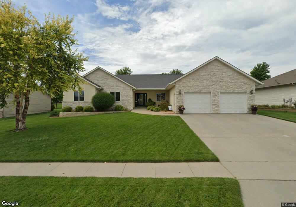
1049 Mayberry Ln Carroll, IA 51401
Estimated Value: $432,000 - $461,110
5
Beds
2
Baths
2,008
Sq Ft
$221/Sq Ft
Est. Value
About This Home
This home is located at 1049 Mayberry Ln, Carroll, IA 51401 and is currently estimated at $442,778, approximately $220 per square foot. 1049 Mayberry Ln is a home with nearby schools including Fairview Elementary School, Adams Elementary School, and Carroll Middle School.
Ownership History
Date
Name
Owned For
Owner Type
Purchase Details
Closed on
Feb 21, 2007
Sold by
King Kyle D and King Erin C
Bought by
Auen Steven M and Auen Krissi N
Current Estimated Value
Home Financials for this Owner
Home Financials are based on the most recent Mortgage that was taken out on this home.
Original Mortgage
$159,600
Outstanding Balance
$95,965
Interest Rate
6.23%
Mortgage Type
New Conventional
Estimated Equity
$346,813
Create a Home Valuation Report for This Property
The Home Valuation Report is an in-depth analysis detailing your home's value as well as a comparison with similar homes in the area
Home Values in the Area
Average Home Value in this Area
Purchase History
| Date | Buyer | Sale Price | Title Company |
|---|---|---|---|
| Auen Steven M | $235,500 | Security Title & Investment |
Source: Public Records
Mortgage History
| Date | Status | Borrower | Loan Amount |
|---|---|---|---|
| Open | Auen Steven M | $159,600 |
Source: Public Records
Tax History Compared to Growth
Tax History
| Year | Tax Paid | Tax Assessment Tax Assessment Total Assessment is a certain percentage of the fair market value that is determined by local assessors to be the total taxable value of land and additions on the property. | Land | Improvement |
|---|---|---|---|---|
| 2025 | $5,078 | $449,150 | $50,760 | $398,390 |
| 2024 | $4,468 | $397,530 | $50,760 | $346,770 |
| 2023 | $4,389 | $357,950 | $50,760 | $307,190 |
| 2022 | $4,164 | $296,200 | $50,040 | $246,160 |
| 2021 | $4,164 | $296,200 | $50,040 | $246,160 |
| 2020 | $4,258 | $296,200 | $50,040 | $246,160 |
| 2019 | $4,330 | $296,200 | $50,040 | $246,160 |
| 2018 | $4,074 | $296,200 | $50,040 | $246,160 |
| 2017 | $4,074 | $293,159 | $53,543 | $239,616 |
| 2016 | $3,798 | $273,980 | $0 | $0 |
| 2015 | $3,798 | $256,760 | $0 | $0 |
| 2014 | $3,510 | $256,760 | $0 | $0 |
Source: Public Records
Map
Nearby Homes
- 1409 E 10th St
- 1407 E 10th St
- 1399 E 11th St
- 1401 E 11th St
- 1068 Amy Ave
- 1505 E 10th St
- 1059 Amy Ave
- 01 Bella Vista Dr
- 0 Monterey Dr Unit 6307161
- 0 Monterey Dr Unit 6137563
- 1137 High Ridge Rd
- 0 Northridge Dr Unit 6151180
- 641 Alta Vista Dr
- 1550 Edgewood Dr
- 638 Capistrano Ave
- 746 Granada Rd
- 1546 Olive St
- 804 N Clark St
- 926 N Court St
- 265 Perch St
- 1059 Mayberry Ln
- 1050 Mayberry Ln
- 1039 Mayberry Ln
- 1058 Mayberry Ln
- 1038 Mayberry Ln
- 1215 Mayberry Cir
- 1227 Mayberry Cir
- 1032 Mayberry Ln
- 1220 E 11th St
- 1216 E 11th St
- 1054 Rolene Rd
- 1068 Mayberry Ln
- 1060 Rolene Rd
- 1046 Rolene Rd
- 1049 Bella Vista Dr
- 1225 E 11th St
- 1205 Mayberry Cir
- 1036 Rolene Rd
- 1022 Mayberry Ln
- 1065 Bella Vista Dr