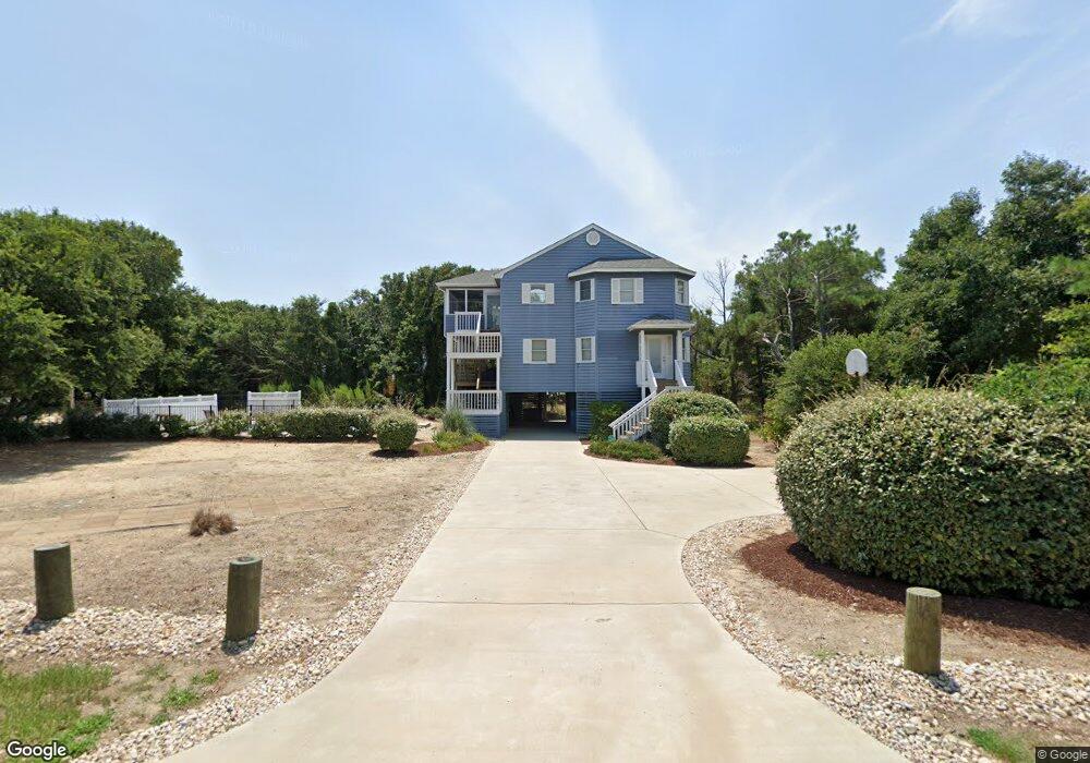
105 Bias Ln E Kitty Hawk, NC 27949
Estimated Value: $944,000 - $1,187,000
6
Beds
5
Baths
2,526
Sq Ft
$417/Sq Ft
Est. Value
About This Home
This home is located at 105 Bias Ln E, Kitty Hawk, NC 27949 and is currently estimated at $1,052,730, approximately $416 per square foot. 105 Bias Ln E is a home located in Dare County with nearby schools including Kitty Hawk Elementary School, First Flight Middle School, and First Flight High School.
Ownership History
Date
Name
Owned For
Owner Type
Purchase Details
Closed on
Oct 10, 2024
Sold by
Cattell Stuart A and Cattell Deborah L
Bought by
Little Thomas A and Little Elizabeth C
Current Estimated Value
Home Financials for this Owner
Home Financials are based on the most recent Mortgage that was taken out on this home.
Original Mortgage
$735,000
Outstanding Balance
$723,113
Interest Rate
6.46%
Mortgage Type
New Conventional
Estimated Equity
$329,617
Purchase Details
Closed on
Oct 2, 2024
Sold by
Cattell Stuart and Cattell Deborah L
Bought by
Little Thomas and Little Elizabeth C
Home Financials for this Owner
Home Financials are based on the most recent Mortgage that was taken out on this home.
Original Mortgage
$735,000
Outstanding Balance
$723,113
Interest Rate
6.46%
Mortgage Type
New Conventional
Estimated Equity
$329,617
Purchase Details
Closed on
Jul 25, 2024
Sold by
Cattell Anthony A and Cattell Stuart A
Bought by
Cattell Stuart A and Cattell Deboarh L
Purchase Details
Closed on
Apr 7, 2006
Sold by
Clayton Family Properties Llc
Bought by
Cattell Anthony A and Cattell Sheila M
Home Financials for this Owner
Home Financials are based on the most recent Mortgage that was taken out on this home.
Original Mortgage
$417,000
Interest Rate
5.89%
Mortgage Type
New Conventional
Create a Home Valuation Report for This Property
The Home Valuation Report is an in-depth analysis detailing your home's value as well as a comparison with similar homes in the area
Home Values in the Area
Average Home Value in this Area
Purchase History
| Date | Buyer | Sale Price | Title Company |
|---|---|---|---|
| Little Thomas A | $1,050,000 | True North Title | |
| Little Thomas | $1,050,000 | True North Title | |
| Cattell Stuart A | -- | None Listed On Document | |
| Cattell Anthony A | $635,000 | None Available |
Source: Public Records
Mortgage History
| Date | Status | Borrower | Loan Amount |
|---|---|---|---|
| Open | Little Thomas A | $735,000 | |
| Closed | Little Thomas | $735,000 | |
| Previous Owner | Cattell Anthony A | $417,000 |
Source: Public Records
Tax History
| Year | Tax Paid | Tax Assessment Tax Assessment Total Assessment is a certain percentage of the fair market value that is determined by local assessors to be the total taxable value of land and additions on the property. | Land | Improvement |
|---|---|---|---|---|
| 2025 | $4,429 | $999,400 | $630,000 | $369,400 |
| 2024 | $3,170 | $649,800 | $318,800 | $331,000 |
| 2023 | $4,032 | $649,800 | $318,800 | $331,000 |
| 2022 | $4,032 | $649,800 | $318,800 | $331,000 |
| 2021 | $4,032 | $649,800 | $318,800 | $331,000 |
| 2020 | $3,879 | $649,800 | $318,800 | $331,000 |
| 2019 | $3,681 | $529,600 | $281,400 | $248,200 |
| 2018 | $3,681 | $529,600 | $281,400 | $248,200 |
| 2017 | $3,601 | $529,600 | $281,400 | $248,200 |
| 2016 | $3,119 | $487,300 | $281,400 | $205,900 |
| 2014 | $3,119 | $487,300 | $281,400 | $205,900 |
Source: Public Records
Map
Nearby Homes
- 105 Yolanda Terrace Unit 19
- 125 Seabreeze Dr
- 125 Seabreeze Dr Unit Lot 10
- 30 11th Ave W Unit Lot 63
- 102 Sea Hawk Dr E Unit Lot 19
- 45 N Dune Loop Unit Lot 55
- 123 Georgetown Rd Unit 19
- 131 Brandon Ct Unit Lot 35
- 123 Georgetown Sands Rd Unit 24
- 123 Georgetown Sands Rd Unit 19
- 126 Jay Crest Rd Unit 3
- 120 Tuckahoe Dr W Unit 75
- 134 Plover Dr Unit lot A-3D
- 101 Georgetown Sands Rd Unit 47
- 114 Sea Hawk Dr W Unit Lot 29
- 343 Sea Oats Trail Unit Lot 10
- 105 Plover Dr Unit Lot 3
- 102 Settlers Ln Unit Lot 7R
- 117 Osprey Ridge Rd Unit Lot 12
- 101 Nash Rd Unit Lot 1
- 103 Bias Ln E
- 104 Charles Jenkins Ln W
- 104 Charles Jenkins Ln W
- 107 Bias Ln E
- 100 Charles Jenkins Ln Unit 54
- 100 Charles Jenkins Ln
- 104 Bias Ln E
- 124 Charles Jenkins Ln
- 101 Bias Ln E
- 106 Charles Jenkins Ln E Unit 51
- 106 Bias Ln E
- 101 Charles Jenkins Ln
- 100 Bias Ln E
- 109 Bias Ln E
- 108 Charles Jenkins Ln W Unit 14
- 108 Charles Jenkins Ln W
- 108 Charles Jenkins Ln W
- 108 Charles Jenkins Ln W
- 1102 Tides Dr
- 111 Bias Ln E Unit Lot12
Your Personal Tour Guide
Ask me questions while you tour the home.