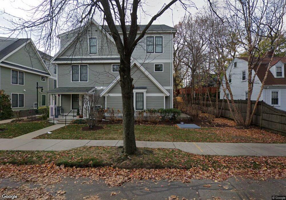
105 Crowninshield Rd Unit B3 Brookline, MA 02446
Coolidge Corner NeighborhoodEstimated Value: $705,870 - $844,000
1
Bed
1
Bath
786
Sq Ft
$1,004/Sq Ft
Est. Value
About This Home
This home is located at 105 Crowninshield Rd Unit B3, Brookline, MA 02446 and is currently estimated at $789,218, approximately $1,004 per square foot. 105 Crowninshield Rd Unit B3 is a home located in Norfolk County with nearby schools including Match Charter Public School, New England Hebrew Academy, and Boston University Academy.
Ownership History
Date
Name
Owned For
Owner Type
Purchase Details
Closed on
Oct 1, 2009
Sold by
Saint Aidans Dev Llc
Bought by
Berger Ethan I
Current Estimated Value
Home Financials for this Owner
Home Financials are based on the most recent Mortgage that was taken out on this home.
Original Mortgage
$299,000
Outstanding Balance
$195,641
Interest Rate
5.12%
Mortgage Type
Purchase Money Mortgage
Estimated Equity
$593,577
Create a Home Valuation Report for This Property
The Home Valuation Report is an in-depth analysis detailing your home's value as well as a comparison with similar homes in the area
Home Values in the Area
Average Home Value in this Area
Purchase History
| Date | Buyer | Sale Price | Title Company |
|---|---|---|---|
| Berger Ethan I | $399,000 | -- | |
| Berger Ethan I | $399,000 | -- |
Source: Public Records
Mortgage History
| Date | Status | Borrower | Loan Amount |
|---|---|---|---|
| Open | Berger Ethan I | $299,000 | |
| Closed | Berger Ethan I | $299,000 |
Source: Public Records
Tax History Compared to Growth
Tax History
| Year | Tax Paid | Tax Assessment Tax Assessment Total Assessment is a certain percentage of the fair market value that is determined by local assessors to be the total taxable value of land and additions on the property. | Land | Improvement |
|---|---|---|---|---|
| 2025 | $7,008 | $710,000 | $0 | $710,000 |
| 2024 | $6,800 | $696,000 | $0 | $696,000 |
| 2023 | $6,747 | $676,700 | $0 | $676,700 |
| 2022 | $6,760 | $663,400 | $0 | $663,400 |
| 2021 | $6,438 | $656,900 | $0 | $656,900 |
| 2020 | $6,146 | $650,400 | $0 | $650,400 |
| 2019 | $5,804 | $619,400 | $0 | $619,400 |
| 2018 | $5,355 | $566,100 | $0 | $566,100 |
| 2017 | $5,179 | $524,200 | $0 | $524,200 |
| 2016 | $4,965 | $476,500 | $0 | $476,500 |
| 2015 | $4,627 | $433,200 | $0 | $433,200 |
| 2014 | $4,565 | $400,800 | $0 | $400,800 |
Source: Public Records
Map
Nearby Homes
- 125 Crowninshield Rd Unit 125
- 99 Crowninshield Rd Unit 99
- 233 Freeman St Unit 1
- 125 Pleasant St Unit 201
- 6 Elba St
- 45 Dwight St
- 11 Abbottsford Rd
- 19 Thatcher St Unit E13
- 79 Pleasant St Unit 4
- 58 Dwight St Unit 6
- 18 Browne St Unit 2
- 63 Green St Unit 3
- 63 Green St Unit 2
- 85 Naples Rd Unit 2
- 52 Babcock St Unit 6
- 17 James St Unit 1
- 15 James St Unit 2
- 51 John St Unit 201
- 10 Bradford Terrace Unit 5
- 14 Green St Unit PHA
- 117 Crowninshield Rd Unit C2
- 113 Crowninshield Rd Unit B1
- 115 Crowninshield Rd
- 115 Crowninshield Rd Unit C3
- 115 Crowninshield Rd Unit 115
- 111 Crowninshield Rd Unit B5
- 111 Crowninshield Rd Unit 111
- 107 Crowninshield Rd Unit B2
- 99 Crowninshield Rd Unit B4
- 123 Crowninshield Rd Unit C5
- 119 Crowninshield Rd Unit C1
- 119 Crowninshield Rd Unit 119
- 95 Crowninshield Rd
- 101 Crowninshield Rd Unit B8
- 109 Crowninshield Rd Unit B6
- 121 Crowninshield Rd Unit C6
- 217 Freeman St
- 217 Freeman St
- 217 Freeman St Unit 905
- 217 Freeman St Unit 2