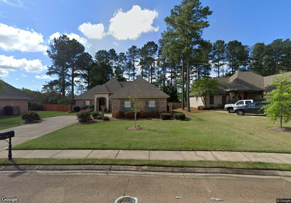
105 Hawks Nest Cove Madison, MS 39110
Estimated Value: $353,414 - $402,000
--
Bed
--
Bath
2,259
Sq Ft
$167/Sq Ft
Est. Value
About This Home
This home is located at 105 Hawks Nest Cove, Madison, MS 39110 and is currently estimated at $376,854, approximately $166 per square foot. 105 Hawks Nest Cove is a home with nearby schools including Mannsdale Elementary School, Germantown Middle School, and Germantown High School.
Ownership History
Date
Name
Owned For
Owner Type
Purchase Details
Closed on
Aug 15, 2014
Sold by
Brunini Anthony Edmund and Brunini Christianne
Bought by
Brummett Paige M
Current Estimated Value
Home Financials for this Owner
Home Financials are based on the most recent Mortgage that was taken out on this home.
Original Mortgage
$192,307
Outstanding Balance
$148,207
Interest Rate
4.4%
Mortgage Type
FHA
Estimated Equity
$228,647
Purchase Details
Closed on
May 2, 2011
Sold by
Brunini Anthony Edmund and Brunini Christianne
Bought by
Brunini Anthony Edmund and Brunini Christianne
Home Financials for this Owner
Home Financials are based on the most recent Mortgage that was taken out on this home.
Original Mortgage
$150,000
Interest Rate
4.83%
Mortgage Type
Unknown
Create a Home Valuation Report for This Property
The Home Valuation Report is an in-depth analysis detailing your home's value as well as a comparison with similar homes in the area
Home Values in the Area
Average Home Value in this Area
Purchase History
| Date | Buyer | Sale Price | Title Company |
|---|---|---|---|
| Brummett Paige M | -- | None Available | |
| Brunini Anthony Edmund | -- | None Available | |
| Brunini Anthony Edmund | -- | None Available |
Source: Public Records
Mortgage History
| Date | Status | Borrower | Loan Amount |
|---|---|---|---|
| Open | Brummett Paige M | $192,307 | |
| Previous Owner | Brunini Anthony Edmund | $150,000 |
Source: Public Records
Tax History Compared to Growth
Tax History
| Year | Tax Paid | Tax Assessment Tax Assessment Total Assessment is a certain percentage of the fair market value that is determined by local assessors to be the total taxable value of land and additions on the property. | Land | Improvement |
|---|---|---|---|---|
| 2024 | $2,131 | $23,676 | $0 | $0 |
| 2023 | $2,131 | $23,676 | $0 | $0 |
| 2022 | $2,131 | $23,676 | $0 | $0 |
| 2021 | $1,997 | $22,811 | $0 | $0 |
| 2020 | $1,996 | $22,800 | $0 | $0 |
| 2019 | $1,996 | $22,800 | $0 | $0 |
| 2018 | $1,996 | $22,800 | $0 | $0 |
| 2017 | $1,961 | $22,454 | $0 | $0 |
| 2016 | $1,714 | $20,006 | $0 | $0 |
| 2015 | $1,634 | $20,006 | $0 | $0 |
| 2014 | $1,634 | $20,006 | $0 | $0 |
Source: Public Records
Map
Nearby Homes
- 109 Grayhawk Dr
- 126 Grayhawk Pkwy
- 105 Talons Point
- 100 Old Orchard Rd
- 111 Claw Creek Cove
- 128 Grayhawk Dr
- 121 Winchester Cove
- 147 Grayhawk Dr
- 152 Grayhawk Dr
- 1 Laws Crossing
- 249 Grayhawk Dr
- 237 Buckhead Dr
- 108 Wingspan Way
- 153 Deerwood Crossing
- 113 Windy Hollow
- 175 Hunter's Cove
- 167 Hunter's Cove
- 174 Hunter's Cove
- 123 Lakeshire Cove
- 144 Red Fox Ln
- 105 Hawk's Nest Cove
- 105 Hawk''S Nest Cove
- 113 Hawks Nest Cove
- 103 Hawks Nest Cove
- 115 Hawks Nest Cove
- 110 Hawk's Nest Cove
- 110 Hawk''S Nest Cove
- 110 Hawks Nest Cove
- 107 Grayhawk Dr Unit LOT 394
- 107 Grayhawk Dr
- 112 Hawk''S Nest Cove Unit LOT 383
- 112 Hawk's Nest Cove Unit LOT 383
- 112 Hawks Nest Cove
- 112 Hawk''S Nest Cove
- 108 Hawks Nest Cove
- 108 Hawk''S Nest Cove
- 106 Hawks Nest Cove
- 114 Hawks Nest Cove
- 104 Hawks Nest Cove
- 104 Hawk''S Nest Cove