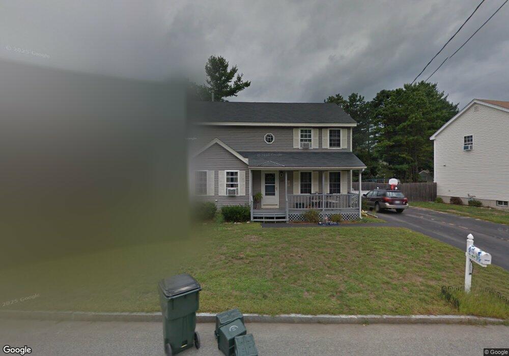
105 Hickory St Manchester, NH 03103
Goffes Falls NeighborhoodEstimated Value: $524,000 - $541,000
3
Beds
2
Baths
1,794
Sq Ft
$298/Sq Ft
Est. Value
About This Home
This home is located at 105 Hickory St, Manchester, NH 03103 and is currently estimated at $534,000, approximately $297 per square foot. 105 Hickory St is a home located in Hillsborough County with nearby schools including Highland-Goffes Falls School, Southside Middle School, and Manchester Memorial High School.
Ownership History
Date
Name
Owned For
Owner Type
Purchase Details
Closed on
Oct 1, 2004
Sold by
Lavoie Jack R
Bought by
Brown Timothy S and Brown Dawn L
Current Estimated Value
Home Financials for this Owner
Home Financials are based on the most recent Mortgage that was taken out on this home.
Original Mortgage
$225,194
Interest Rate
5.81%
Mortgage Type
Purchase Money Mortgage
Purchase Details
Closed on
Apr 1, 1998
Sold by
Soucy Brian P and Soucy Brooke
Bought by
Stewart Mitchell A
Home Financials for this Owner
Home Financials are based on the most recent Mortgage that was taken out on this home.
Original Mortgage
$123,536
Interest Rate
6.89%
Purchase Details
Closed on
Mar 29, 1996
Sold by
Gagnon Jean M
Bought by
Berry Robert V
Create a Home Valuation Report for This Property
The Home Valuation Report is an in-depth analysis detailing your home's value as well as a comparison with similar homes in the area
Home Values in the Area
Average Home Value in this Area
Purchase History
| Date | Buyer | Sale Price | Title Company |
|---|---|---|---|
| Brown Timothy S | $218,000 | -- | |
| Stewart Mitchell A | $124,900 | -- | |
| Berry Robert V | $121,400 | -- |
Source: Public Records
Mortgage History
| Date | Status | Borrower | Loan Amount |
|---|---|---|---|
| Open | Berry Robert V | $280,321 | |
| Closed | Berry Robert V | $47,700 | |
| Closed | Berry Robert V | $225,194 | |
| Previous Owner | Berry Robert V | $123,536 |
Source: Public Records
Tax History Compared to Growth
Tax History
| Year | Tax Paid | Tax Assessment Tax Assessment Total Assessment is a certain percentage of the fair market value that is determined by local assessors to be the total taxable value of land and additions on the property. | Land | Improvement |
|---|---|---|---|---|
| 2024 | $6,657 | $340,000 | $94,700 | $245,300 |
| 2023 | $6,412 | $340,000 | $94,700 | $245,300 |
| 2022 | $6,202 | $340,000 | $94,700 | $245,300 |
| 2021 | $6,011 | $340,000 | $94,700 | $245,300 |
| 2020 | $5,884 | $238,600 | $65,300 | $173,300 |
| 2019 | $5,803 | $238,600 | $65,300 | $173,300 |
| 2018 | $5,650 | $238,600 | $65,300 | $173,300 |
| 2017 | $5,564 | $238,600 | $65,300 | $173,300 |
| 2016 | $5,521 | $238,600 | $65,300 | $173,300 |
| 2015 | $5,372 | $229,200 | $62,100 | $167,100 |
| 2014 | $5,386 | $229,200 | $62,100 | $167,100 |
| 2013 | $5,196 | $229,200 | $62,100 | $167,100 |
Source: Public Records
Map
Nearby Homes
- 15 Tamarack Ct
- 29 Watts Landing Unit 24
- 53 Pine Ave
- 67 Pullman St
- 8 Iroquois Cir
- 3-C Mustang Dr Unit MODEL
- 4543 Brown Ave
- 4481 Brown Ave
- 9 Mustang Dr Unit C
- 9 Mustang Dr Unit B
- 7 Mustang Dr Unit C
- 7 Mustang Dr Unit END UNIT-A
- 769 Daniel Webster Hwy
- 4243 Brown Ave
- 490 Charles Bancroft Hwy
- 15 Harvey Rd
- 25 Chatfield Dr
- 34 Chatham Dr
- 29 Bedford Rd
- 5 Webster Rd