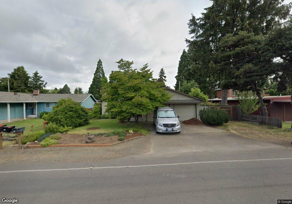
105 Owosso Dr Eugene, OR 97404
River Road NeighborhoodEstimated Value: $394,000 - $440,000
3
Beds
2
Baths
1,230
Sq Ft
$346/Sq Ft
Est. Value
About This Home
This home is located at 105 Owosso Dr, Eugene, OR 97404 and is currently estimated at $426,002, approximately $346 per square foot. 105 Owosso Dr is a home located in Lane County with nearby schools including Howard Elementary School, Kelly Middle School, and North Eugene High School.
Ownership History
Date
Name
Owned For
Owner Type
Purchase Details
Closed on
Nov 1, 2021
Sold by
Stroh Scott A and Stroh Barbara K
Bought by
Klingsporn Soren Peter and Klingsporn Rilke Anya
Current Estimated Value
Home Financials for this Owner
Home Financials are based on the most recent Mortgage that was taken out on this home.
Original Mortgage
$210,000
Outstanding Balance
$191,674
Interest Rate
3.01%
Mortgage Type
New Conventional
Estimated Equity
$234,328
Purchase Details
Closed on
Aug 2, 2016
Sold by
Cougill Robert C
Bought by
Stroh Scott A and Stroh Barbara K
Purchase Details
Closed on
May 28, 2008
Sold by
Tengs Brian C and Tengs Julian Harold
Bought by
Cougill Robert C
Create a Home Valuation Report for This Property
The Home Valuation Report is an in-depth analysis detailing your home's value as well as a comparison with similar homes in the area
Home Values in the Area
Average Home Value in this Area
Purchase History
We collect this data history from publicly available records. To have your information removed, we recommend requesting removal directly through your county’s website.
| Date | Buyer | Sale Price | Title Company |
|---|---|---|---|
| Klingsporn Soren Peter | $360,000 | Western Title & Escrow | |
| Stroh Scott A | $219,000 | Western Title & Escrow Co | |
| Cougill Robert C | $215,500 | Western Title & Escrow Compa |
Source: Public Records
Mortgage History
We collect this data history from publicly available records. To have your information removed, we recommend requesting removal directly through your county’s website.
| Date | Status | Borrower | Loan Amount |
|---|---|---|---|
| Open | Klingsporn Soren Peter | $210,000 |
Source: Public Records
Tax History
| Year | Tax Paid | Tax Assessment Tax Assessment Total Assessment is a certain percentage of the fair market value that is determined by local assessors to be the total taxable value of land and additions on the property. | Land | Improvement |
|---|---|---|---|---|
| 2025 | $4,231 | $217,178 | -- | -- |
| 2024 | $3,796 | $191,557 | -- | -- |
| 2023 | $3,796 | $185,978 | $0 | $0 |
| 2022 | $3,557 | $180,562 | $0 | $0 |
| 2021 | $3,341 | $175,303 | $0 | $0 |
| 2020 | $3,352 | $170,198 | $0 | $0 |
| 2019 | $3,238 | $165,241 | $0 | $0 |
| 2018 | $3,048 | $155,756 | $0 | $0 |
| 2017 | $2,911 | $155,756 | $0 | $0 |
| 2016 | $2,839 | $151,219 | $0 | $0 |
| 2015 | $2,707 | $146,815 | $0 | $0 |
| 2014 | $2,661 | $142,539 | $0 | $0 |
Source: Public Records
Map
Nearby Homes
- 1920 River Rd
- 345 E Rosewood Ave
- 172 Norman Ave
- 132 Formac Ave
- 233 Howard Ave
- 1880 Manihi Dr
- 389 Maxwell Rd
- 184 E Hatton Ave
- 1565 Santa Rosa St
- 2519 Justine Ln
- 501 Division Ave Unit 28
- 1348 Manzana St
- 460 Autumn Ave
- 260 Greenleaf Ave
- 2615 Mimi St
- 445 Sterling Dr
- 84 Green Ln
- 2439 Quince St
- 2463 Moore St
- 260 Susan St
- 93 Owosso Dr
- 119 Owosso Dr
- 75 Owosso Dr
- 85 Owosso Dr
- 125 Owosso Dr
- 110 Corliss Ln
- 124 Corliss Ln
- 121 Owosso Dr
- 55 Owosso Dr
- 133 Owosso Dr
- 116 Owosso Dr
- 152 Corliss Ln
- 0 Cherry Blossom Village 26 40 46 66 86 Owosso Dr Unit 5694925-11880662
- 0 Cherry Blossom Village 26 40 46 66 86 Owosso Dr Unit 5694925-9398355
- 0 Cherry Blossom Village 26 40 46 66 86 Owosso Dr Unit 5694925-11614582
- 0 Cherry Blossom Village 26 40 46 66 86 Owosso Dr Unit 5694925-11614583
- 0 Cherry Blossom Village 26 40 46 66 86 Owosso Dr Unit 5694925-11384842
- 0 Cherry Blossom Village 26 40 46 66 86 Owosso Dr Unit 5694925-9523125
- 120 Owosso Dr
- 90 Corliss Ln
Your Personal Tour Guide
Ask me questions while you tour the home.