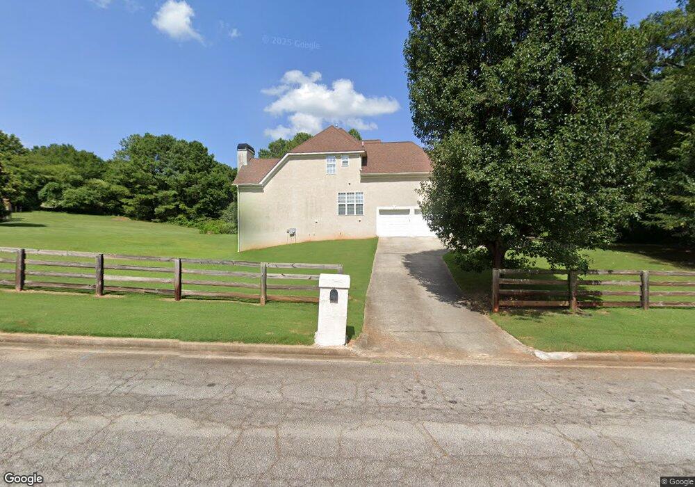
105 Strandhill Rd Tyrone, GA 30290
Estimated Value: $473,047 - $558,000
Studio
1
Bath
2,558
Sq Ft
$203/Sq Ft
Est. Value
About This Home
This home is located at 105 Strandhill Rd, Tyrone, GA 30290 and is currently estimated at $519,012, approximately $202 per square foot. 105 Strandhill Rd is a home located in Fayette County with nearby schools including Crabapple Lane Elementary School, Flat Rock Middle School, and Sandy Creek High School.
Ownership History
Date
Name
Owned For
Owner Type
Purchase Details
Closed on
Mar 31, 1999
Sold by
Sturm Hiram M
Bought by
Barnes Luther and Barnes Clara
Current Estimated Value
Home Financials for this Owner
Home Financials are based on the most recent Mortgage that was taken out on this home.
Original Mortgage
$194,300
Interest Rate
7.7%
Mortgage Type
New Conventional
Create a Home Valuation Report for This Property
The Home Valuation Report is an in-depth analysis detailing your home's value as well as a comparison with similar homes in the area
Home Values in the Area
Average Home Value in this Area
Purchase History
| Date | Buyer | Sale Price | Title Company |
|---|---|---|---|
| Barnes Luther | $29,500 | -- |
Source: Public Records
Mortgage History
| Date | Status | Borrower | Loan Amount |
|---|---|---|---|
| Previous Owner | Barnes Luther | $194,300 |
Source: Public Records
Tax History
| Year | Tax Paid | Tax Assessment Tax Assessment Total Assessment is a certain percentage of the fair market value that is determined by local assessors to be the total taxable value of land and additions on the property. | Land | Improvement |
|---|---|---|---|---|
| 2024 | $4,504 | $194,688 | $24,000 | $170,688 |
| 2023 | $3,793 | $166,080 | $24,000 | $142,080 |
Source: Public Records
Map
Nearby Homes
- 130 Windchime Way Unit 9
- 100 Clydesdale Ct
- 2230 Castle Lake Dr
- 135 French Village Blvd
- 2185 Castle Lake Dr
- 200 Chaparral Trace
- 121 Northwoods Rd
- 105 Laurel Forest Dr
- 408 Strathmore Dr
- 95 Tyler Woods Dr
- 10 Monteray Ct
- 70 N Strathmore Dr
- 12 Race Point Way
- 100 Sycamore Way
- 110 Calypso Ct
- 125 Lyndhurst Way
- 321 Cottonwood Cir
- 108 Tullamore Trail
- 125 Cannongate Cir
- 125 Meadowview Cir
- 108 Castlewood Rd
- 115 Strandhill Rd
- 112 Castlewood Rd
- 104 Ashland Trail
- 125 Strandhill Rd
- 119 Castlewood Rd
- 119 Castlewood Rd Unit 81
- 116 Castlewood Rd
- 135 Strandhill Rd
- 103 Ashland Trail
- 125 Castlewood Rd
- 0 Castlewood Rd Unit 18 8019867
- 0 Castlewood Rd Unit 9005407
- 105 Rosses Point
- 110 Rosses Point
- 122 Castlewood Rd
- 2 Ashland Trail
- 115 Kylemore Ct
- 145 Strandhill Rd
- 105 Ashland Trail