Estimated Value: $195,000 - $210,013
4
Beds
2
Baths
2,482
Sq Ft
$83/Sq Ft
Est. Value
About This Home
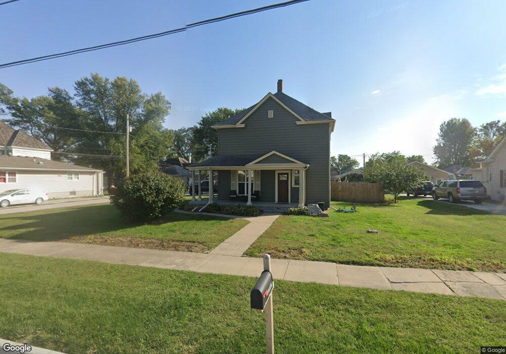
This home is located at 105 W 4th St, Logan, IA 51546 and is currently estimated at $205,003, approximately $82 per square foot. 105 W 4th St is a home located in Harrison County with nearby schools including Logan-Magnolia Elementary School and Logan-Magnolia Junior/Senior High School.
Ownership History
Date
Name
Owned For
Owner Type
Purchase Details
Closed on
Feb 1, 2025
Sold by
Payne Summer D F and Springston Summer D
Bought by
Springston Summer D F
Current Estimated Value
Home Financials for this Owner
Home Financials are based on the most recent Mortgage that was taken out on this home.
Original Mortgage
$108,000
Outstanding Balance
$107,264
Interest Rate
6.91%
Mortgage Type
New Conventional
Estimated Equity
$97,739
Purchase Details
Closed on
Aug 8, 2017
Sold by
Champlin Owen E
Bought by
Payne Nickolas K and Payne Summer D F
Home Financials for this Owner
Home Financials are based on the most recent Mortgage that was taken out on this home.
Original Mortgage
$88,000
Interest Rate
4.03%
Mortgage Type
Closed End Mortgage
Create a Home Valuation Report for This Property
The Home Valuation Report is an in-depth analysis detailing your home's value as well as a comparison with similar homes in the area
Home Values in the Area
Average Home Value in this Area
Purchase History
| Date | Buyer | Sale Price | Title Company |
|---|---|---|---|
| Springston Summer D F | -- | Servicelink | |
| Springston Summer D F | -- | Servicelink | |
| Payne Summer D F | -- | Servicelink | |
| Payne Summer D F | -- | Servicelink | |
| Payne Nickolas K | -- | None Available |
Source: Public Records
Mortgage History
| Date | Status | Borrower | Loan Amount |
|---|---|---|---|
| Open | Springston Summer D F | $108,000 | |
| Closed | Springston Summer D F | $108,000 | |
| Previous Owner | Payne Nickolas K | $88,000 |
Source: Public Records
Tax History Compared to Growth
Tax History
| Year | Tax Paid | Tax Assessment Tax Assessment Total Assessment is a certain percentage of the fair market value that is determined by local assessors to be the total taxable value of land and additions on the property. | Land | Improvement |
|---|---|---|---|---|
| 2025 | $2,954 | $185,620 | $19,910 | $165,710 |
| 2024 | $2,850 | $168,080 | $19,910 | $148,170 |
| 2023 | $2,850 | $168,080 | $19,910 | $148,170 |
| 2022 | $2,432 | $124,730 | $19,907 | $104,823 |
| 2021 | $2,432 | $124,730 | $19,907 | $104,823 |
| 2020 | $2,306 | $121,755 | $19,907 | $101,848 |
| 2019 | $2,812 | $121,755 | $19,907 | $101,848 |
| 2018 | $2,754 | $140,328 | $0 | $0 |
| 2017 | $2,754 | $140,328 | $0 | $0 |
| 2016 | $2,886 | $140,328 | $0 | $0 |
| 2015 | $2,886 | $126,422 | $0 | $0 |
| 2014 | $2,514 | $126,422 | $0 | $0 |
Source: Public Records
Map
Nearby Homes
- 721 Glen Rd
- 114 E 10th St
- 1010 Skyline Dr
- 415 Wessar Dr
- Lot 18 Mulligan Trail
- 2607 220th St
- 2144 Norton Ave
- LOT 27 Mulligan Trail
- 2484 280th St
- LOT 26 Lmvcc Estates
- 2464 Mulligan Trail
- LOT 20 Lmvcc Estates
- LOT 17 Lmvcc Estates
- Lot 17 Lmvcc Estates Trail
- LOT 15 Mulligan Trail
- 2853 Preston Place
- 2740 Whitetail Dr
- LOT D Fieldcrest Dr
- LOT E & K Fieldcrest Dr
- LOT C Fieldcrest Dr