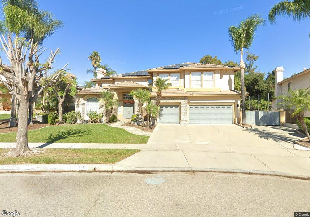
105 W Winslow St Upland, CA 91786
Estimated Value: $1,383,064 - $1,784,000
5
Beds
5
Baths
4,107
Sq Ft
$382/Sq Ft
Est. Value
About This Home
This home is located at 105 W Winslow St, Upland, CA 91786 and is currently estimated at $1,568,021, approximately $381 per square foot. 105 W Winslow St is a home located in San Bernardino County with nearby schools including Magnolia Elementary, Pioneer Junior High School, and Upland High School.
Ownership History
Date
Name
Owned For
Owner Type
Purchase Details
Closed on
Nov 1, 2022
Sold by
Patel Sachin Kanu and Patel Monica Sachin
Bought by
Patel Family Revocable Living Trust
Current Estimated Value
Purchase Details
Closed on
Feb 4, 2009
Sold by
Luedeke John R
Bought by
Patel Sachin Kanu and Patel Monica Sachin
Home Financials for this Owner
Home Financials are based on the most recent Mortgage that was taken out on this home.
Original Mortgage
$692,000
Interest Rate
5.19%
Mortgage Type
Purchase Money Mortgage
Purchase Details
Closed on
Jun 3, 2005
Sold by
Luedeke John R
Bought by
Luedeke John R and Luedeke Laraine A
Purchase Details
Closed on
Aug 9, 1999
Sold by
Layne William Robert
Bought by
Luedeke John R and Luedeke Laraine A
Home Financials for this Owner
Home Financials are based on the most recent Mortgage that was taken out on this home.
Original Mortgage
$350,000
Interest Rate
7.37%
Purchase Details
Closed on
Aug 5, 1999
Sold by
Layne Pamela
Bought by
Layne Robert William and Layne William Robert
Home Financials for this Owner
Home Financials are based on the most recent Mortgage that was taken out on this home.
Original Mortgage
$350,000
Interest Rate
7.37%
Purchase Details
Closed on
Jul 15, 1997
Sold by
Woodbridge Upland Estates Llc
Bought by
Layne William Robert
Home Financials for this Owner
Home Financials are based on the most recent Mortgage that was taken out on this home.
Original Mortgage
$390,300
Interest Rate
7.45%
Create a Home Valuation Report for This Property
The Home Valuation Report is an in-depth analysis detailing your home's value as well as a comparison with similar homes in the area
Home Values in the Area
Average Home Value in this Area
Purchase History
We collect this data history from publicly available records. To have your information removed, we recommend requesting removal directly through your county’s website.
| Date | Buyer | Sale Price | Title Company |
|---|---|---|---|
| Patel Family Revocable Living Trust | -- | -- | |
| Patel Sachin Kanu | $875,000 | Chicago Title Company | |
| Luedeke John R | -- | -- | |
| Luedeke John R | $515,000 | Fidelity National Title Ins | |
| Layne Robert William | -- | Fidelity National Title Ins | |
| Layne William Robert | $434,000 | First American Title Ins Co |
Source: Public Records
Mortgage History
We collect this data history from publicly available records. To have your information removed, we recommend requesting removal directly through your county’s website.
| Date | Status | Borrower | Loan Amount |
|---|---|---|---|
| Previous Owner | Patel Sachin Kanu | $692,000 | |
| Previous Owner | Luedeke John R | $350,000 | |
| Previous Owner | Layne William Robert | $390,300 |
Source: Public Records
Tax History
| Year | Tax Paid | Tax Assessment Tax Assessment Total Assessment is a certain percentage of the fair market value that is determined by local assessors to be the total taxable value of land and additions on the property. | Land | Improvement |
|---|---|---|---|---|
| 2025 | $12,223 | $1,126,797 | $394,380 | $732,417 |
| 2024 | $11,834 | $1,104,703 | $386,647 | $718,056 |
| 2023 | $11,658 | $1,083,042 | $379,066 | $703,976 |
| 2022 | $11,407 | $1,061,806 | $371,633 | $690,173 |
| 2021 | $11,398 | $1,040,986 | $364,346 | $676,640 |
| 2020 | $11,089 | $1,030,312 | $360,610 | $669,702 |
| 2019 | $11,049 | $1,010,110 | $353,539 | $656,571 |
| 2018 | $10,774 | $990,304 | $346,607 | $643,697 |
| 2017 | $10,463 | $970,886 | $339,811 | $631,075 |
| 2016 | $10,178 | $951,849 | $333,148 | $618,701 |
| 2015 | $9,945 | $937,552 | $328,144 | $609,408 |
| 2014 | $9,688 | $919,187 | $321,716 | $597,471 |
Source: Public Records
Map
Nearby Homes
- 1448 N Euclid Ave
- 1471 N 1st Ave
- 1383 N 2nd Ave
- 1528 N 1st Ave
- 1382 N Ukiah Way
- 1560 Carnation Way
- 1234 N Laurel Ave
- 1418 Winston Ct
- 276 Grant St
- 1393 Bouquet Dr
- 1623 N Vallejo Way
- 655 Doreen Ct
- 1695 N Palm Ave
- 1309 N Albright Ave
- 351 West St
- 1696 N Redding Way
- 1618 Winston Way
- 888 Via Maria
- 1685 Francis Ave
- 1489 N Mulberry Ave
- 115 W Winslow St
- 145 W Winslow St
- 116 Harford Place
- 144 W Winslow St
- 108 W Winslow St
- 152 Harford Place
- 87 W Winslow St
- 185 W Winslow St
- 100 Harford Place
- 1439 N Palm Ave
- 1436 N Laurel Ave
- 190 Harford Place
- 1429 N Palm Ave
- 1430 N Laurel Ave
- 1418 N Palm Ave
- 1419 N Laurel Ave
- 1423 N Palm Ave
- 1438 N Quince Way
- 1424 N Laurel Ave
- 1447 N Euclid Ave
Your Personal Tour Guide
Ask me questions while you tour the home.