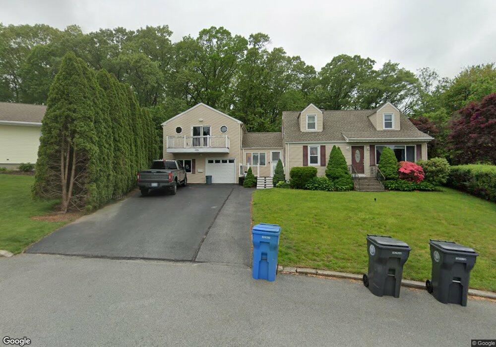
105 Westfield Dr Cranston, RI 02920
Thornton NeighborhoodEstimated Value: $504,000 - $632,000
3
Beds
1
Bath
1,200
Sq Ft
$474/Sq Ft
Est. Value
About This Home
This home is located at 105 Westfield Dr, Cranston, RI 02920 and is currently estimated at $568,933, approximately $474 per square foot. 105 Westfield Dr is a home located in Providence County with nearby schools including Stone Hill School, Western Hills Middle School, and Cranston High School West.
Ownership History
Date
Name
Owned For
Owner Type
Purchase Details
Closed on
Feb 27, 2004
Sold by
Barron Tyler
Bought by
Keenan Matthew and Keenan Elizabeth
Current Estimated Value
Purchase Details
Closed on
Nov 7, 2002
Sold by
Stangelo Richard
Bought by
Barron Tyler
Purchase Details
Closed on
Jun 26, 2002
Sold by
Errico Louis F and Errico Patricia
Bought by
Stangelo Richard
Create a Home Valuation Report for This Property
The Home Valuation Report is an in-depth analysis detailing your home's value as well as a comparison with similar homes in the area
Home Values in the Area
Average Home Value in this Area
Purchase History
| Date | Buyer | Sale Price | Title Company |
|---|---|---|---|
| Keenan Matthew | $228,000 | -- | |
| Barron Tyler | $187,500 | -- | |
| Stangelo Richard | $150,000 | -- |
Source: Public Records
Mortgage History
| Date | Status | Borrower | Loan Amount |
|---|---|---|---|
| Open | Stangelo Richard | $50,000 | |
| Open | Stangelo Richard | $99,800 | |
| Closed | Stangelo Richard | $75,100 |
Source: Public Records
Tax History Compared to Growth
Tax History
| Year | Tax Paid | Tax Assessment Tax Assessment Total Assessment is a certain percentage of the fair market value that is determined by local assessors to be the total taxable value of land and additions on the property. | Land | Improvement |
|---|---|---|---|---|
| 2025 | $6,732 | $485,000 | $144,700 | $340,300 |
| 2024 | $6,462 | $474,800 | $144,700 | $330,100 |
| 2023 | $6,407 | $339,000 | $103,900 | $235,100 |
| 2022 | $6,275 | $339,000 | $103,900 | $235,100 |
| 2021 | $6,102 | $339,000 | $103,900 | $235,100 |
| 2020 | $6,354 | $305,900 | $103,900 | $202,000 |
| 2019 | $6,354 | $305,900 | $103,900 | $202,000 |
| 2018 | $6,207 | $305,900 | $103,900 | $202,000 |
| 2017 | $5,792 | $252,500 | $83,100 | $169,400 |
| 2016 | $5,669 | $252,500 | $83,100 | $169,400 |
| 2015 | $5,669 | $252,500 | $83,100 | $169,400 |
| 2014 | $5,358 | $234,600 | $83,100 | $151,500 |
Source: Public Records
Map
Nearby Homes
- 118 Westfield Dr
- 27 Nardolillo St
- 1603 Plainfield Pike Unit D5
- 1603 Plainfield Pike Unit E2
- 26 Rachela St
- 11 Red Robin Rd
- 27 Tartaglia St
- 20 Wild Berry Dr
- 51 Stone Dr
- 134 Lake Garden Dr
- 26 Scituate Farms Dr
- 41 Yeoman Ave
- 25 Loomis St
- 38 Mill St
- 1448 Plainfield Pike
- 9 Baker St
- 20 Doreen Ct
- 60 Harmony St
- 91 Curry Rd
- 53 Charcalee Dr
- 99 Westfield Dr
- 109 Westfield Dr
- 95 Westfield Dr
- 117 Westfield Dr
- 96 Westfield Dr
- 1750 Plainfield Pike
- 89 Westfield Dr
- 1762 Plainfield Pike
- 123 Westfield Dr
- 90 Westfield Dr
- 1740 Plainfield Pike
- 15 Olivia Dr
- 124 Westfield Dr
- 83 Westfield Dr
- 129 Westfield Dr
- 84 Westfield Dr
- 11 Olivia Dr
- 69 Leawood Dr
- 135 Westfield Dr
- 78 Westfield Dr