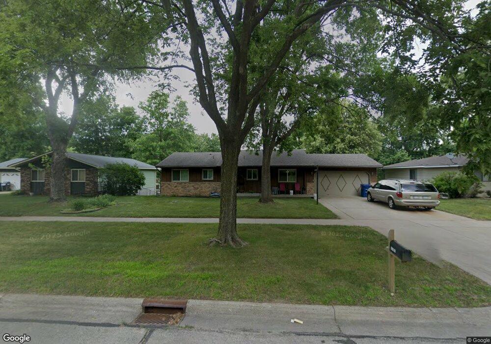
1050 Pioneer Rd Red Wing, MN 55066
Estimated Value: $248,000 - $318,000
4
Beds
1
Bath
1,232
Sq Ft
$236/Sq Ft
Est. Value
About This Home
This home is located at 1050 Pioneer Rd, Red Wing, MN 55066 and is currently estimated at $291,157, approximately $236 per square foot. 1050 Pioneer Rd is a home located in Goodhue County with nearby schools including Sunnyside Elementary School, Burnside Elementary School, and Twin Bluff Middle School.
Ownership History
Date
Name
Owned For
Owner Type
Purchase Details
Closed on
Aug 5, 2024
Sold by
Steffenhagen Carole and Steffenhagen Darrell
Bought by
Mason Anthony and Mason Ashleigh
Current Estimated Value
Home Financials for this Owner
Home Financials are based on the most recent Mortgage that was taken out on this home.
Original Mortgage
$192,000
Outstanding Balance
$189,827
Interest Rate
6.87%
Mortgage Type
New Conventional
Estimated Equity
$101,330
Create a Home Valuation Report for This Property
The Home Valuation Report is an in-depth analysis detailing your home's value as well as a comparison with similar homes in the area
Home Values in the Area
Average Home Value in this Area
Purchase History
| Date | Buyer | Sale Price | Title Company |
|---|---|---|---|
| Mason Anthony | $240,000 | -- |
Source: Public Records
Mortgage History
| Date | Status | Borrower | Loan Amount |
|---|---|---|---|
| Open | Mason Anthony | $192,000 |
Source: Public Records
Tax History Compared to Growth
Tax History
| Year | Tax Paid | Tax Assessment Tax Assessment Total Assessment is a certain percentage of the fair market value that is determined by local assessors to be the total taxable value of land and additions on the property. | Land | Improvement |
|---|---|---|---|---|
| 2025 | $3,464 | $279,300 | $53,400 | $225,900 |
| 2024 | -- | $274,700 | $53,400 | $221,300 |
| 2023 | $3,264 | $260,200 | $53,600 | $206,600 |
| 2022 | $3,022 | $253,000 | $47,900 | $205,100 |
| 2021 | $2,808 | $217,000 | $47,900 | $169,100 |
| 2020 | $2,760 | $205,800 | $47,900 | $157,900 |
| 2019 | $2,736 | $190,900 | $47,900 | $143,000 |
| 2018 | $2,194 | $191,400 | $46,000 | $145,400 |
| 2017 | $2,150 | $168,200 | $46,000 | $122,200 |
| 2016 | $1,968 | $167,100 | $46,000 | $121,100 |
| 2015 | $1,722 | $161,500 | $46,000 | $115,500 |
| 2014 | -- | $144,100 | $46,000 | $98,100 |
Source: Public Records
Map
Nearby Homes
- 1927 Twin Bluff Rd
- 1846 Twin Bluff Rd
- 1825 Twin Bluff Rd
- 1903 Lenore Ln
- 1838 Spruce Dr
- 2345 S Oak Dr
- 1606 Reichert Ave
- 769 Pioneer Rd
- 732 Hi Park Ave
- 1224 Tee Up Ln
- 672 Hi Park Ave
- 676 Hi Park Ave
- 1632 Spruce Dr
- 1822 Bohmbach Dr
- 1164 Hawthorn St
- 2351 Hallquist Ave
- 639 Hi Park Ave
- 434 Fridell Crescent
- 2543 Sunny Meadow Ln
- 611 Cherrywood Ct
- 1058 Pioneer Rd
- 1042 Pioneer Rd
- 1029 Launa Ct
- 1066 Pioneer Rd
- 1036 Pioneer Rd
- 2031 Launa Ave
- 1031 Launa Ct
- 2039 Launa Ave
- 2025 Launa Ave
- 1028 Pioneer Rd
- 1072 Pioneer Rd
- 1067 Pioneer Rd
- 1020 Pioneer Rd
- 1080 Pioneer Rd
- 2013 Launa Ave
- 1067 1067 Pioneer-Road-
- 1019 Pioneer Rd
- 1003 Burton St
- 991 Burton St
- 2034 Launa Ave