1052 Maukdale Riverside Ln Chuckey, TN 37641
Estimated Value: $117,000 - $166,000
--
Bed
--
Bath
800
Sq Ft
$168/Sq Ft
Est. Value
About This Home
This home is located at 1052 Maukdale Riverside Ln, Chuckey, TN 37641 and is currently estimated at $134,633, approximately $168 per square foot. 1052 Maukdale Riverside Ln is a home with nearby schools including South Central Elementary School and David Crockett High School.
Ownership History
Date
Name
Owned For
Owner Type
Purchase Details
Closed on
Sep 11, 2012
Sold by
Shelton Janet R
Bought by
Smith David and Smith Gena
Current Estimated Value
Purchase Details
Closed on
Mar 17, 2007
Bought by
Shelton Janet R and Powell Katherine M
Purchase Details
Closed on
Mar 17, 2006
Sold by
Shelton Janet R
Bought by
Lynn Shelton David
Purchase Details
Closed on
Oct 19, 2004
Sold by
Melvin Underwood
Bought by
Shelton Janet R
Purchase Details
Closed on
Jul 31, 2000
Bought by
Underwood Melvin
Create a Home Valuation Report for This Property
The Home Valuation Report is an in-depth analysis detailing your home's value as well as a comparison with similar homes in the area
Home Values in the Area
Average Home Value in this Area
Purchase History
| Date | Buyer | Sale Price | Title Company |
|---|---|---|---|
| Smith David | $45,000 | -- | |
| Shelton Janet R | $4,300 | -- | |
| Lynn Shelton David | $4,300 | -- | |
| Shelton Janet R | $5,000 | -- | |
| Underwood Melvin | $11,600 | -- |
Source: Public Records
Tax History Compared to Growth
Tax History
| Year | Tax Paid | Tax Assessment Tax Assessment Total Assessment is a certain percentage of the fair market value that is determined by local assessors to be the total taxable value of land and additions on the property. | Land | Improvement |
|---|---|---|---|---|
| 2024 | $545 | $31,850 | $10,200 | $21,650 |
| 2022 | $372 | $17,325 | $5,050 | $12,275 |
| 2021 | $372 | $17,325 | $5,050 | $12,275 |
| 2020 | $372 | $17,325 | $5,050 | $12,275 |
| 2019 | $396 | $17,325 | $5,050 | $12,275 |
| 2018 | $396 | $16,650 | $4,300 | $12,350 |
| 2017 | $396 | $16,650 | $4,300 | $12,350 |
| 2016 | $396 | $16,650 | $4,300 | $12,350 |
| 2015 | $330 | $16,650 | $4,300 | $12,350 |
| 2014 | $330 | $16,650 | $4,300 | $12,350 |
Source: Public Records
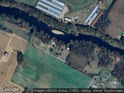
Map
Nearby Homes
- 236 Bill Mauk Rd
- 207 Bill Mauk Rd
- 188 Frank Stanton Rd
- 151 Frank Stanton Rd
- 1942 Bailey Bridge Rd
- 2928 Highway 107
- 133 Dillow Hill Dr
- 131 Brown Dr
- 273 Dunbar Rd
- 154 New Salem Dr
- 110 Green Ln
- 123 New Salem Dr
- Lot-4 Bailey Bridge Rd
- Lot-3 Bailey Bridge Rd
- 15.59 Ac Lester Snapp Rd
- 364 Laws Rd
- 150 Lester Snapp Lot 1 - 11 Acres Rd
- 150 Lester Snapp Lot 2 - 10 Acres Rd
- 438 Horace Dillow Rd
- 1540 Corby Bridge Rd
- 1052 Maukdale Riverside Ln
- 1058 Maukdale Riverside Ln
- 1046 Maukdale Riverside Ln
- 1064 Maukdale Riverside Ln
- 1070 Maukdale Riverside Ln
- 1084 Maukdale Riverside Ln
- 264 Bill Mauk Rd
- 260 Bill Mauk Rd
- 281 Bill Mauk Rd
- 248 Bill Mauk Rd
- 244 Bill Mauk Rd
- 1744 Corby Bridge Rd
- 1744 Corby Bridge Rd Unit 1
- 212 Frank Stanton Rd
- 231 Bill Mauk Rd
- 290 Bill Mauk Rd
- 289 Bill Mauk Rd
- 221 Bill Mauk Rd
- 296 Bill Mauk Rd
- 215 Bill Mauk Rd