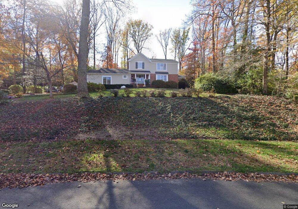
1052 Ulmstead Cir Arnold, MD 21012
Estimated Value: $713,000 - $977,000
Studio
3
Baths
2,410
Sq Ft
$367/Sq Ft
Est. Value
About This Home
This home is located at 1052 Ulmstead Cir, Arnold, MD 21012 and is currently estimated at $883,796, approximately $366 per square foot. 1052 Ulmstead Cir is a home located in Anne Arundel County with nearby schools including Broadneck Elementary School, Magothy River Middle School, and Broadneck High School.
Ownership History
Date
Name
Owned For
Owner Type
Purchase Details
Closed on
May 21, 1999
Sold by
Mcdonnell Kevin T
Bought by
Wang Earl C and Wang Barbara
Current Estimated Value
Purchase Details
Closed on
Sep 17, 1998
Sold by
West Malcolm W
Bought by
Mcdonnell Kevin T and Mcdonnell Patricia J
Purchase Details
Closed on
Jan 26, 1994
Sold by
Krautler C C
Bought by
West Malcolm W
Home Financials for this Owner
Home Financials are based on the most recent Mortgage that was taken out on this home.
Original Mortgage
$200,000
Interest Rate
7.11%
Create a Home Valuation Report for This Property
The Home Valuation Report is an in-depth analysis detailing your home's value as well as a comparison with similar homes in the area
Home Values in the Area
Average Home Value in this Area
Purchase History
We collect this data history from publicly available records. To have your information removed, we recommend requesting removal directly through your county’s website.
| Date | Buyer | Sale Price | Title Company |
|---|---|---|---|
| Wang Earl C | $345,000 | -- | |
| Mcdonnell Kevin T | $325,000 | -- | |
| West Malcolm W | $280,000 | -- |
Source: Public Records
Mortgage History
We collect this data history from publicly available records. To have your information removed, we recommend requesting removal directly through your county’s website.
| Date | Status | Borrower | Loan Amount |
|---|---|---|---|
| Previous Owner | West Malcolm W | $200,000 |
Source: Public Records
Tax History
| Year | Tax Paid | Tax Assessment Tax Assessment Total Assessment is a certain percentage of the fair market value that is determined by local assessors to be the total taxable value of land and additions on the property. | Land | Improvement |
|---|---|---|---|---|
| 2025 | $5,537 | $651,500 | -- | -- |
| 2024 | $5,537 | $617,800 | $319,300 | $298,500 |
| 2023 | $5,406 | $613,533 | $0 | $0 |
| 2022 | $5,075 | $609,267 | $0 | $0 |
| 2020 | $4,877 | $605,000 | $319,300 | $285,700 |
| 2019 | $4,806 | $605,000 | $319,300 | $285,700 |
| 2018 | $6,271 | $618,400 | $381,300 | $237,100 |
| 2017 | $4,557 | $612,300 | $0 | $0 |
| 2016 | -- | $606,200 | $0 | $0 |
| 2015 | -- | $600,100 | $0 | $0 |
| 2014 | -- | $585,033 | $0 | $0 |
Source: Public Records
Map
Nearby Homes
- 1041 Placid Ct
- 903 Pine Trail
- 876 Shore Acres Rd
- 1202 Viking Dr N
- 452 Knottwood Ct
- 492 Colonial Ridge Ln
- 700 Pine Valley Ct
- 511 Norton Ln
- 1247 Doubleday Dr
- 462 Colonial Ridge Ln
- 1233 Birchcrest Ct
- 982 Stonington Dr
- 1114 Brassie Ct Unit 71
- 404 Alameda Pkwy
- 323 Ternwing Dr
- 1472 Bay Green Dr Unit 143
- 1467 Eagle Ct
- 1256 Masters Dr
- 557 Bay Dale Ct
- 553 Bay Dale Ct Unit 31
- 1058 Ulmstead Cir
- 1046 Ulmstead Cir
- 576 Shore Acres Rd
- 572 Shore Acres Rd
- 1045 Ulmstead Cir
- 1039 Ulmstead Cir
- 1064 Ulmstead Cir
- 1040 Ulmstead Cir
- 1051 Ulmstead Cir
- 568 Four Acres Ct
- 1033 Ulmstead Cir
- 580 Shore Acres Rd
- 566 Four Acres Ct
- 1034 Ulmstead Cir
- 1070 Ulmstead Cir
- 1026 Garywood Ln
- 594 Shore Acres Rd
- 1057 Ulmstead Cir
- 1027 Ulmstead Cir
- 1020 Garywood Ln
Your Personal Tour Guide
Ask me questions while you tour the home.