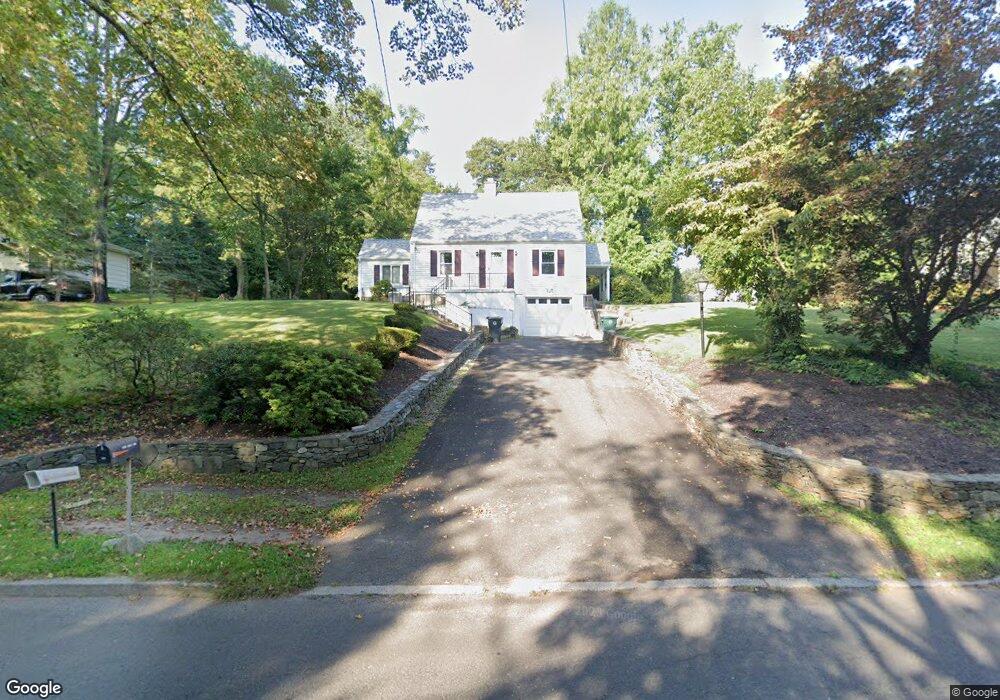
1053 King Rd Cheshire, CT 06410
Estimated Value: $378,000 - $490,000
2
Beds
2
Baths
1,380
Sq Ft
$302/Sq Ft
Est. Value
About This Home
This home is located at 1053 King Rd, Cheshire, CT 06410 and is currently estimated at $417,333, approximately $302 per square foot. 1053 King Rd is a home located in New Haven County with nearby schools including Darcey School, Norton School, and Dodd Middle School.
Ownership History
Date
Name
Owned For
Owner Type
Purchase Details
Closed on
Sep 12, 2000
Sold by
Droller David
Bought by
Oconnor Sean
Current Estimated Value
Home Financials for this Owner
Home Financials are based on the most recent Mortgage that was taken out on this home.
Original Mortgage
$144,100
Interest Rate
8.1%
Purchase Details
Closed on
Mar 15, 1993
Sold by
Farrel S Dennis and Farrel Patricia A
Bought by
Droller David
Create a Home Valuation Report for This Property
The Home Valuation Report is an in-depth analysis detailing your home's value as well as a comparison with similar homes in the area
Home Values in the Area
Average Home Value in this Area
Purchase History
| Date | Buyer | Sale Price | Title Company |
|---|---|---|---|
| Oconnor Sean | $151,000 | -- | |
| Oconnor Sean | $151,000 | -- | |
| Droller David | $128,000 | -- | |
| Droller David | $128,000 | -- |
Source: Public Records
Mortgage History
| Date | Status | Borrower | Loan Amount |
|---|---|---|---|
| Open | Droller David | $114,000 | |
| Closed | Droller David | $129,500 | |
| Closed | Droller David | $144,100 |
Source: Public Records
Tax History
| Year | Tax Paid | Tax Assessment Tax Assessment Total Assessment is a certain percentage of the fair market value that is determined by local assessors to be the total taxable value of land and additions on the property. | Land | Improvement |
|---|---|---|---|---|
| 2025 | $6,114 | $205,590 | $66,780 | $138,810 |
| 2024 | $5,646 | $205,590 | $66,780 | $138,810 |
| 2023 | $5,032 | $143,400 | $66,780 | $76,620 |
| 2022 | $4,921 | $143,400 | $66,780 | $76,620 |
| 2021 | $4,835 | $143,400 | $66,780 | $76,620 |
| 2020 | $4,764 | $143,400 | $66,780 | $76,620 |
| 2019 | $4,764 | $143,400 | $66,780 | $76,620 |
| 2018 | $4,684 | $143,580 | $67,100 | $76,480 |
| 2017 | $4,586 | $143,580 | $67,100 | $76,480 |
| 2016 | $4,406 | $143,580 | $67,100 | $76,480 |
| 2015 | $4,406 | $143,580 | $67,100 | $76,480 |
| 2014 | $4,343 | $143,580 | $67,100 | $76,480 |
Source: Public Records
Map
Nearby Homes
- 1023 King Rd
- 70 Southwick Ct Unit 204
- 80 Southwick Ct Unit 201
- 124 Southwick Ct
- 1600 S Main St
- 0 Main St S Unit 24155068
- 851 Ward Ln
- 46 Soderman Way Unit 46
- 8 Soderman Way Unit 8
- 22 Soderman Way
- 550 Oak Ave Unit 550
- 66 Old Towne Rd
- 764 Bethany Mountain Rd
- 886 Maribou Ct
- 886 Coleman Rd
- 35 Stonehenge Place
- 15 Philson Ct
- 6 Melrose Dr Unit Lot 10
- 9 Melrose Dr Unit 6
- 8 Melrose Dr
- 1061 King Rd
- 1041 King Rd
- 190 Brentwood Dr
- 180 Brentwood Dr
- 1071 King Rd
- 200 Brentwood Dr
- 170 Brentwood Dr
- 1062 King Rd
- 1081 King Rd
- 1076 King Rd
- 160 Brentwood Dr
- 210 Brentwood Dr
- 185 Brentwood Dr
- 195 Brentwood Dr
- 1009 King Rd
- 1009 King Rd Unit Ground Floor
- 1093 King Rd
- 175 Brentwood Dr
- 205 Brentwood Dr
- 1090 King Rd
Your Personal Tour Guide
Ask me questions while you tour the home.