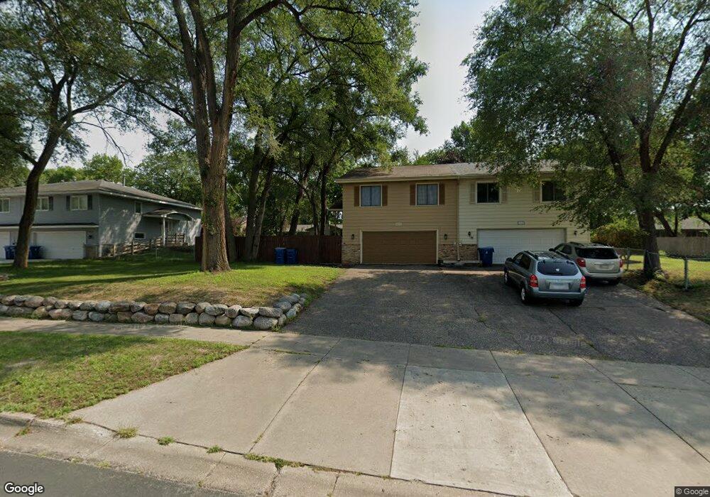
10533 Rhode Island Ave S Bloomington, MN 55438
West Bloomington NeighborhoodEstimated Value: $272,000 - $320,316
3
Beds
1
Bath
1,460
Sq Ft
$201/Sq Ft
Est. Value
About This Home
This home is located at 10533 Rhode Island Ave S, Bloomington, MN 55438 and is currently estimated at $292,829, approximately $200 per square foot. 10533 Rhode Island Ave S is a home located in Hennepin County with nearby schools including Ridgeview Elementary School, Olson Middle School, and Jefferson Senior High School.
Ownership History
Date
Name
Owned For
Owner Type
Purchase Details
Closed on
Apr 29, 2021
Sold by
Lang Michael A and Lang Julie
Bought by
Dico Nino
Current Estimated Value
Home Financials for this Owner
Home Financials are based on the most recent Mortgage that was taken out on this home.
Original Mortgage
$249,399
Outstanding Balance
$226,018
Interest Rate
3.1%
Mortgage Type
FHA
Estimated Equity
$66,811
Create a Home Valuation Report for This Property
The Home Valuation Report is an in-depth analysis detailing your home's value as well as a comparison with similar homes in the area
Home Values in the Area
Average Home Value in this Area
Purchase History
| Date | Buyer | Sale Price | Title Company |
|---|---|---|---|
| Dico Nino | $260,000 | Minnesota Title |
Source: Public Records
Mortgage History
| Date | Status | Borrower | Loan Amount |
|---|---|---|---|
| Open | Dico Nino | $249,399 |
Source: Public Records
Tax History Compared to Growth
Tax History
| Year | Tax Paid | Tax Assessment Tax Assessment Total Assessment is a certain percentage of the fair market value that is determined by local assessors to be the total taxable value of land and additions on the property. | Land | Improvement |
|---|---|---|---|---|
| 2024 | $3,183 | $263,100 | $80,000 | $183,100 |
| 2023 | $3,183 | $273,000 | $85,000 | $188,000 |
| 2022 | $2,758 | $260,400 | $74,900 | $185,500 |
| 2021 | $2,737 | $213,000 | $66,300 | $146,700 |
| 2020 | $2,853 | $213,400 | $64,400 | $149,000 |
| 2019 | $2,525 | $216,100 | $64,400 | $151,700 |
| 2018 | $2,360 | $187,600 | $65,000 | $122,600 |
| 2017 | $2,351 | $171,500 | $56,200 | $115,300 |
| 2016 | $2,243 | $155,100 | $51,500 | $103,600 |
| 2015 | $2,045 | $135,900 | $50,000 | $85,900 |
| 2014 | -- | $118,500 | $48,500 | $70,000 |
Source: Public Records
Map
Nearby Homes
- 7534 Landau Dr
- 10433 Utah Rd
- 7401 Landau Dr Unit 12
- 7256 Woodstock Dr
- 7321 Woodstock Curve
- 10170 Utah Ave S
- 10911 Rhode Island Ave S
- 10907 Rhode Island Ave S
- 10707 Yukon Ave S
- 7501 W 101st St Unit 107
- 7501 W 101st St Unit 310
- 7525 W 110th St Unit 7
- 7471 W 110th St
- 10926 Bush Lake Rd
- 8149 W 103rd St
- 11058 Oregon Curve
- 11015 Oregon Curve
- 11036 Quebec Cir
- 11048 Quebec Cir
- 10456 Cavell Ave S
- 10527 Rhode Island Ave S
- 10535 Rhode Island Ave S
- 10525 Rhode Island Ave S
- 10541 Rhode Island Ave S
- 10524 Quebec Rd
- 10528 Quebec Rd
- 10517 Rhode Island Ave S
- 10520 Quebec Rd
- 10543 Rhode Island Ave S
- 10532 Quebec Rd
- 10509 Rhode Island Ave S
- 10516 Quebec Rd
- 10525 Quebec Rd
- 10517 Quebec Rd
- 10512 Quebec Rd
- 10533 Quebec Rd
- 7441 W 105th St
- 7304 Landau Dr
- 7316 Landau Dr
- 7310 Landau Dr